इस क्षेत्रीय गोता गाइड का उद्देश्य पहले से ही योग्य लोगों को प्रदान करना है स्कूबा गोताखोर जानकारी के साथ जो केप प्रायद्वीप और फाल्स बे के पानी में गोता लगाने की योजना बनाने में मदद करेगी, चाहे वह स्थानीय निवासी हो या आगंतुक। जानकारी बिना किसी पूर्वाग्रह के प्रदान की जाती है, और इसकी सटीक या पूर्ण गारंटी नहीं है। अपने जोखिम पर इसका इस्तेमाल करो। जब आप कर सकते हैं इसका विस्तार या सुधार करें।
वर्णित क्षेत्र ग्रेटर . के किसी भी हिस्से से सड़क मार्ग द्वारा एक दिन की यात्रा के भीतर है केप टाउन, में पश्चिम केप इसका प्रांत दक्षिण अफ्रीका और इसमें 280 से अधिक नामित गोता साइटें शामिल हैं जिनके लिए स्थिति दर्ज की गई है, जो कि किसी एक गंतव्य के लिए बहुत कुछ है।
व्यक्तिगत गोता साइटों पर विस्तृत जानकारी से जुड़े उप-लेखों में प्रदान की जाती है गोता लगाने वाली साइटें अनुभाग। साइट के बारे में जो जानकारी है, उसके आधार पर साइट विवरण में जानकारी सतही से लेकर अत्यधिक विस्तृत तक होती है। नक्शा हो सकता है। SURGMAP द्वारा बाथमीट्रिक चार्ट को नए सर्वेक्षण डेटा एकत्र किए जाने पर अपडेट किया जाता है, और जीपीएस बॉय को खींचकर समोच्चों को तैरकर मैप किया जाता है। वे यथोचित रूप से सटीक हैं - आमतौर पर कुछ मीटर के भीतर - और जो दिखाया जाता है उसके लिए विश्वसनीय, लेकिन शायद ही कभी पूरा होता है। यह बहुत संभव है कि कुछ लम्बे शिखर छूट गए हों। इस बात की कोई गारंटी नहीं है कि आप इसे अपनी नाव से मारकर नहीं खोज पाएंगे। यदि आप करते हैं, तो कृपया हमें बताएं।
कुछ उदाहरणों में एक गोता साइट उप-लेख में कई साइटें शामिल होंगी जो निकटता में हैं, क्योंकि अधिकांश जानकारी उन सभी के लिए सामान्य होगी। अन्य मामलों में, आमतौर पर मलबे वाली साइटें शामिल होती हैं, दो आसन्न साइटों में से प्रत्येक का अपना उप-लेख होगा, लेकिन यदि दो या दो से अधिक मलबे एक ही स्थिति में हैं, या पर्याप्त ओवरलैप के साथ हैं, तो उन्हें उसी उप-लेख में वर्णित किया जाएगा।
समझ


सामान्य स्थलाकृति
केप टाउन शहर की स्थापना के उत्तरी छोर पर हुई थी केप प्रायद्वीप, भूमि की एक संकरी पहाड़ी पट्टी जो अधिकतम ११ किमी चौड़ी और केवल ५० किमी से अधिक लंबी है। उत्तरी सीमा टेबल बे का तट है, एक द्वीप के साथ एक बड़ी खुली खाड़ी, रॉबेन द्वीप, उसके मुँह में।
एक उबड़-खाबड़ तटरेखा अटलांटिक महासागर के साथ पश्चिमी सीमा को चिह्नित करती है। तट के किनारे कई छोटी खाड़ियाँ पाई जाती हैं जिनमें एक बड़ी होती है, हौट बे, लगभग आधा रास्ता। इसके अलावा दक्षिण में प्रायद्वीप तब तक संकरा होता है जब तक कि यह केप पॉइंट पर समाप्त नहीं हो जाता। उत्तरी छोर पर 1,085 मीटर पर टेबल माउंटेन के साथ पहाड़ों की एक श्रृंखला प्रायद्वीप की रीढ़ बनाती है। दक्षिणी प्रायद्वीप का उच्चतम बिंदु, साइमन टाउन के पास, 678 मीटर पर स्वार्टकोप है। प्रायद्वीप में अधिकांश तट के साथ काफी खड़ी ढलान हैं, दक्षिणी सिरे के पश्चिम की ओर को छोड़कर अपेक्षाकृत सपाट भूमि के बहुत संकीर्ण क्षेत्रों के साथ।
खड़ी पूर्वी तरफ फाल्स बे की सीमा है, और समुद्र तट के इस खंड में छोटे स्मट्सविंकेल बे, साइमन की खाड़ी और फिश होक बे शामिल हैं, जहां कम जमीन की एक पट्टी दोनों तरफ के तटों के बीच फैली हुई है। मुइज़ेनबर्ग में समुद्र तट अपेक्षाकृत कम और रेतीले हो जाता है और दक्षिण की दक्षिणी सीमा के पूर्व में घटता है केप फ्लैट्स फाल्स बे की उत्तरी सीमा बनाने के लिए गॉर्डन की खाड़ी तक। से गॉर्डन की खाड़ी समुद्र तट मोटे तौर पर दक्षिण की ओर घूमता है, और होटेंटॉट की हॉलैंड पर्वत श्रृंखला के पैर के साथ केप हैंगक्लिप तक अपना रास्ता ज़िग-ज़ैग करता है जो केप पॉइंट के समान अक्षांश पर है। इस तरफ की सबसे ऊंची चोटी कोगेलबर्ग 1,269 मीटर है।
योजना में खाड़ी लगभग घुमावदार किनारों के साथ लगभग चौकोर है, जो उत्तर से दक्षिण तक पूर्व से पश्चिम (30 किमी) तक लगभग समान है, पूरे दक्षिणी हिस्से में समुद्र के लिए खुला है। फाल्स बे का क्षेत्रफल लगभग 1,090 किमी² मापा गया है, और मात्रा लगभग 45 किमी³ (औसत गहराई लगभग 40 मीटर) है। 1:50,000 पैमाने के नक्शे से भूमि की परिधि को 116 किमी मापा गया है।
फाल्स बे का निचला आकार आमतौर पर चिकना और काफी उथला होता है, जो उत्तर से दक्षिण की ओर धीरे-धीरे नीचे की ओर झुका होता है, जिससे मुंह के केंद्र में गहराई लगभग 80 मीटर होती है। तल तलछट से ढका हुआ है जो बहुत मोटे से लेकर बहुत महीन तक है, जिसमें खाड़ी के केंद्र में अधिकांश महीन तलछट और कीचड़ है। मुख्य अपवाद तलछटी चट्टान की एक लंबी रिज है जो स्ट्रैंड से दक्षिण दिशा में स्टीनब्रास नदी के मुहाने के साथ लगभग स्तर तक फैली हुई है। इस रिज के दक्षिणी सिरे को स्टीनब्रास डीप के नाम से जाना जाता है।
खाड़ी में एक सच्चा द्वीप है, सील द्वीप, लगभग 200 मीटर लंबा और लगभग 2 हेक्टेयर क्षेत्र के साथ ग्रेनाइट का एक बंजर और पथरीला बहिर्गमन। यह स्ट्रैंडफ़ोन्टेन से लगभग 6 किमी दक्षिण में है और अपने उच्चतम बिंदु पर समुद्र तल से 10 मीटर से भी कम है। कई छोटे चट्टानी टापू भी हैं जो उच्च पानी के निशान से ऊपर फैले हुए हैं, और अन्य चट्टानें और शोल जो सतह तक पहुंचते हैं। इनमें से अधिकांश के ग्रेनाइट हैं प्रायद्वीप प्लूटन, लेकिन सील द्वीप के पूर्व में वे आम तौर पर बलुआ पत्थर हैं, शायद टायगरबर्ग खाड़ी के भीतर गठन, हालांकि यह संभव है कि कुछ हो सकते हैं टेबल माउंटेन श्रृंखला। इन रीफ क्षेत्रों में सबसे बड़ा व्हिटल रॉक है, जो ग्रेनाइट की एक पानी के नीचे की पहाड़ी है, जो रेतीले तल से सतह के 5 मीटर के भीतर और लगभग 1 किमी व्यास में रेतीले तल से उठती है।
खाड़ी के बाहर, लेकिन इसमें लहर के पैटर्न को प्रभावित करते हुए, रॉकी बैंक है, जो . की एक विस्तृत चट्टान है टेबल माउंटेन शीर्ष पर 20 से 30 मीटर की गहराई के बीच बलुआ पत्थर की चट्टान, और दक्षिण में 100 मीटर से अधिक गहराई तक ढलान।
कड़ाई से बोलते हुए, फाल्स बे अटलांटिक महासागर का हिस्सा है, जो केप अगुलहास तक फैला हुआ है, लेकिन जब केप टाउन में, अटलांटिक आमतौर पर केप प्रायद्वीप के पश्चिमी समुद्र तट को संदर्भित करता है, और पूर्व की ओर को फाल्स बे कहा जाता है, या साइमन टाउन की ओर। इस पूरे गाइड में इस सम्मेलन का उपयोग किया जाएगा।
स्थानीय स्थलाकृति
स्थानीय स्थलाकृति पर सबसे मजबूत प्रभाव स्थानीय भूविज्ञान है। गाद, रेत या बजरी के असंगठित निक्षेप काफी समतल होते हैं। शिंगल और छोटे बोल्डर अधिक तेजी से ढलान कर सकते हैं, और बेडरॉक और बड़े बोल्डर आसपास के असंगठित तल से थोड़ा ऊपर उठे हुए, चट्टानों के चेहरे और टॉर्स को ओवरहैंग करने के लिए कुछ भी हो सकते हैं। रॉक प्रकार, और तलछटी स्तर के लिए, डुबकी और हड़ताल, संभावित रीफ रूपों की सीमा पर एक बड़ा प्रभाव है।
वर्तमान रीफ संरचनाएं हिमयुग के दौरान भू-आकृतियों के रूप में विकसित हुईं, जब वे समुद्र तल से ऊपर थीं, और ग्रेनाइट की चट्टानें बड़े पैमाने पर भूमिगत अपक्षय प्रक्रिया द्वारा और भी लंबी अवधि में आकार लेती थीं। ग्रेनाइट काफी पुराने हैं, और टेक्टोनिक बलों द्वारा बहुत अधिक जोड़ दिए गए हैं, और दरारों के किनारों को लंबे समय तक भूजल द्वारा रासायनिक रूप से नष्ट कर दिया गया है ताकि कोनों को गोल किया जा सके और गहरी दरारें और नाले बन सकें, जो बाद में कटाव से उजागर हुए थे। सैप्रोलिथ और आगे अपक्षय और उजागर सतहों के क्षरण द्वारा कोरस्टोन और टॉर्स के रूप में जानी जाने वाली संरचनाओं में संशोधित किया गया। इसी तरह, उजागर तलछटी चट्टान जमीन के ऊपर उजागर होने पर मिट गई। जब हिमनदों के पिघलने के दौरान समुद्र का स्तर बढ़ गया, तो इन भू-आकृतियों में बाढ़ आ गई, और अपने पिछले स्वरूप और चरित्र को बरकरार रखा। तटीय कटाव के बाद से उच्च ऊर्जा तरंग क्रिया के संपर्क में आने वाले क्षेत्रों में संशोधित चट्टानें हैं, और तलछट की कुछ गति लहरों और धाराओं के कारण होती है।
जलवायु, मौसम और समुद्र की स्थिति

पश्चिमी केप की जलवायु
दक्षिण-पश्चिमी केप की जलवायु दक्षिण अफ्रीका के बाकी हिस्सों से स्पष्ट रूप से भिन्न है, जो गर्मियों में वर्षा वाला क्षेत्र है, जो दिसंबर से फरवरी के गर्मियों के महीनों के दौरान अपनी अधिकांश वर्षा प्राप्त करता है। दक्षिण-पश्चिमी केप में भूमध्यसागरीय प्रकार की जलवायु है, इसकी अधिकांश वर्षा जून से सितंबर तक सर्दियों के महीनों के दौरान होती है।
गर्मियों के दौरान इस क्षेत्र में मौसम का निर्धारण करने वाला प्रमुख कारक एक उच्च दबाव क्षेत्र है, जिसे अटलांटिक हाई के रूप में जाना जाता है, जो केप तट के पश्चिम में दक्षिण अटलांटिक महासागर के ऊपर स्थित है। इस तरह की प्रणाली से वामावर्त दिशा में घूमने वाली हवाएं दक्षिण-पूर्व से केप तक पहुंचती हैं, जिससे कई दिनों तक तेज हवाएं और साफ आसमान दिखाई देता है। इन दक्षिण पूर्वी हवाओं को स्थानीय रूप से केप डॉक्टर के रूप में जाना जाता है। वे क्षेत्र को अपेक्षाकृत ठंडा रखते हैं और औद्योगिक क्षेत्रों और केप फ्लैट्स से प्रदूषित हवा को समुद्र में उड़ाने में मदद करते हैं। इसके दक्षिण मुखी पहलू के कारण फाल्स बे इन हवाओं के संपर्क में है, विशेष रूप से पश्चिम की ओर, जबकि टेबल बे और प्रायद्वीप के पश्चिमी तट एक अपतटीय हवा का अनुभव करते हैं। यह हवा पैटर्न स्थानीय रूप से स्थलाकृति से इस हद तक प्रभावित होता है कि आंधी बल हवाएं चल सकती हैं गॉर्डन की खाड़ी , जबकि लगभग 10 किमी दूर away समरसेट वेस्ट एक गर्म और हवा रहित दिन हो सकता है।
दक्षिण-पश्चिमी केप में सर्दियों में सर्कंपोलर पश्चिमी हवाओं में गड़बड़ी की विशेषता होती है, जिसके परिणामस्वरूप पूर्व की ओर बढ़ने वाले ललाट अवसादों की एक श्रृंखला होती है। ये उत्तर-पश्चिम से ठंडा बादल मौसम, हवा और बारिश लाते हैं, इसके बाद तापमान में गिरावट आती है और सामने से गुजरने के साथ दक्षिण-पश्चिम हवा में बदलाव होता है। दक्षिण अटलांटिक के ऊपर दक्षिण पश्चिमी हवाएं प्रचलित दक्षिण-पश्चिमी प्रफुल्लित करती हैं जो सर्दियों के महीनों की विशिष्ट होती हैं, जो उजागर अटलांटिक तटरेखा और फाल्स बे के पूर्व की ओर धड़कती हैं। केप प्रायद्वीप के पहाड़ इस हवा से और दक्षिण पश्चिमी लहरों से फाल्स बे के पश्चिम की ओर सुरक्षा प्रदान करते हैं - एक ऐसा तथ्य जिसने डच ईस्ट इंडिया कंपनी के लिए शीतकालीन लंगर के रूप में साइमन की खाड़ी की अपनी पसंद में गवर्नर साइमन वैन डेर स्टेल को प्रभावित किया था। केप टाउन के लिए जहाज। उत्तर-पश्चिमी सर्दियों के तूफानों ने सदियों से टेबल बे में लंगर डाले हुए कई जहाजों को बर्बाद कर दिया है। आज भी, तकनीकी प्रगति और बेहतर मौसम पूर्वानुमान के बावजूद, यह अभी भी होता है, हालांकि अतीत की तुलना में कम बार होता है, और इन दिनों बचाव अभियान अधिक सफल होते हैं।
मौसम
सामान्य प्रवृत्ति मौसम के लिए पश्चिम से आने और ललाट प्रणालियों के साथ पूर्व की ओर बढ़ने की है, लेकिन अधिक स्थानीय मौसम की घटनाएं भी हो सकती हैं जैसे कि गरज (दुर्लभ) और 'बर्ग' हवाएं, जो गर्म हवाएं हैं जो ऊपर से नीचे आ रही हैं। अंतर्देशीय से पहाड़। किसी भी दिन इस गाइड द्वारा कवर किए गए क्षेत्र में विभिन्न साइटों के बीच मौसम की स्थिति में काफी भिन्नता हो सकती है, हालांकि सामान्य प्रवृत्ति समान हो सकती है। उदाहरण के लिए केप प्रायद्वीप पर सुबह बारिश हो सकती है, और दोपहर तक ये स्थितियां फाल्स बे के पूर्व की ओर बढ़ सकती हैं और प्रायद्वीप उत्तर-पश्चिम से दक्षिण-पश्चिम की ओर एक महत्वपूर्ण हवा दिशात्मक बदलाव के साथ साफ हो सकता है। हवा की ताकत में स्थानीय भिन्नता चरम पर हो सकती है, और कभी-कभी विश्वास करना मुश्किल हो सकता है, क्योंकि एक स्थान पर एक शांत शांति और कुछ किलोमीटर दूर एक तेज हवा हो सकती है। दक्षिण-पूर्वी और उत्तर-पश्चिमी हवाओं दोनों के संपर्क के लिए जाने जाने वाले स्थान हैं, और कुछ ऐसे हैं जो एक या दूसरे से आश्रय लेते हैं, जबकि दक्षिण-पश्चिमी हवाएँ अधिकांश स्थानों को उड़ाती हैं, लेकिन आमतौर पर समान चरम सीमा तक नहीं। व्यवहार में इसका मतलब यह है कि जिस मौसम में आप किसी विशेष समय पर होते हैं, वह दिन में थोड़ी देर बाद गोता लगाने वाली जगह से काफी भिन्न हो सकता है।
एक बर्ग हवा उच्च ऊंचाई वाले अंतर्देशीय उच्च दबाव के कारण होती है, आमतौर पर सर्दियों में, महान ढलान के ऊपर ठंडे, शुष्क केंद्रीय पठारी क्षेत्रों पर, तट पर कम दबाव के साथ मिलकर। हवा ढलान के नीचे बहती है और संपीड़न द्वारा गर्म होती है। तापमान में वृद्धि काफी और कम अवधि में हो सकती है। यह गर्म, शुष्क हवा अपतटीय है और डाइविंग की स्थिति को बहुत प्रभावित नहीं करती है, लेकिन इसके बाद आमतौर पर कम बादल, कोहरे और बूंदा बांदी के साथ ठंडी तटवर्ती हवाएं होती हैं, और अक्सर सर्दियों में पश्चिम से ठंडे मोर्चे के दृष्टिकोण से जुड़ी होती है, जो तेज पछुआ हवाएँ और पर्याप्त ललाट वर्षा ला सकती है।
समुद्र की स्थिति
लहरें और प्रफुल्लित
फाल्स बे और केप प्रायद्वीप के तटों तक पहुंचने वाली लहरों को स्थानीय पवन तरंगों के संयोजन के रूप में माना जा सकता है और दूर के स्रोतों से प्रफुल्लित होता है। आमतौर पर महाद्वीप के दक्षिण में मौसम प्रणालियों द्वारा प्रफुल्लित किया जाता है, कभी-कभी काफी दूर, जिनमें से सबसे महत्वपूर्ण दक्षिण अटलांटिक में ललाट प्रणालियां हैं, जो हवा की लहरें उत्पन्न करती हैं जो तब अपने स्रोत से दूर फैल जाती हैं और समय के साथ अलग-अलग क्षेत्रों में अलग हो जाती हैं। अवधि। लंबी अवधि की तरंगें तेज होती हैं और उनमें अधिक ऊर्जा होती है, और वे छोटी अवधि के घटकों से आगे बढ़ती हैं, इसलिए वे पहले तट पर पहुंचती हैं। यह सर्फर्स के लिए एक पल्स के रूप में जाना जाता है, और आमतौर पर इसके बाद धीरे-धीरे कम शक्ति की अवधि कम हो जाती है।
स्थानीय हवाएं भी लहरें पैदा करेंगी जो उनके प्रभाव को प्रफुल्लित के साथ जोड़ देंगी। एक सामान्य नियम के रूप में अपतटीय हवाएं समुद्र को समतल कर देंगी क्योंकि फ़ेच (वह दूरी जो हवा ने पानी के ऊपर उड़ा दी है) आमतौर पर बड़ी ऊंचाई या लंबाई की लहरों को विकसित करने के लिए बहुत छोटी होती है। दूसरी ओर, तटवर्ती हवाएं, यदि पर्याप्त मजबूत हैं, तो एक छोटी और खराब चॉप का उत्पादन होगा जो प्रवेश और निकास को असुविधाजनक बना सकती है, और सतह पर तैरना या नाव की सवारी अप्रिय है।
गोता लगाने की योजना बनाते समय प्रफुल्लित और हवा की लहरों के संयोजन पर विचार किया जाना चाहिए। इसके लिए इन स्थितियों के ज्ञान की आवश्यकता होती है, जिनका पूर्वानुमान कई संगठनों द्वारा परिवर्तनशील सटीकता के साथ किया जाता है, कुछ मामलों में सात या अधिक दिनों के लिए। सटीकता आमतौर पर पूर्वानुमान के अंतराल के व्युत्क्रमानुपाती होती है। यह आमतौर पर दो या तीन दिन आगे दिखने में काफी विश्वसनीय होता है, लेकिन एक सप्ताह से अधिक समय में यह थोड़ा अस्थिर हो सकता है। मौसम ऐसा ही है।
अपवेलिंग्स
दक्षिण-पूर्वी हवाएं जो अपतटीय और तट के साथ केप प्रायद्वीप के पश्चिम की ओर और फाल्स बे के पूर्व की ओर बहती हैं, एकमैन परिवहन के कारण तट के पश्चिम में सतही जल अपतटीय की गति का कारण बनती हैं। तट से दूर पानी की इस आवाजाही की भरपाई गहरे पानी के ऊपर उठने से होती है।
ये उभार गोताखोर के लिए काफी रुचिकर हैं, क्योंकि पश्चिमी तट पर ऊपर उठा हुआ पानी ठंडा और अपेक्षाकृत साफ है। हालांकि, चूंकि ऊपर चढ़े पानी में पोषक तत्व की मात्रा अधिक होती है, इसलिए अपवेलिंग अक्सर "रेड टाइड" के रूप में जाने जाने वाले प्लवक खिलने के अग्रदूत होते हैं, जो दृश्यता को काफी कम कर देगा। पश्चिमी तट पर उफान के दौरान पानी का तापमान 12 डिग्री सेल्सियस से नीचे चला जाता है, और कभी-कभी यह 7 डिग्री सेल्सियस तक पहुंच सकता है।
फाल्स बे के पूर्व की ओर, उथल-पुथल अक्सर खराब दृश्यता का कारण बनती है क्योंकि वे बहुत महीन और कम घनत्व वाले तलछट को परेशान कर सकते हैं जो खाड़ी के उस तरफ आम है, विशेष रूप से गॉर्डन की खाड़ी के पास उथले हिस्से में। पानी भी अपेक्षाकृत ठंडा है, लेकिन आमतौर पर प्रायद्वीप के पश्चिम की तरह ठंडा नहीं होता है और एक या दो दिन में तापमान लगभग 19 डिग्री सेल्सियस से 12 डिग्री सेल्सियस तक गिर सकता है।
ज्वार
स्थानीय ज्वार चंद्र प्रभुत्व, अर्ध-दैनिक, और अपेक्षाकृत कमजोर हैं, और अटलांटिक तट पर या झूठी खाड़ी में कोई मजबूत ज्वारीय धाराएं नहीं हैं। परिणामी ज्वारीय प्रवाह गोताखोर के लिए बहुत कम परिणाम होते हैं, मुख्य प्रभाव गोता स्थल पर गहराई में मामूली परिवर्तन और सतह के पास केल्प फ्रोंड द्वारा प्रस्तुत बाधा पर भिन्नता है, जो कि केल्प के माध्यम से प्राप्त करने के लिए आवश्यक प्रयास को प्रभावित कर सकता है। सतह। इस संबंध में यह आमतौर पर उच्च ज्वार पर आसान होता है।
कुछ स्लिपवे पर बोट लॉन्च करना कम ज्वार पर मुश्किल हो सकता है, जो कभी-कभी बोट डाइव शेड्यूल को प्रभावित कर सकता है, और स्प्रिंग लो लगभग पहले लॉन्च के समय (लगभग 09: 00 से 09:30) होता है।
केप टाउन में अधिकतम ज्वार की सीमा लगभग 1.86 मीटर (वसंत ज्वार) है, और साइमन टाउन में 1.91 मीटर है, जिसमें न्यूनतम पर्वतमाला लगभग 0.26 मीटर (नीप ज्वार) के दोनों स्थानों पर है।
पानि का तापमान
केप प्रायद्वीप से दूर अटलांटिक की औसत गर्मी की सतह का तापमान 10 डिग्री से 13 डिग्री सेल्सियस के बीच है। नीचे का तापमान कुछ डिग्री ठंडा हो सकता है। न्यूनतम तापमान लगभग 8 डिग्री सेल्सियस है, हालांकि कम से कम 6 डिग्री और अधिकतम 17 डिग्री सेल्सियस के लिए दावा किया गया है।
केप प्रायद्वीप से दूर अटलांटिक की औसत सर्दियों की सतह का तापमान 13 डिग्री से 15 डिग्री सेल्सियस के बीच है। नीचे का तापमान इंशोर बहुत समान है।
फाल्स बे का औसत सर्दियों की सतह का तापमान लगभग 15 डिग्री सेल्सियस है, और नीचे का तापमान काफी समान या थोड़ा कम है। फाल्स बे की औसत गर्मी की सतह का तापमान लगभग 19 डिग्री सेल्सियस है। नीचे का तापमान आमतौर पर सर्दियों की तुलना में 1° से 3°C कम होता है, लेकिन 10° से 12°C अज्ञात नहीं होता है।
धाराओं
इस क्षेत्र के अधिकांश गोता स्थलों पर धाराओं को आमतौर पर एक मुद्दा नहीं माना जाता है। एक छोटी अवधि में तेज हवाओं द्वारा एक उथली सतह की धारा का उत्पादन किया जा सकता है, जो अपतटीय सेट होने पर एक असुविधा हो सकती है। धारा की गहराई इस बात पर निर्भर करती है कि हवा कितनी देर से चल रही है, और जब कोई गोता लगाते समय अचानक हवा उठाता है, तो धारा उथली होती है और एक गोताखोर अधिकांश धारा के नीचे 3 से 6 मीटर की गहराई पर किनारे पर लौट सकता है। ज्वारीय धाराएँ नगण्य हैं, और केवल कुछ पृथक गोता स्थलों पर ही अनुभव की जाती हैं, जैसे कि विंडमिल बीच, वसंत ज्वार के दौरान जब कुछ सूजन चल रही होती है। ध्यान रखें कि कोरिओलिस प्रभाव के कारण हवा द्वारा संचालित सतह की धारा हवा की दिशा के बाईं ओर प्रवाहित होगी, और कोण बढ़ेगा और गहराई के साथ ताकत कम होगी।
दो स्थान जो महत्वपूर्ण धाराओं का अनुभव कर सकते हैं, वे हैं फाल्स बे के मुहाने पर, at रॉकी बैंक तथा धौंकनी रॉक, जहां अगुलहास धारा के एडीज अक्सर प्रकाश से मध्यम शक्ति की धारा उत्पन्न करते हैं, जो बेलोज़ रॉक के आसपास उथले में गोताखोरों को असुविधा के लिए पर्याप्त मजबूत हो सकती है। कभी-कभी अपतटीय गोता स्थलों पर फाल्स में लगभग एक गाँठ तक की धाराओं का अनुभव किया गया है। साइमन टाउन के दक्षिण में खाड़ी, और डुइकर पॉइंट और रॉबेन द्वीप के पास अटलांटिक समुद्र तट पर। ये धाराएं आमतौर पर तल पर काफी कमजोर होती हैं, और आमतौर पर गोताखोरों को ज्यादा कठिनाई नहीं होती है, हालांकि वे अधिक महत्वपूर्ण सरफेसिंग के लिए डीएसएमबी का उपयोग करते हैं, क्योंकि एक सुरक्षा स्टॉप के साथ सामान्य चढ़ाई पर भी काफी लंबा रास्ता तय कर सकता है। . ये सतह धाराएं गोता लगाने की शुरुआत में एक असुविधा के रूप में अधिक हो सकती हैं, क्योंकि यदि आप अवरोही के बारे में संकेत नहीं देते हैं, तो वे आपको शॉटलाइन से आगे ले जाएंगे, जो कि जैसे ही लाइन दिखाई दे रही है, किया जाना चाहिए। इसके अलावा शॉटलाइन में सुस्ती के आधार पर, बुआ नीचे की ओर और निशान के नीचे कई मीटर की दूरी पर होगा। एक सक्षम कप्तान कुछ भत्ता देगा और गोताखोरों को बॉय के ऊपर की ओर छोड़ देगा।
मौसम डेटा
फाल्स बे के लिए रीयल टाइम मौसम डेटा a . से उपलब्ध है मौसम बोया सेंटर फॉर ऑब्जर्वेशनल ओशनोग्राफी द्वारा संचालित। हवा और समुद्र की सतह के तापमान, हवा की ताकत और दिशा, और बैरोमीटर के दबाव के लिए वर्तमान और 7-दिवसीय ऐतिहासिक डेटा प्रदर्शित किया जाता है। बोया की स्थिति भिन्न हो सकती है, लेकिन अक्टूबर 2012 में यह 34°11'19"S, 18°27'03"E पर थी। (साइमन टाउन बंदरगाह से लगभग 700 मीटर पूर्व में)
मौसम और समुद्र की स्थिति की भविष्यवाणी
इस क्षेत्र में गोताखोरी की स्थिति की भविष्यवाणी करना काफी जटिल है। ऐसी वेबसाइटें हैं जैसे बुवाईवेदर, सर्फ-पूर्वानुमान तथा विंडगुरु जो हवा और प्रफुल्लित के लिए यथोचित विश्वसनीय पूर्वानुमान प्रदान करते हैं। यह पानी के तापमान और दृश्यता की हाल की स्थितियों की जानकारी के साथ संयुक्त रूप से कुछ दिनों पहले स्थितियों की काफी विश्वसनीय भविष्यवाणी की अनुमति देगा। स्थानीय वेवस्केप वेबसाइट और सर्फ रिपोर्ट भी एक विशिष्ट दक्षिण अफ़्रीकी माहौल के साथ एक मूल्यवान संदर्भ है, हालांकि अन्य लोगों की तरह, यह मुख्य रूप से सर्फर्स के लिए है, और गोताखोरों को थोड़ा सा इंटरपोलेट करना चाहिए।
अटलांटिक तट पर धाराओं और अपेक्षाकृत मोटे तलछट के कारण दृश्यता बहुत जल्दी (रातोंरात) साफ हो सकती है। फाल्स बे के पश्चिम की ओर यह थोड़ा धीमा है, और खाड़ी के पूर्व की ओर, जहां तलछट ठीक और हल्की है, इसमें कई दिन, यहां तक कि सप्ताह भी लग सकते हैं।
उपग्रह समुद्र की सतह का तापमान और क्लोरोफिल डेटा भी इंटरनेट से उपलब्ध हैं, और सतह की स्थिति की भविष्यवाणी करने में मदद कर सकते हैं, लेकिन वे नीचे की स्थितियों का कितना अनुमान लगाते हैं, यह ज्ञात नहीं है।
जब तक आप इस प्रक्रिया के लिए एक भावना विकसित नहीं कर लेते, तब तक अनुभव वाले लोगों या संगठनों से दूसरी राय प्राप्त करना उपयोगी होता है।
कुछ स्थानीय गोताखोर चार्टर ऑपरेटरों के पास मौसम की भविष्यवाणी के लिए दूसरों की तुलना में बेहतर प्रतिष्ठा है, और कुछ ऐसे हैं जो लगभग हमेशा दावा करेंगे कि स्थितियां अच्छी हैं या अच्छी थीं। ब्लू फ्लैश साप्ताहिक समाचार पत्र किसी भी अन्य की तरह ही अच्छा है और बहुतों से बेहतर है। यह केप प्रायद्वीप के पसंदीदा क्षेत्रों को संदर्भित करेगा, जिसमें फाल्स बे के पश्चिम की ओर भी शामिल है। फाल्स बे के पूर्व की ओर जानकारी के लिए आप इंडिगो डाइवर्स को फोन करने का प्रयास कर सकते हैं।
समुद्री पारिस्थितिकी

जैवक्षेत्र
केप प्रायद्वीप के सिरे पर केप प्वाइंट को दक्षिण अफ्रीका के पांच तटवर्ती समुद्री जीवों में से दो के बीच की सीमा माना जाता है। केप प्वाइंट के पश्चिम में शीतोष्ण शीतोष्ण दक्षिण-पश्चिमी केप इंशोर बायोरेगियन है, और पूर्व में गर्म समशीतोष्ण अगुलहास इंशोर बायोरेगियन है। केप प्वाइंट ब्रेक को बायोरेगियंस में अपेक्षाकृत अलग बदलाव माना जाता है और इसे प्रायद्वीप के अटलांटिक समुद्र तट और फाल्स बे के बीच समुद्री जीवन में अंतर से स्पष्ट रूप से देखा जा सकता है।
निवास स्थान
इस क्षेत्र में समुद्र में चार प्रमुख आवास मौजूद हैं, जो सब्सट्रेट की प्रकृति से अलग हैं। सब्सट्रेट, या आधार सामग्री, इस मायने में महत्वपूर्ण है कि यह एक ऐसा आधार प्रदान करता है जिसके लिए एक जीव खुद को लंगर डाल सकता है, जो उन जीवों के लिए बेहद महत्वपूर्ण है जिन्हें एक विशेष प्रकार के स्थान पर रहने की आवश्यकता होती है। चट्टानी तट और चट्टान एक निश्चित निश्चित सब्सट्रेट प्रदान करते हैं। पौधों और जानवरों के लगाव के लिए। इनमें से कुछ में केल्प वन हो सकते हैं, जो लहरों के प्रभाव को कम करते हैं और जीवों की एक विस्तृत श्रृंखला के लिए भोजन और आश्रय प्रदान करते हैं। रेतीले समुद्र तट और बॉटम्स अपेक्षाकृत अस्थिर सब्सट्रेट हैं और केल्प या कई अन्य बेंटिक जीवों को लंगर नहीं डाल सकते हैं। अंत में खुला पानी है, सब्सट्रेट के ऊपर और केल्प वन से साफ है, जहां जीवों को बहाव या तैरना चाहिए। मिश्रित आवास भी अक्सर पाए जाते हैं, जो ऊपर वर्णित लोगों का एक संयोजन हैं। निम्नलिखित वर्गों में आवासों का अधिक विस्तार से वर्णन किया गया है।
चट्टानी तट और चट्टानें

स्थानीय जल में लोकप्रिय गोता स्थलों का अधिकांश हिस्सा चट्टानी चट्टानों या मिश्रित चट्टानी और रेतीले तलों पर है, जिसमें महत्वपूर्ण संख्या में मलबे हैं, जो आवास के वर्गीकरण के लिए चट्टानी चट्टानों के बराबर हैं, जैसा कि सामान्य तौर पर, समुद्री जीवों के बारे में विशेष रूप से नहीं हैं। सब्सट्रेट की सामग्री अगर बनावट और ताकत उपयुक्त है और यह विषाक्त नहीं है। कई समुद्री जीवों के लिए सब्सट्रेट एक अन्य प्रकार का समुद्री जीव है, और कई परतों का सह-अस्तित्व होना आम है। इसके उदाहरण लाल चारा फली हैं, जो आमतौर पर स्पंज, जलोदर, ब्रायोज़ोअन, एनीमोन, और गैस्ट्रोपोड, और अबालोन से घिरे होते हैं, जो आमतौर पर आसपास के चट्टानों पर पाए जाने वाले समान समुद्री शैवाल से ढके होते हैं, आमतौर पर कई अन्य जीवों के साथ रहते हैं समुद्री शैवाल पर।
चट्टान के प्रकार का कुछ महत्व है, क्योंकि यह स्थानीय स्थलाकृति के लिए संभावनाओं की सीमा को प्रभावित करता है, जो बदले में प्रदान किए गए आवासों की सीमा को प्रभावित करता है, और इसलिए निवासियों की विविधता।
ग्रेनाइट की चट्टानें आमतौर पर सेंटीमीटर से डेसीमीटर पैमाने पर अपेक्षाकृत चिकनी सतह होती हैं, लेकिन अक्सर मीटर पैमाने में उच्च प्रोफ़ाइल होती हैं, इसलिए वे अपेक्षाकृत क्षैतिज ऊपरी सतह से, ऊर्ध्वाधर पक्षों के पास, ओवरहैंग, छेद और सुरंगों के लिए आवास में मैक्रो-विविधता प्रदान करते हैं। शिलाखंडों के समान पैमाने पर और स्वयं को उखाड़ फेंकते हैं। समग्र सतह क्षेत्र की तुलना में अपेक्षाकृत कम छोटी दरारें हैं।
बलुआ पत्थर और अन्य तलछटी चट्टानें बहुत अलग तरीके से खराब होती हैं और मौसम, और डुबकी और हड़ताल की दिशा और डुबकी की स्थिरता के आधार पर, चट्टानें उत्पन्न हो सकती हैं जो अपेक्षाकृत फ्लैट से बहुत उच्च प्रोफ़ाइल और छोटी दरारों से भरी होती हैं। ये विशेषताएं तटरेखा और लहर मोर्चों के अलग-अलग कोणों पर हो सकती हैं। बलुआ पत्थर की चट्टानों में बहुत कम छोटी गुफाएँ और तैराक हैं, लेकिन अक्सर कई गहरी लेकिन कम निकट-क्षैतिज दरारें होती हैं। कुछ क्षेत्रों में चट्टान मुख्य रूप से लहर-गोल माध्यम से लेकर छोटे शिलाखंड तक होती है। इस मामले में चट्टान के प्रकार का बहुत कम महत्व है।
हाल के हिमयुगों के दौरान इस क्षेत्र में समुद्र तट काफी कम था, और गोता स्थलों की विस्तृत स्थलाकृति बड़े पैमाने पर समुद्र तल से ऊपर की अवधि के दौरान बनाई गई थी। नतीजतन, गोता लगाने वाले स्थल ज्यादातर समुद्र तल से निकटतम परिदृश्य के चरित्र के समान होते हैं।
ऐसे उल्लेखनीय अपवाद हैं जहां पानी के ऊपर और नीचे की चट्टान एक अलग प्रकार की होती है। ये ज्यादातर स्मट्सविंकेल खाड़ी के दक्षिण में फाल्स बे में हैं, जहां ग्रेनाइट चट्टानों के साथ एक बलुआ पत्थर का किनारा है।
केल्प वन

केल्प वन चट्टानी भित्तियों का एक रूप है, क्योंकि केल्प को एक काफी मजबूत और स्थिर सब्सट्रेट की आवश्यकता होती है जो केल्प पौधों पर खींची जाने वाली बार-बार लहरों के भार का सामना कर सकता है। सागर बांस एक्लोनिया मैक्सिमा पानी में उगता है जो इतना उथला होता है कि यह अपने गैस से भरे स्टिपों के साथ सतह तक पहुंचने की अनुमति देता है, ताकि फ्रैंड्स सतह के ठीक नीचे एक घनी परत बना लें। छोटा स्प्लिट-फैन केल्प लामिनारिया पल्लीडा ज्यादातर गहरी चट्टानों पर उगता है, जहां समुद्री बांस से इतनी प्रतिस्पर्धा नहीं होती है। ये दोनों केल्प प्रजातियां कई अन्य जीवों, विशेष रूप से समुद्री बांस के लिए भोजन और आश्रय प्रदान करती हैं, जो कि एपिफाइट्स की एक विस्तृत श्रृंखला के लिए आधार है, जो बदले में अधिक जीवों के लिए भोजन और आश्रय प्रदान करती है।
मूत्राशय केल्प मैक्रोसिस्टा एंगुस्टिफोलिया कुछ स्थलों पर भी पाया जा सकता है, ज्यादातर रोबेन द्वीप के पास। यह दुनिया के उन कुछ स्थानों में से एक है जहां एक ही स्थान पर केल्प की तीन प्रजातियां पाई जा सकती हैं।
रेतीले समुद्र तट और तलहटी (छिलकेदार, कंकड़ और बजरी की बोतलों सहित)
पहली नज़र में सैंडी बॉटम्स काफी बंजर क्षेत्र प्रतीत होते हैं, क्योंकि उनमें कई शानदार रीफ आधारित प्रजातियों का समर्थन करने के लिए स्थिरता की कमी होती है, और बड़े जीवों की विविधता अपेक्षाकृत कम होती है। मौसम की स्थिति और क्षेत्र के जोखिम के आधार पर रेत को लगातार लहर की क्रिया द्वारा अधिक या कम डिग्री तक ले जाया जा रहा है। इसका मतलब यह है कि उपजाऊ जीवों को विशेष रूप से अपेक्षाकृत ढीले सब्सट्रेट के क्षेत्रों में पनपने के लिए अनुकूलित किया जाना चाहिए, और रेतीले या बजरी तल पर पाए जाने वाली प्रजातियों की विविधता इन सभी कारकों पर निर्भर करेगी।
इन कारणों से रेतीले और बजरी की बोतलें आमतौर पर नौसिखियों और आगंतुकों के साथ लोकप्रिय नहीं होती हैं, जो आमतौर पर अधिक शानदार स्थलों की ओर आकर्षित होते हैं, लेकिन गोताखोर के लिए जो समुद्री वातावरण की पूरी विविधता में रुचि रखते हैं, वे एक ताज़ा और आकर्षक बदलाव प्रदान कर सकते हैं, क्योंकि बहुत सारे जीव हैं जो केवल इन तल प्रकारों पर पाए जाएंगे। अधिकतर वे रीफ क्षेत्रों के निकट पाए जा सकते हैं, लेकिन कुछ ऐसे स्थान हैं जो मुख्य रूप से रेतीले हैं।
सैंडी बॉटम्स में उनकी अस्थिरता के लिए एक महत्वपूर्ण मुआवजा होता है, जानवर रेत में दब सकते हैं और इसकी परतों के भीतर ऊपर और नीचे जा सकते हैं, जो भोजन के अवसर और शिकार से सुरक्षा प्रदान कर सकते हैं। अन्य प्रजातियां आश्रय के लिए खुद को छेद खोद सकती हैं, या सुरंग के माध्यम से खींचे गए पानी को छानकर या रेत के ऊपर पानी में इस कार्य के लिए अनुकूलित शरीर के अंगों को बढ़ाकर खिला सकती हैं।
लाल ज्वार
प्रायद्वीप के पश्चिमी तट पर और कुछ हद तक फाल्स बे के पूर्व की ओर, दक्षिण पूर्वी हवाएं गहरे, ठंडे, पोषक तत्वों से भरपूर पानी का कारण बन सकती हैं। यह आमतौर पर गर्मियों में होता है जब ये हवाएं सबसे तेज होती हैं, और यह तीव्र गर्मी की धूप के संयोजन में फाइटोप्लांकटन के तेजी से विकास के लिए अनुकूल परिस्थितियां प्रदान करती है। यदि ऊपर उठने के बाद हल्की हवा या तटवर्ती हवाओं की अवधि होती है, तो फाइटोप्लांकटन की कुछ प्रजातियां इतनी घनी रूप से खिल सकती हैं कि वे पानी को रंग देती हैं, विशेष रूप से एक लाल या भूरा रंग, जिसे लाल ज्वार के रूप में जाना जाता है।
शामिल प्रजातियों के आधार पर, ये लाल ज्वार विभिन्न कारणों से समुद्री जानवरों के लिए बड़े पैमाने पर मृत्यु का कारण बन सकते हैं। कुछ मामलों में जीव सभी उपलब्ध पोषक तत्वों का उपभोग कर सकते हैं और फिर मर जाते हैं, सड़ने वाले अवशेष छोड़ते हैं जो ऑक्सीजन के पानी को समाप्त कर देते हैं, जानवरों के जीवन को दम तोड़ देते हैं, जबकि अन्य बस इतने घने हो सकते हैं कि वे समान प्रभाव से समुद्री जानवरों के गलफड़ों को बंद कर देते हैं। एक तीसरा समूह स्वाभाविक रूप से विषाक्त होता है, और ये विशेष रूप से समस्याग्रस्त हो सकते हैं क्योंकि कुछ फिल्टर फीडिंग प्रजातियां विषाक्त पदार्थों से प्रतिरक्षित होती हैं, लेकिन उन्हें अपने ऊतकों में जमा कर देती हैं और फिर उन मनुष्यों के लिए विषाक्त हो जाएंगी जो उन्हें खा सकते हैं।
दृश्यता कम करने की डाइविंग स्थितियों पर लाल ज्वार का भी अधिक प्रत्यक्ष प्रभाव पड़ता है। दृश्यता में कमी सतह की परतों में हल्के प्रभाव से लेकर गंभीर रूप से कम दृश्यता तक काफी गहराई तक हो सकती है।
लाल ज्वार छोटा और स्थानीय हो सकता है और आमतौर पर कुछ दिनों तक रहता है, लेकिन चरम मामलों में डोरिंगबाई से केप अगुलहास तक, केप टाउन के दोनों किनारों पर कई सौ किलोमीटर तक विस्तार करने के लिए जाना जाता है, और फैलने में सप्ताह लगते हैं (मार्च 2005)।
उपकरण
मानक उपकरण
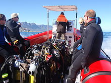
इस क्षेत्र में अधिकांश गोता स्थल अपेक्षाकृत उथले हैं और इन्हें सामान्य मनोरंजक डाइविंग उपकरण के साथ हवा में किया जा सकता है, जिसमें निम्न शामिल होंगे:
- कम से कम 5 मिमी मोटाई, हुड, जूते और दस्ताने का पूरा गीला सूट।
- हार्नेस, रेगुलेटर और सबमर्सिबल प्रेशर गेज वाला एक सिलेंडर।
- एक उछाल कम्पेसाटर डिवाइस (बीसीडी)।
- मुखौटा और स्नोर्कल।
- पंख।
- बाकी उपकरणों के लिए एक डिचेबल वेट सिस्टम को सही ढंग से कैलिब्रेट किया गया।
- एक गोता कंप्यूटर या एक गहराई नापने का यंत्र और डीकंप्रेसन टेबल और गोता योजना के साथ टाइमर।
इसमें आप जोड़ सकते हैं:
- कोई और उपकरण जिसे आप या आपकी प्रमाणित करने वाली एजेंसी अनिवार्य मान सकती है, जैसे कि द्वितीयक नियामक, कम दबाव वाला बीसीडी इनफ्लोटर, चाकू, आदि।
- कोई भी उपकरण जिसे आप व्यक्तिगत पसंद के मामले में ले जाते हैं या उपयोग करते हैं, जैसे कैमरा, सिग्नलिंग डिवाइस, कलाई स्लेट, सूखा सूट, रील और सतह मार्कर बॉय, वैकल्पिक गैस आपूर्ति, कंपास इत्यादि।
सिफारिशों
- यदि आपके पंखों में पूरे पैर की जेब (बंद एड़ी) है, और आपके गीले सूट के जूते में नरम तलवे हैं, तो किनारे पर गोता लगाने के लिए प्रवेश बिंदु पर जाने के लिए जूते पहनना आवश्यक हो सकता है। इस क्षेत्र में अधिकांश तट पर गोता लगाने के लिए खुली एड़ी के पंख और कठोर तलवों के जूते की सिफारिश की जाती है क्योंकि जमीन खुरदरी हो जाती है और जब आप गोता लगाकर लौटते हैं तो जूते अभी भी नहीं हो सकते हैं।
- एक मानक सतह मार्कर बोया की सिफारिश नहीं की जाती है जहां भारी केल्प की वृद्धि होती है, क्योंकि यह अक्सर रोड़ा और अंतहीन झुंझलाहट प्रदान करेगा। ऐसी साइटों पर तैनात करने योग्य या "विलंबित" सतह मार्कर बेहतर होता है और नाव में गोता लगाने के लिए हमेशा एक अच्छी बात होती है।
- उपरोक्त में से किसी भी वस्तु को छोड़ना आपके अपने जोखिम पर है। ऐसे गोताखोर हैं जो हुड, या दस्ताने, या जूते नहीं पहनेंगे, या महसूस करेंगे कि स्नोर्कल या बीसी आवश्यक नहीं है, या वे 3 मिमी सूट में गोता लगा सकते हैं। इसे पहले एक आसान गोता लगाने का प्रयास करें, जहां आप जल्दी से बाहर निकल सकते हैं। It may work for you – there are divers who manage in each of these cases, but you have been warned.
Additional equipment

For each dive site there may be additional or alternative equipment required or recommended, which may improve the dive experience or improve safety at that site. The most commonly recommended items are:
- दिशा सूचक यंत्र
- Dry suit
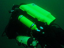
- रोशनी
- Nitrox
- Reel with DSMB
Use of a compass is recommended wherever it may be desirable to swim back to shore below the surface to avoid wind or boat traffic, or to keep below the kelp fronds. It is required for the compass navigation routes.
A dry suit is recommended for most dives on the Atlantic seaboard, or in general if the dive is deeper than about 20 m and the water is colder than 13°C. An appropriate undergarment is required for the dry suit, at this is what provides the insulation. With a suitable combination it is possible to enjoy an hour's dive in comfort at a water temperature of 8°C, when most of the divers in 7-mm wetsuits are cold after 30 minutes. If your face and head are particularly sensitive to cold, a full-face mask will keep your face warm.
Recommendations for a light are for daytime dives, as lights are considered standard equipment on night dives. Backup lights should be carried on night dives from a boat. Underwater flashers may not be well received by the other divers as they are extremely annoying. If you feel you must use one, warn the others and stay away from those divers who do not wish to have a light continually flashing in their peripheral vision and distracting them. A strobe which may be switched on in an emergency is another matter entirely, and is accepted as a valuable safety aid.
The equipment recommendations are for divers who are competent to use those items, and if you are not, you should consider whether your competence is sufficient to dive the site without this equipment.
No recommendations are made regarding equipment for wreck penetration dives and deep dives. If you do not know exactly what equipment is required and have it with you, or are not competent in its use, you should not do the penetration. Depth, wrecks and caves are nature’s tools for culling reckless divers.
Recommendations for gas mixtures are generic. You must choose the appropriate mixture based on your qualifications, competence and the dive plan. Nitrox mixtures are generally recommended to increase dive time without obligatory decompression stops, and Trimix to reduce narcotic effects. Nitrox is available from many of the dive shops, and charter operators will usually provide cylinders filled with the blend of your choice if given sufficient notice. Trimix is more difficult to arrange, as not many filling stations keep Helium in stock, so it may require a bit of shopping around.
Decompression dives should generally only be planned by divers who are familiar with the site, and are competent and properly equipped for the planned dive. Recommendations in this regard are outside the scope of this article, and it will be necessary to discuss any planned decompression dives well in advance with the dive operator, as only a few of them are competent and willing to support planned decompression dives, and those will usually require strong evidence of your competence to do the dive, and advance notice of your dive plan.
Exotic equipment

Diving equipment other than open circuit back mounted scuba with half mask and mouth-grip demand valve is considered to be exotic for this section.This would include surface supplied breathing apparatus and full face masks, used as standard equipment by commercial divers, and rebreathers, seldom used by commercial divers, but frequently used by military divers and gaining popularity with Technical recreational divers.
Also considered as exotic equipment is side-mount scuba and diver propulsion vehicles (scooters), as they are not used by many recreational divers.
Generally speaking, any use of surface supplied diving equipment will require special preparation and logistics, which are not available from the listed service providers, but are perfectly legal for use and technical support is available from the suppliers to the commercial diving industry in Cape Town.
Rebreathers are relatively uncommon, but are used by a few local aficionados, and sorb is available over the counter at a few suppliers. There is even one charter boat which regularly runs dives for mainly rebreather divers. Expect to be checked out for skills and certification before being allowed to join these dives, so it would be advisable to make prior arrangements. Technical support is available for a limited range and parts will usually only be available from overseas agencies. Most of the local dive sites do not really justify the expense and relative risk of rebreathers, and they are mostly used by divers who also use them in other places where they are more of an advantage, and by those who just enjoy the technology. They are not available for rental, except in some cases as part of a training package.
Full-face masks will not be a problem, provided you can show your ability to provide buddy support if diving with a partner (some charters will insist that you dive with a buddy). Technical support and parts are available from local agencies for most of the more popular models used for commercial and technical diving, but you may have to wait some time if parts are not in stock. The use of a full-face mask can be a particular advantage when the water is cold, and if you have one and prefer to use it, by all means bring it to Cape Town.
Side mount scuba is relatively uncommon in Cape Town, but there should be no problems if you chose to use it. Do not expect boat crews to know how to help you kit up, but they will probably respond well to explanations. There is a growing number of local side-mount aficionados, including several instructors for side-mount.
Diver propulsion vehicles (scooters) are rare but not unknown. Check with the charter boat whether will be space on board for your unit, and don't expect to find one for rental.
Decompression and bailout sets are not considered exotic, but are not easily available for rental. Bring your own, or ask around. Some of the service providers carry a small range of cylinders suitable for sling mount, but may not have the gas mixture you want in stock. Almost all the local divers that carry decompression or bailout cylinders routinely have their own equipment
गोता लगाने वाली साइटें


The dive sites described in these articles include some which are well known favourites and have been dived frequently and by many divers for decades, and also newly described sites, which may only have been dived a few times, and by a few divers. There are also sites which have been known for years, but seldom dived due to their relative inaccessibility, and a few which are basically not particularly interesting, but have been included in the interests of completeness, as the information is available, and occasionally people want to know what they are like. With a few exceptions, the information provided is based on personal observation at the sites by Wikivoyagers. All photos of marine life and features of interest were taken at the listed site.
Geographical information is provided in as much detail as is available. Sites are geolinked, which allows them to be identified on various internet map systems. Positional accuracy is usually good. The maps provided should be usable, to scale, and accurate, but are not guaranteed either to be correct in all details or complete. Clicking on the thumbnail will open a link to a higher resolution image.
Atlantic coast of the Cape Peninsula

Introduction and some tips on diving the Atlantic coast.
This coastline from Table Bay to Cape Point is exposed to the south westerly swells generated by the cold fronts of the Southern Ocean. The continental shelf is narrow in this part of the coast and swells are not greatly influenced by the narrow band of shallow water, so they retain most of their deep-water energy. These swells pound this coast most of the winter, and to a lesser extent in summer, so diving in this region is mostly a summer activity, and the frontal weather patterns far to the south are more important than local weather for swell prediction.
North westerly winds are a feature of the approach of a cold front, and in winter they can be very strong for a few days before swinging to southwesterly as the front passes. These north westerly winter storms were responsible for many shipwrecks in Table Bay and other parts of the west coast, and the associated wind waves can be severe. However the fetch is short and these onshore wind waves do not last long after the storm. They do mess up the visibility though, and this effect lasts for some time after the waves have dissipated.
The south easterly winds are longshore to offshore in this area and tend to knock the swell down a bit. They also cause an offshore displacement of the surface water, which results in deeper water rising to take its place. This upwelling brings colder, initially cleaner water to the inshore areas, and can produce conditions of 20 m visibility and temperatures down to 8°C, though more usually 10° to 12°C. The diving is wonderful if you are sufficiently insulated. Out of the water, however, it is commonly fine and hot, with blazing sunshine high ultraviolet levels and air temperatures in the high 20 and 30° Celsius. This means you will be overheating until you get in the water, hence the comment that summer diving in Cape Town is one easy step from hyperthermia to hypothermia.
There is no escaping the need for a well-fitting, thick (preferably 7 mm), wet suit or a dry suit with an adequate undergarment for these conditions if you intend to stay for more than a few minutes. Carrying a bottle of water with your equipment to wet the outside of your suit before or after putting it on will help keep the temperature down due to evaporative cooling, specially on a windy day. Overheating after leaving the water is seldom a problem. The alternative option of kitting up at the water’s edge requires a shore party to look after your clothes, etc., while you dive, so it has become less common. Do not leave equipment unattended if you wish to see it again.
An upwelling is frequently followed by a plankton bloom, often called a red tide. This will reduce visibility considerably, particularly near the surface. Often the water will be much clearer below the surface layer, though the light levels may be a bit dim and the colour relatively green, or even brownish. The phytoplankton will bloom while the sun shines, so it is much more developed in summer.
The south-easter is an offshore wind at some sites, and besides its influence on temperature and visibility, it also affects the swim back to shore after the dive. The south-easter can appear seemingly out of nowhere on a previously cloudless and windless day, and build up to near gale force in the time you are underwater on a dive, though it is usually predictable, so take note of weather forecasts, and in any case, allow sufficient reserve air to swim back a few metres below the surface. A compass is extremely useful if you do this as it allows you to swim shallower, which is good for air consumption, decompression and warmth. A depth of 3 to 5 m is recommended for a long swim home. The strong south-easter in these cases produces a short, steep wind chop with white-caps which does not penetrate to any significant depth, but the constant slapping of waves and the spray in the air can make snorkelling unpleasant and difficult. There may also be a shallow offshore wind drift (surface current), but this takes some time to develop and gets rapidly weaker with depth and is not usually a problem below about a metre depth inshore. Further offshore the wind induced current can take you several hundred metres during a decompression stop, at a rate of about 0.5 to 1 kph.
When boat diving a deployable surface marker buoy (DSMB) is useful to both facilitate controlled ascent and accurate decompression or safety stop depth, and as a signal to the boat that you are on your way up. In strong wind conditions it will also improve your visibility on the surface, specially if your equipment is all black, so it is worth carrying even if only as a signalling device. Bright yellow has been shown to be best for all round visibility at sea, but orange and red are fairly good too.
Robben Island

These sites are all boat dives. There is no other practical way to get to them, as they are all several kilometres from the mainland across major shipping lanes.The waters around Robben Island were proclaimed a Marine Protected Area in 2019, so a permit is required to dive there. The boat operator will have to have a permit for the restricted area. Details of how this will be done are not yet known.
Local geography:Robben Island is a low, rocky shored island in the mouth of Table Bay. The island and surrounding reefs are rock of the टायगरबर्ग series of the late Precambrian Malmesbury group. These are folded sedimentary rocks, frequently with very steep dip, which often weather to form rather jagged outcrops.
The sites include:
- 1 एमवी खजाना: S33°40.45' E018°19.95' (approximate)
- Wreck dive. Boat access only. Depth: 30 to 50 m
- On 23 June 2000 the damaged Panamanian registered bulk ore carrier sank off the coast of South Africa approximately 7 nautical miles north of Robben Island.
- The vessel lies upright on a fairly level bottom at about 50 m depth. The superstructure was removed shortly after the sinking by sawing it off at about 30 m depth with a cable towed by tugs as it was a hazard to shipping.
- 2 Robben Island steamer wreck: S33°49.886', E018°21.524' (approximate centre of wreckage)
- Wreck dive. Boat access only. Depth: 30 to 36 m
- Unidentified wreck of a steel steamship about 48 m long in reasonable structural condition.
- 3 एमवी Afrikaner: S33°50.012' E018°20.686'
- Boat access only. Deep wreck dive. Depth 43 to 50 m
- The 61 m fishing vessel struck Whale Rock in 1993 and sank while being towed away from the rock.
- 4 Whale Rock: S33°50.112' E018°22.858'
- Reef dive. Boat access only. Depth: Mostly less than 10 m
- A large shoal area of rocky reef, usually with a break over the pinnacle, which is the last resting place of a few ships.
- 5 एसएस हाइपेटिया: S33°50.10’ E018°22.90’ (Turner 1988)
- Wreck and reef dive. Boat access only. Depth: Shallow, maximum probably about 15 m
- British Houston Line steamer of 5 728 tons, built in 1902. Wrecked on Whale Rock in Table Bay on 29 October 1929 in fog while on a voyage from Beira to New York with a cargo of blister copper and chrome ore.
- 6 एमवी Daeyang Family: S33°50.388' E18°23.133
- Wreck and reef dive. Boat access only. Maximum depth about 15 m
- A large Korean ore carrier which was wrecked on Whale Rock on 1 March 1986 when anchors dragged in heavy weather. The wreckage lies at a depth of about 15:nbsp;m
Table Bay

- 7 एमवी Winton: S33°52.1514' E18°29.1828 (Engine block)
- Wreck dive. Boat access, though shore access is feasible. Close to surf line. Maximum depth about 6 m.
- Wreck of a small steel freighter on a flat sand bottom.
- 8 एमवी Gemsbok: S33°53.0' E018°20.5'
- Boat access only. Deep wreck dive. Depth about 57 m on the sand.
- The 50 m 313 tonne buoy tender MV Gemsbok capsized and sank about 4 km from Green Point Lighthouse on 2 Seprember 1975 while transferring an anchor chain of a cargo vessel. The chain snagged and the weight of the chain caused the vessel to capsize and sink within minutes. The wreck lies on its starboard side.
- 9 Highfields: S33°53.13’ E018°25.83’ (Bow)
- Wreck dive. Boat access only. Close to major shipping lane at harbour mouth. Maximum depth 24 m.
- Wreck of a steel barque which sank after a collision in 1902.
- 10 एसएस Cape Matapan: S33°53.233' E018°24.533' About a kilometer north of Granger Bay harbour
- Wreck and reef dive. Boat access only. Maximum depth 25 m. The wreck is close to the shipping lane and there are no landmarks nearby.
- Wreck of a steel fishing boat which was sunk in a collision in 1960 in heavy fog.
- 11 आरएमएस एथेंस: S33°53.85’ E018°24.57’
- Wreck and reef dive. Shore or boat access. Maximum depth about 7 m
- Union Company iron steam screw barque of 739 tons, built in 1856. Wrecked between Mouille Point and Green Point on 17 May 1865 during a north-west gale while trying to steam out of Table Bay. The site can be identified by the remains of the engine-block, which is visible above the water.
- 12 एसएस SA Seafarer: S33°53.80’ E018°23.80’
- Wreck and reef dive. Boat access recommended. Depth: Fairly shallow. Mostly between 5 and 9 m.
- The 8000-ton Safmarine freighter SS South African Seafarer was wrecked in a north westerly gale on 1 July 1966, and lies in front of the Green Point lighthouse.
- 13 Two Oceans Aquarium: S33°54.476’ E018°25.074’
- Shore access only. Confined water. Maximum depth 6 m
- Visitors may dive in the Predator tank, which is a large oval tank, or the Kelp Forest tank, which is roughly square. There are large windows, almost full height on one side, through which you can observe the other visitors watching you if you get bored with the fish.
Sea Point

Local Geography:There is a narrow coastal plain at the base of Signal Hill and Lion’s Head. The contact zone between the intrusive granites of the प्रायद्वीप pluton and the sedimentary greywackes and shales of the टायगरबर्ग formation of the Malmesbury series is in this area.The northern sites are on the टायगरबर्ग rocks, which are steeply dipped and form parallel ridges and gullies, while Bantry Bay is on the granite, and has the characteristic corestone topography of rounded boulders and outcrops with sand bottom in deeper areas.
The sites include:
- 14 थ्री एंकर बे: S33°54.36’ E018°23.85’
- Reef dive. Shore access. Depth: Shallow
- A small sand bottomed bay with reef to both sides. Easy access.
- 15 सी प्वाइंट रिज शिखर: S33°54.905' E018°21.421'
- Reef dive. Boat access. Depth: 17 to 27 m
- An isolated pair of corestone pinnacles on a low granite ridge.
- 16 बैंट्री बे: S33°55.56’ E018°22.65’
- Reef dive. Shore or boat access Depth: Less than 10 m
- This little bay is at the southern end of Sea Point, towards Clifton.
क्लिफटन

Clifton Rocks is generally considered a shore dive, but the Paws are quite a distance offshore and are only dived from boats. Parking in Clifton is often a problem, particularly in the kind of weather in which you may wish to go diving. Weekdays will be better and early morning will help. The offshore dives avoid this problem by using boats from Oceana Power Boat Club slipway, which has its own parking problems, though not quite as serious.
Local geography:The suburb of Clifton is built on the rather steep slopes of the base of Lion’s Head above Clifton Bay. There are four beaches in the bay which are famous for white sand, shelter from the south easter and cold water. North Paw is offshore of the headland to the north, and South Paw is offshore from Clifton Rocks, on the south headland. Access to the area by road is from Sea Point to the north and Camps Bay to the south.
The reefs of Clifton are granite corestones of the प्रायद्वीप प्लूटन In this area the granite base of the mountain extends to approximately the height of Signal Hill, and is capped by sandstones of the Graafwater and Table Mountain formations. Occasional rounded granite outcrops can be seen on the mountainside, which is mostly deeply weathered granitic saprolite, with some sandstone scree.
The sites include:
- North Lion’s Paw: S33°55.854’ E018°21.849’ (Exposed Rock)
- Reef dive. Boat access only. Depth: 15 to 23 m.
- A spectacular site in good conditions. A popular part of the site is the cave rock, which is slightly offshore from the exposed rocks.
- 17 उत्तरी शेर का पंजा उत्तरी शिखर
- 18 उत्तर शेर का पंजा मोंटी के शिखर
- 19 उत्तर शेर का पंजा पूर्वी शिखर
- 20 उत्तर शेर का पंजा बैरी के शिखर
- 21 उत्तरी शेर की पंजा गुफा रॉक
- 22 उत्तरी शेर का पंजा मुख्य रीफ
- 23 दक्षिण शेर का पाव: S33°56.308’ E018°21.890’
- Reef dive. Boat access only. Maximum depth about 20 m.
- An extensive reef of granite corestones marked by the large outcrop which extends above the water.
- 24 क्लिफ्टन रॉक्स: S33°56.346' E018°22.222'
- Reef dive. Shore or boat access. Maximum depth about 14 m.
- A large area of granite corestones, bounded to the north by sand bottom. The reef extends to seaward from the shoreline at the point.
- 25 क्लीव्स टनल: S33°56.540' E018°21.894'
- Reef dive. Boat access. Maximum depth about 20 m.
- A large corestone pinnacle with a long low tunnel
Camps Bay
Local geography:Camps Bay is in the corner made by Lion’s Head and Table Mountain. Access is over Kloof Nek from the city bowl, and round the coast from Sea Point via Clifton to the north, and from Hout Bay via Oudekraal to the south
The reefs of this area are like those of Clifton.
The sites include:
- 26 बकोवेन रॉक: S33°57.555’ E018°22.204’
- Reef dive. Shore or boat access. Maximum depth 17 m.
- This site is generally considered a shore dive. Parking is limited so it is most conveniently dived during the working week when there is less competition for space, otherwise get there early.
Oudekraal

This area includes some of the best and most popular shore dive sites on the Atlantic seaboard. Most can also be dived from a boat, and this is of particular importance to divers with restricted mobility on shore, as there is generally a rugged bit of coast to negotiate and in some cases a long climb. There is also a moderate to long swim at some of the sites, and at some states of the tide, heavy kelp inshore.
Local geography:The coastline at the base of the Twelve Apostles range just south of Table Mountain is steep, and south of Camps Bay, virtually undeveloped. Fortunately for divers, the coastal road is not far above sea level in the north of this area, and though there are not many off-road parking areas, the road is wide enough to park along the side.
This is an area of pale grey प्रायद्वीप Granite corestone outcrops and boulders with some Table Mountain Sandstone boulders which have rolled down the mountainside to the water’s edge. The mountainside below the sandstone cliffs is deeply weathered granite saprolite with occasional corestone outcrops. The cuttings at the roadside display the granular yellow-brown saprolite with a thin soil covering. The underwater topography is almost entirely corestones exposed by erosion, surrounded by samd, and is a continuation of the granite boulders and outcrops at the water’s edge.

North Oudekraal
The sites include:
- 27 ड्रेडलॉक रीफ: S33°58'22.05" S18°21'42.59"
- Reef dive. Boat access. Depth: 1.5 to 20 m.
- A relatively new site. First survey 30th January 2010. This granite ridge peaks about 1.5m from the surface at low tide, but the tip is small and seldom breaks. Bottom on low granite at about 20m. Colourful and diverse invertebrate cover, and notable for the relatively large colonies of Dreadlock hydroids.
- 28 गेल्डकिस ब्लाइंडर: S33°58.67’ E018°21.62’
- Reef dive. Boat or shore access. Maximum depth about 20 m.
- A relatively infrequently dived site. The highest rock on the reef is a blinder beyond Geldkis rock which occasionally breaks the surface at low tide. Huge boulders and outcrops, and a few swimthroughs.
- 29 स्ट्रॉबेरी रॉक्स: S33°58.725’ E018°21.658’ (approximate)
- Reef dive. Shore or boat access. Maximum depth about 15 m.
- The two smaller rocks to the north of Geldkis rock. Several small caverns and swimthroughs.
- 30 गेल्डकिसो: S33°58.73’ E018°21.61’
- Reef dive. Shore or boat access. Maximum depth about 15 m.
- A large group of rocks with lots of overhangs, swimthroughs and chimneys. The Dutch East Indiaman Het huys te Craijestein was wrecked on the rocks in the bay at Oudekraal on 27 May 1698 in thick mist. Three chests of treasure disappeared and the name "Geldkis" (money-chest) appears on maps of the area and is now applied to the offshore rocks.
- 31 बोर्डरूम: S33°58.761’ E018°21.151’
- Reef dive. Boat access, though possible from shore. Maximum depth about 21 m near the pinnacle, but deeper water nearby. about 10 m on top.
- A very large boulder with a large swimthrough cave and a large overhang in an area of high profile boulder reef.
- 32 हेट हुइस ते क्रैएस्टीन: S33°58.85’ E018°21.65’
- Wreck and reef dive. Shore access. Maximum depth 10 m.
- Remnants of the Dutch East Indiaman हेट हुइस ते क्रैएस्टीन of 1,154 tons, which was wrecked in the bay at Oudekraal on 27 May 1698 in thick mist while trying to find the way into Table Bay. Some cannon, anchors and a few baulks of timber are all that are usually visible above the sand.
- 33 मशरूम शिखर: S33°58.781’ E018°21.521’
- Reef dive. Shore or boat access. Maximum depth 17 m.
- A submerged granite tor (stacked group of large corestones) between Geldkis and Justin’s Caves. The pinnacle is surrounded by lower outcrops separated by sandy gullies.
- 34 सैंडी कोव: S33°58.90’ E018°21.65’
- Reef dive. Confined waters. Shore access. Maximum depth 4 m
- A shallow sheltered cove at Oudekraal, suitable for open water training exercises, refresher courses and testing equipment when you don’t need depth. Entry area for several other sites.
- 35 जस्टिन की गुफाएं: S33°58.85’ E018°21.50’
- Reef dive. Shore or boat access. Maximum depth about 13 m.
- A group of big granite corestone outcrops and boulders with several swimthroughs, overhangs, caves and deep narrow gaps between the rocks. Spectacular in good visibility, colourful reef life.

Central Oudekraal
The sites include:
- 36 एंटीपोलिस: S33°59.06’ E018°21.37’ (Bow section)
- Wreck and reef dive. Shore or boat access. Maximum depth about 10 m.
- The tankers "Romelia" and "Antipolis" were under tow on 28 July 1977 during a north westerly gale when the tow cable to the "Antipolis" snagged on the sea bed. In the ensuing confusion the cables broke and the two ships were driven aground by the wind. The "Antipolis" ran aground at Oudekraal and was later cut down to water level.
- 37 क्लेन पन्नेकोएकी: S33°58.91’ E018°21.09’
- Reef dive. Boat or shore access. Maximum depth about 15 m.
- A group of large fairly low and flat rocks visible offshore to the west of the "Antipolis" and north of Coral Gardens.

South Oudekraal
The sites include:
- 38 ग्रोट पन्नेकोएक: S33°59.13’ E018°20.75’
- Reef dive. Boat or shore access. Maximum depth about 15 m
- A large flattish outcrop of granite, which extends a short way above the sea level at all tides. Some overhangs, crevices and small caves.
- मूंगा उद्यान (Oudekraal): S33°59.270' E018°20.782' (The pinnacles)
- Reef dive. Shore or boat access. Maximum depth 17 m
- A spectacular dive in good conditions. Huge granite boulders in groups with open patches between them. There are overhangs, small caverns, a few swimthroughs, and many deep gaps and crevices. Extensively covered in colourful reef life. Possibly the best shore dive on the Atlantic side of the Cape Peninsula on a good day.
- 39 मूंगा उद्यान
- 40 Coral Gardens Offshore Pinnacle
लैंददनो

These sites can be accessed from the shore or by boat. Parking is limited, but the area is reasonably secure. Some walking is required, but no serious climbing as the parking is near the sea level.
Local geography:The small residential suburb of Llandudno is built on the moderately steep slopes of the Cape Peninsula below the peak of Klein-Leeukop, where the coast road (M6 – Victoria Drive) from Camps Bay crosses over the neck to Hout Bay. There is only one way into Llandudno by road, which is from the M6 near the top of the pass.This is an area of granite corestone reefs with sand bottom.
The sites include:
- 41 १३वाँ प्रेरित: S33°59.486' E18°19.922'
- Reef dive. Boat access. Depth: 10 to 24 m.
- A large granite pinnacle on an area of low granite reef with occasional sand patches.
- 42 Llandudno Reef: S34°00.037' E18°19.897'
- Reef dive. Boat access. Depth: 10 to about 30 m, on sand
- An unsurveyed granite reef, with several pinnacles, outcrops and gullies.
- 43 लोगीज बे: S34°00.25’ E018°20.53’
- Reef dive. Shore access. Maximum depth probably about 10 m.
- A small rocky cove to the north of Llandudno beach.
- 44 MV Romelia: S34°00.700’ E018°19.860’ approximately
- Wreck and reef dive. Shore or boat access. अधिकतम गहराई लगभग 24 मी.
- The tankers रोमेलिया तथा एंटीपोलिस were under tow on 28 July 1977 during a north westerly gale when the tow cable to the एंटीपोलिस snagged on the sea bed. In the ensuing confusion the cables broke and the two ships were driven aground by the wind. रोमेलिया ran aground at Sunset Rocks, Llandudno, where its back was broken by the heavy surf and the ship split in two. Later the bow section sank, leaving the stern mostly above sea level on the rocks. Over the years the stern section has also broken up and is no longer visible above the water.
Oude Schip headland
Local geography:Oude Schip headland lies at the foot of the Karbonkelberg between Sandy Bay to the north and Leeugat to the south, It is a low rocky headland of Peninsula granite, with several reef dives and one known wreck. It is a fairly exposed section of coast but protected from the south easterly winds by the mountain. The sites are only accessible by boat as there is no road access to this part of the shore, and most are too far offshore to safely swim.
This is an area of granite bedrock of the प्रायद्वीप pluton, The reefs are exposed corestone outcrops and boulders, with sand patches in the deeper areas
The sites include:
- 45 कदम: S34°01.330’ E018°18.600’
- Reef dive. Boat access only. Maximum depth about 20 m.
- An area of high granite reef with deep gullies. Not actually in Leeugat, but just north of Oude Schip headland.
- 46 एमवी Harvest Capella: S34°01.600’ E018°18.750’
- Wreck dive. Boat access only. Maximum depth about 15 m.
- An area of mostly flattish granite reef with a few ridges and some wreckage of a steel motor fishing vessel, some of which has washed up onto the point and is visible from a distance. Not actually in Leeugat, but on the north shore of Oude Schip headland.

The Blue Flash Reefs
- 47 Rachel's Reef: S34°01.431' E018°18.151'
- Reef dive. Boat access only. Depth between about 3 and 21 m.
- Rachel's Reef is a compact granite pinnacle with surrounding high profile reef.
- 48 Humpback Ridge: S34°01.548' E018°18.142'
- Reef dive. Boat access only. Depth between about 4 and 21 m.
- A fairly massive granite pinnacle in the middle of a more extensive north-south ridge rising to about 12 m. Humpback whales have been seen near these reefs on several occasions.
- 49 Wilhelm's Wall: S34°01.502’ E018°17.931’
- Reef dive. Boat access only. Depth between about 12 and 31 m.
- A granite ridge somewhat more than 50 m long with sheer faces to the north and south, a flattish bottomed gully to the south, and another, more broken ridge south of the gully. Colourful sessile invertebrates on the sides and seaweeds on top.
The Middelmas reefs:
- Hakka Reef (Middelmas): S34°01.747’ E018°18.328’
- Reef dive. Boat access only. Maximum depth about 21 m.
- 50 Die Middelmas is a rock that projects several metres above the water at all tides, to the west of the Oude Schip peninsula.
- 51 Hakka Reef Southeast pinnacles is off this rock.
- 52 Hakka Reef Sven's Caves pinnacles is nearby at a set of pinnacles near a sand patch.
- 53 ट्विन टावर्स: S34°01.920’ E018°18.330’
- Reef dive. Boat access only. Depth about 20 m at the tops of the pinnacles to 34 m on the sand.
- A small but tall double-peaked granite pinnacle on a narrow base reef and surrounded by sand.
Leeugat (Maori Bay)

.jpg/220px-Gelderland_(1).jpg)
Although several of the sites are quite close inshore, this area is in practice only accessible by boat, as the distance to the nearest parking is too far to carry dive gear (about 3 km as the crow flies, more on foot).
Local geography:Leeugat, also known to divers as Maori Bay, lies at the foot of the Karbonkelberg, between the northern headland of Oude Schip, and Duikerpunt to the south. It is a small bay, but fairly deep close inshore, which in combination with the partial barrier afforded by the reefs at the headlands, has provided the wrecks in Leeugat bay with better protection from wave action than those on more exposed parts of the coastline. This means that not only have they lasted well for their ages, but conditions are suitable for diving more often than for many other wrecks on the Atlantic seaboard of the Cape Peninsula.
This is an area of granite bedrock of the प्रायद्वीप pluton, The reefs are exposed corestone outcrops and boulders, with sand patches in the deeper areas
The sites include:
- 54 MV Keryavor and the Jo May: S34°02.037’ E018°18.636’
- Wreck and reef dive. Boat access only. Depth: Not available, probably between 25 and 30 m.
- These two wrecks lie next to each other approximately between the माओरी और यह गेल्डरलैंड. Jo May sank first and not much of her wooden structure remains. Ker Yar Vor was a steel lobster fishing vessel and several chunks of hull structure and twisted sections of plating remain.
- 55 SS Maori: S34°02.062’ E018°18.793’ (Machinery)
- Wreck and reef dive. Boat access only. Depth: 6 to 21 m
- एसएस माओरी was a typical British steam cargo vessel of the early 1890s. The ship was wrecked in the bay between Oude Schip and Duikerpunt on 5 August 1909 in thick fog and drizzle while on a voyage from London to New Zealand.
- 56 SAS Gelderland: S34°02.070’ E018°18.180’
- Wreck and reef dive. Boat access only. Depth: 30 to 35 m
- The Ford class Seaward Defense Boat SAS गेल्डरलैंड was scuttled on 21s ecember 1988, north west of Duiker Point, as demolition trials.
- The vessel was about 40 m long but the main part of the wreckage is now only about 20 m long as the bow and stern sections were blown right off.
- Plan B pinnacle is just to the south of the southernmost wreckage.
- 57 SS Oakburn / MV Bos 400: S34°02.216’ E018°18.573’
- Wreck and reef dive. Boat access only. Depth: Maximum 22 m
- The "Oakburn", a British cargo steamer of 3865 tons, was wrecked on the north side of Duikerpunt in fog on 21 May 1906, on a voyage from New York to Sydney. The Oakburn has pretty much fallen apart, and on 27 June 1994, the French pipe-laying crane barge Bos 400, broke its towline and stranded virtually on top of the older wreck. The Bos has started to break up, and two large sections have collapsed into the sea, though the main crane section is still firmly stuck on top of the rocks.
Outer Hout Bay


This area includes the dive sites between Duiker Point and Duiker Island and the extensive reefs to the south as far as Vulcan Rock and Tafelberg Reef. All of these are only accessible by boat. There are a number of sites being explored in this area: the reefs between Kanobi’s wall and Stonehenge, and a wreck of a lifeboat which was used to salvage materials from the Boss 400 and which lies between Stonehenge and Duiker Island are among these. There are several unexplored pinnacles in the region identified on the SAN charts as bakleiplaas, where the sea is often very lumpy due to the influence of the underwater topography on the swell.
Local geography:The suburb of Hout Bay lies in the valley between the Constantiaberg to the east and the peninsula formed by Karbonkelberg and its lesser peaks to the west. One of these peaks, the Sentinel, gives its name to a dive site at its foot. At the mouth of the valley is the business area of Hout Bay, with its small commercial fishing harbour and marina, and a public slipway used by dive charters and private dive boats for access to most of the southern peninsula dive sites on the Atlantic coast. The slipway is in good condition, wide and accessible, and has a large parking area, which on occasions can be crowded due to heavy use by commercial fishing skiboats.
The bedrock of this area is granite of the प्रायद्वीप pluton, and most of the sites are on corestone reefs of this rock.
The sites include:
Duiker Point sites:
- 58 Die Perd: S34°02.282’ E18°18.324’
- Reef dive. Boat access only. Depth: Not available, maximum probably about 20 m
- This rock off Duiker Point extends above the water and is surrounded by rugged reefs of high outcrops and deep gullies.
- 59 Kanobi’s Wall: S34°02.365’ E018°18.138’
- Reef dive. Boat access only. Maximum depth about 25 m.
- This blinder off Duiker Point is a good site with rugged topography, good biodiversity and large depth variation. Huge boulders are stacked, with tunnels, overhangs and caves of various sizes, and lots of vertical walls, some probably 10 m or more in height.
- 60 SURG Pinnacles: S34°02.375' E018°18.015'
- Reef dive. Boat access only. Depth 9 to over 30 m.
- A group of steep granite corestone pinnacles, probably mostly huge boulders, with walls, overhangs and a swimthrough. Deep narrow cracks divide the pinnacles. Spectacular topography, covered with lots of sea urchins and vast numbers of hairy brittlestars, a moderate variety of sponges, noble corals, gorgonians, and patches of cauliflower soft coral. Red bait and Laminaria on the tops of the pinnacles. Surge can be strong when a long swell is running.
- Star Wall: S34°02.466' E18°18.087' (pinnacle)
- Reef dive. Boat access only. Depth: 6 to 32 m.
- This site has the tallest and longest wall known in the Cape Town area and is a dive site well worth visiting. A massive and continuous granite wall of about 25m almost vertical height, extending for a length of 100 m on the south face and 50 m on the south-east face. Very diverse and colourful invertebrate cover on the wall face. The sites are:
- 61 Star Wall
- 62 Star Wall - M&M Cave
- 63 Star Wall - Lollipop Pinnacle
- 64 Sunfish Pinnacle: S34°02.475' E18°18.290' (pinnacle)
- Reef dive. Boat access only. Depth: 7 to 26 m.
- A fairly large pinnacle on a rocky bottom on the way to Duiker Point from Hout Bay harbour, which has been picked up quite frequently on the echo sounders of dive boats passing over it. It has now been dived, and to some extent mapped. The site is quite pretty and should make a pleasant alternative site. Topography is rugged, with high vertical walls on two sides of the pinnacle.
Stonehenge sites:
- 65 घाटी: S34°02.595’ E018°18.073’
- Reef dive. Boat access only. Maximum depth about 35 m.
- The area is named for a gully between rows of pinnacles. Big boulders and rock outcrops cover an extensive area.
- स्टोनहेंज: S34°02.838’ E018°18.316’
- Reef dive. Boat access only. Maximum depth about 22 m.
- The area is named for a group of tall rocks which break the surface. Big boulders and rock outcrops cover an extensive area. High profile in the deeper areas, with swimthroughs, holes and overhangs. Heavy kelp in some areas. Included in this area, Stonehenge Blinder, a pinnacle that approaches the surface and breaks in a large swell or at low tide.
- 66 Stonehenge Dusky Pinnacles - Coral Pinnacle
- 67 Stonehenge North
- 68 A-340 Pinnacle
- 69 Stonehenge Central
- 70 Stonehenge South
- 71 Stonehenge Blinder
- 72 Stonehenge Wreck
Seal Island sites:
- 73 सील द्वीप (Duiker island): S34°03.458’ E018°19.562’
- Reef dive. Boat access only. गहराई: उथला, ज्यादातर 6 मीटर से कम।
- मानचित्रों और चार्टों पर डुइकेरेइलैंड के रूप में चिह्नित छोटे चट्टानी टापू को सील द्वीप के रूप में जाना जाता है, जो कि सील की निवासी कॉलोनी के कारण एक पर्यटक आकर्षण बन गया है। इसके साथ भ्रमित नहीं होना चाहिए सील द्वीप झूठी खाड़ी में।
वल्कन रॉक साइटें:

- 74 Di's Cracks: S34°03.855' E018°18.400' - बड़ा 14m शिखर - चट्टान के शीर्ष पर बोल्डर। वल्कन रॉक के लगभग 300 मीटर उत्तर पश्चिम (328 ° चुंबकीय)
- रीफ गोता। केवल नाव का उपयोग। गहराई: 10 से 30 मीटर।
- दृश्यता अच्छी होने पर एक शानदार गोता। बहुत सारी दीवारें और ओवरहैंग्स, स्विमथॉउज़ और गहरी, चौड़ी दरारें। समृद्ध अकशेरुकी आवरण। नाटकीय वाइड एंगल दर्शनीय फोटोग्राफी के लिए अच्छी साइट।
- 75 वल्कन रॉक: S34°03.967' E018°18.582'
- रीफ गोता। केवल नाव का उपयोग। चट्टान के पास अधिकतम गहराई 25 मीटर से अधिक है।
- वल्कन रॉक एक बड़ी ग्रेनाइट चट्टान का उच्चतम बिंदु है और ज्वार के कुछ राज्यों में सतह को तोड़ता है। यह नीचा है और ऊपर से सपाट है। दृश्यता अच्छी होने पर एक शानदार गोता।
टैफेलबर्ग रीफ साइट:
- 76 टैफेलबर्ग रीफ: S34°04.22' E018°18.93'
- रीफ गोता। केवल नाव का उपयोग। गहराई : 8 से 30 मी.
- पश्चिम में लगभग 29 मीटर की दूरी पर उच्च राहत और रेत के तल के साथ ऊबड़-खाबड़ ग्रेनाइट का विस्तृत क्षेत्र। गहरी दरारें और गलियां। ज्यादा ओवरहांग नहीं, लेकिन बहुत सारे लंबवत चेहरे। अच्छी दृश्यता में बहुत ऊबड़-खाबड़ और शानदार स्थलाकृति।
- 77 क्लेन टैफेलबर्ग रीफ (सलाद कटोरा, यॉट मलबे): S34°04.442' E018°19.191'
- रीफ गोता। केवल नाव का उपयोग। गहराई: 14 से 36 मीटर।
- बड़े शिलाखंडों के साथ विशाल ग्रेनाइट। गहरे क्षेत्रों में रेत तल। बीहड़ और शानदार स्थलाकृति। जीआरपी नौका का मलबा शिखर के किनारे एक खरोज में होता है। चट्टान के पूर्व की ओर रेत पर शुरू करते हुए ४० से ४५ मीटर गोता लगाना संभव है, और उत्तर-पश्चिमी दिशा में चट्टान पर तैरना संभव है, लेकिन यह संभावना है कि यदि आप सभी तरह से प्राप्त करते हैं तो डीकंप्रेसन की आवश्यकता होगी उथला शिखर।
- टैफेलबर्ग डीप:
- रीफ गोता। केवल नाव का उपयोग। रेत पर अधिकतम गहराई लगभग 40 मीटर।
- निम्न से मध्यम प्रोफ़ाइल ग्रेनाइट आउटक्रॉप्स, ऊपर की ओर झुका हुआ टैफेलबर्ग डीप पिनेकल क्लेन टैफेलबर्ग रीफ में शिखर के दक्षिण में। 50 मीटर गोता लगाना और चट्टान पर तैरना संभव है, लेकिन कुछ विघटन की आवश्यकता होगी।
- 78 टैफेलबर्ग डीप
- 79 टैफेलबर्ग डीप पिनेकल
हौट बे


इस क्षेत्र में सेंटिनल और चैपमैन पीक के बीच के स्थल शामिल हैं। इनमें से ज्यादातर नाव में गोता लगाने वाले हैं। एक अपवाद, प्रहरी, को बड़ी कठिनाई के बिना भूमि द्वारा पहुँचा जा सकता है, लेकिन इसमें सुरक्षा समस्या है।
सेंटिनल ग्रेनाइट तटरेखा का एक विशिष्ट क्षेत्र है, जिसमें किनारे के साथ बड़ी संख्या में बोल्डर और सामान्य गोलाकार प्रोफाइल के साथ कोरस्टोन रीफ हैं। एस्टर और कात्सु मारू के मलबे एक सपाट रेत के तल पर हैं, और डाई जोसी की साइट चालू है लोअर चैपमैन के पीकी की चट्टानों के आधार पर अपेक्षाकृत अप्रभावित ग्रेनाइट
साइटों में शामिल हैं:
- 80 पहरेदार:
- रीफ गोता। किनारे या नाव का उपयोग। गहराई: अधिकतर 10 मीटर से कम।
- यह अटलांटिक तट पर वह स्थान है जहाँ 30 मीटर गहराई का समोच्च तट के सबसे निकट है।
- प्रहरी को कुछ लोगों द्वारा ऊर्ध्वाधर चट्टानों के नीचे का क्षेत्र माना जाता है, और यह समतल चट्टान का एक क्षेत्र है जिसमें बहुत सारे केल्प और बॉक्स जेलीफ़िश और कुछ बड़े बोल्डर हैं।
- शिखर, सीवेज कार्यों के पास, हाउट बे बंदरगाह के ठीक बाहर किनारे के पास चट्टानों का एक समूह है।
- 81 एमवी एस्टर: एस३४°०३.८९१' ई०१८°२०.९५५'
- मलबे गोता। केवल नाव का उपयोग। अधिकतम गहराई 28 मी.
- 340 टन, 27 मीटर लंबा मोटर फिशिंग वेसल "एस्टर" एक दक्षिण अफ़्रीकी पंजीकृत लॉबस्टर मछली पकड़ने वाला पोत था जिसे संरचना में खोलने और काटने के द्वारा गोताखोर-अनुकूल कृत्रिम चट्टान के रूप में तैयार किया गया था और हौट बे में मलबे के पास बिखरा हुआ था 9 अगस्त 1997 को "एमवी काटज़ू मारू"। इसे मलबे के प्रवेश के लिए एक प्रशिक्षण स्थल के रूप में इस्तेमाल किया गया है। बर्तन नीचे की तरफ सीधा है और टूटने लगा है।
- 82 एमवी कात्सु मारु: S34°03.910' E018°20.942' (मलबे के बीच में)
- मलबे गोता। केवल नाव का उपयोग। अधिकतम गहराई लगभग 30 मी.
- जापानी ट्रॉलर "कात्सु मारू #25" समुद्र में एक अज्ञात वस्तु से टकराया और उसे बंदरगाह की तरफ छिपा दिया गया। हौट बे की ओर जाने के दौरान जहाज में बाढ़ आ गई और यह 7 अगस्त 1978 को खाड़ी में डूब गया। मलबे रेत के तल पर इसके स्टारबोर्ड की तरफ है।
- 83 डाई जोसी: S34° 04.497' E018° 21.256'
- रीफ गोता। केवल नाव का उपयोग। गहराई: 7 से 17 मी.
- चैपमैन पीक के नीचे एक उथली चट्टान, जो हाउट बे बंदरगाह के करीब है और रात में गोता लगाने के लिए उपयुक्त है। उन कुछ क्षेत्रों में से एक जहां ग्रेनाइट को अपक्षय द्वारा गोल नहीं किया जाता है, जैसा कि साइट के ऊपर की चट्टानों से देखा जा सकता है।
अटलांटिक दक्षिण प्रायद्वीप

इस क्षेत्र में नूर्दोएक के दक्षिण में सभी प्रायद्वीप तट शामिल हैं। यह अक्सर मनोरंजक उद्देश्यों के लिए गोता नहीं लगाया जाता है क्योंकि यह अच्छी लॉन्च साइटों से एक लंबा रास्ता तय करता है और कई अच्छे गोता स्थलों को ज्ञात नहीं है। इस क्षेत्र में कई मलबे हैं, विशेष रूप से अल्बाट्रॉस रॉक्स/ओलिफेंट्सबोस्पंट में। केवल कुछ मलबों की ही सकारात्मक पहचान की गई है।
साइटों में शामिल हैं
- 84 एसएस कबीले मुनरो: S34°08.817' E18°18.949'
- मलबे और चट्टान गोता। केवल नाव का उपयोग। गहराई: 4 से 8 मी.
- Kommetjie में Slangkop प्रकाशस्तंभ के एक छोटे से उत्तर में बर्बाद हो गया। बहुत कम ही गोता लगाया। उथली सपाट बलुआ पत्थर की चट्टान, जिसमें कोरलीन शैवाल के साथ मलबा है।
- एसएस थॉमस टी. टकर:
- मलबे और चट्टान गोता। केवल नाव का उपयोग। गहराई: उथला
- यह जहाज चट्टानों पर ऊंचा टूट गया था, और मलबे के कुछ हिस्से किनारे पर दिखाई दे रहे हैं। अधिकांश मलबा काफी उथले पानी में है।
- 85 अफ्रीका का सितारा:
- मलबे और चट्टान गोता। केवल नाव का उपयोग। गहराई: लगभग 27 मीटर अधिकतम।
- 86 एसएस बिया: धनुष खंड: S34°16.140' E018°22.812' मुख्य खंड: S34°16.217' E018°22.638'
- मलबे और चट्टान गोता। केवल नाव का उपयोग। गहराई : 3 से 8 मी.
- 87 एसएस उम्हलालि: S34°16.435' E18°22.487'
- मलबे और चट्टान गोता। केवल नाव का उपयोग। गहराई: 5 से 8 मी.
- 88 अल्बाट्रॉस रॉक: S34°16.495' E18°22.197'
- रीफ गोता। केवल नाव का उपयोग। गहराई: चट्टान के पास शायद 15 मीटर से कम।
- दक्षिण-पश्चिम रीफ्स:
- रीफ गोता। केवल नाव का उपयोग। गहराई: अनिश्चित।
- प्रायद्वीप की नोक के पश्चिम में उथले चट्टान और केल्प बेड का एक विशाल क्षेत्र। यह स्पीयरफिशरमैन और क्रेफिश पकड़ने वालों का अड्डा है और स्कूबा पर इसकी खोज नहीं की गई है।
केप प्रायद्वीप का फाल्स बे तट


परिचय और केप प्रायद्वीप (साइमन टाउन की ओर) के फाल्स बे तट पर गोता लगाने के कुछ सुझाव
शेष क्षेत्र के विपरीत, फाल्स बे के पश्चिम की ओर सर्दियों के पछुआ हवा से आश्रय है, लेकिन बदले में यह दक्षिण-पूर्वी सिर पर ले जाता है। इसके परिणामस्वरूप इस क्षेत्र में आमतौर पर सर्दियों में गोता लगाया जाता है, जब दक्षिण-ईस्टर शायद ही कभी लंबे समय तक या बड़ी ताकत के साथ उड़ता है।
दक्षिणी महासागर के ऊपर शीतकालीन ललाट तूफान प्रफुल्लित पैदा करते हैं जो महाद्वीपीय शेल्फ द्वारा धीमा हो जाते हैं और केप प्रायद्वीप के चारों ओर अपवर्तित और विसरित होते हैं, जिससे कि वे ज्यादातर समुद्र तट के समानांतर फैलते हैं, और जब तक वे वक्र की ओर झुकते हैं, तब तक वे अपनी अधिकांश ऊर्जा खो चुके होते हैं। किनारा। यहां के तट का अनियमित रूप कुछ क्षेत्रों को दूसरों की तुलना में अधिक सुरक्षित रखता है। सामान्यतया, तट के वे भाग जो उत्तर-पश्चिम से दक्षिण पूर्व दिशा में अधिक होते हैं, उत्तर से दक्षिण भागों की तुलना में दक्षिण-पश्चिम प्रफुल्लित से बेहतर संरक्षित होते हैं, इसलिए गोता स्थल का चुनाव हाल के मौसम के पैटर्न पर निर्भर है।
गर्मियों के महीनों के दौरान जब दक्षिण-पूर्व अधिक बार, लंबे समय तक, और आम तौर पर कठिन होता है, तो यह क्षेत्र अक्सर गोता लगाने योग्य नहीं होता है, और दृश्यता आमतौर पर सर्दियों की तुलना में खराब होती है, भले ही परिस्थितियां अन्यथा उपयुक्त हों।
इस क्षेत्र में सर्दियों के महीनों के दौरान पानी का तापमान आम तौर पर गर्मियों में अटलांटिक तट की तुलना में गर्म होता है, जो कि कम दिन के उजाले के घंटों और अक्सर ठंड और बरसात के मौसम के लिए कुछ मुआवजा है।
पानी का तापमान गहराई के साथ भिन्न हो सकता है। आमतौर पर गर्मियों में थर्मोकलाइन होती है, और थर्मोकलाइन के नीचे दृश्यता काफी बदल सकती है। सतह 18 या 19 डिग्री सेल्सियस और नीचे 10 या 11 डिग्री सेल्सियस हो सकती है, लेकिन अंतर 5 डिग्री सेल्सियस या उससे कम होने की अधिक संभावना है। गहराई पर स्थितियां आसानी से अनुमानित नहीं हैं, और सतह के नजदीक से बेहतर या बदतर हो सकती हैं। सतह की परतों में एक प्लवक खिल सकता है और ठंडे तल के पानी में दृश्यता में अचानक सुधार 3 मीटर या उससे कम से 10 मीटर से अधिक हो सकता है। थर्मोकलाइन की गहराई भी बहुत अनुमानित नहीं है, लेकिन देर से गर्मियों में 12 से 20 मीटर के बीच होने का पता चला है।
सर्दियों में पानी का तापमान ऊपर से नीचे तक समान हो सकता है, और चूंकि फाइटोप्लांकटन खिलने के लिए कम धूप होती है, कम रोशनी होने पर भी दृश्यता और प्राकृतिक रोशनी बेहतर हो सकती है।
ठंड और बरसात के मोर्चों के बीच अक्सर कम या कोई हवा नहीं होती है, और हल्की से गर्म धूप होती है, जब पानी सपाट और साफ होता है और गोताखोरी अद्भुत होती है, और बड़ी संख्या में साइटें यह तय करना मुश्किल बनाती हैं कि कहां जाना है। इतना विकल्प है। अफ्रीका के अंत में यहां एक कठिन जीवन है, लेकिन किसी को यह करना होगा।
सर्दियों के दौरान पानी का तापमान आमतौर पर 13 डिग्री सेल्सियस और 17 डिग्री सेल्सियस के बीच होता है, हालांकि इसे 11 डिग्री सेल्सियस तक कम करने के लिए जाना जाता है, इसलिए यहां एक अच्छे सूट की भी जरूरत है। गर्मियों में तापमान 20 डिग्री सेल्सियस से ऊपर बढ़ सकता है, लेकिन 17 डिग्री सेल्सियस से 19 डिग्री सेल्सियस के आसपास रहने की संभावना है।
अधिकांश तट गोता अपेक्षाकृत उथले हैं, अधिकतम गहराई 8 मीटर से 15 मीटर के क्रम में, हालांकि यदि आप वहां पहुंचने के लिए 700 मीटर तैरने का मन नहीं करते हैं तो 30 मीटर किनारे गोता लगाना संभव है। उथला पानी सूखे सूट को कम फायदेमंद बनाता है, लेकिन हवा में गीले सूट से बाहर निकलना और रात में बारिश एक वांछनीय विकल्प के रूप में सूखे सूट को फिर से ऊपर धकेलती है। पसंद करना अच्छा है, और कई स्थानीय गोताखोर गोता लगाने की योजना के आधार पर गीले और सूखे सूट का आदान-प्रदान करते हैं।
मुइज़ेनबर्ग से कल्क बे

ये साइट फाल्स बे के पश्चिम की ओर सबसे उत्तरी स्थल हैं। वे उथले हैं और दक्षिण पूर्वी हवाओं और लहरों के संपर्क में हैं, इसलिए आमतौर पर शीतकालीन गोता माना जाता है।
स्थानीय भूगोल:पहाड़ और समुद्र के बीच भूमि की एक संकरी पट्टी है जिस पर सेंट जेम्स और काल्क खाड़ी के उपनगरों का कब्जा है, और इसके दक्षिणी छोर पर एक छोटी सी पहाड़ी है जिसे ट्रैपीस्कोप कहा जाता है। इस बिंदु पर फिश होक बे बनाने के लिए वापस मुड़ने से पहले समुद्र तट फाल्स बे में घटता है। काल्क बे में मछली पकड़ने का छोटा वाणिज्यिक बंदरगाह इसी कोव में बनाया गया है।
यह एक ऐसा क्षेत्र है जहां तटरेखा टेबल माउंटेन श्रृंखला का बलुआ पत्थर है, और डुबकी दक्षिण में लगभग 7 डिग्री पर लगभग क्षैतिज है। परिणामी तटरेखा आमतौर पर चट्टानी है, कुछ रेतीले क्षेत्रों के साथ, और आश्चर्यजनक रूप से उथली है जो पहाड़ी की ढलान को देखते हुए है। रेत का तल डेल ब्रुक में लगभग 5 मीटर गहराई और बंदरगाह पर 9 मीटर के करीब शुरू होता है।
साइटों में शामिल हैं:
- 1 मुइज़ेनबर्ग ट्रॉलर मलबे
- मलबे में गोता, नाव का उपयोग। अधिकतम गहराई लगभग 18 मीटर।
- दो स्टील ट्रॉलर जिन्हें 1970 या उसके आसपास बमबारी अभ्यास के लिए रोक दिया गया था। वे काफी हद तक बर्बाद हो गए हैं, लेकिन पतवार संरचनाएं मध्यम रूप से बरकरार हैं और अकशेरूकीय द्वारा भारी रूप से उग आई हैं।
- 2 डेल ब्रूक: S34°07.436' E018°27.154'
- रीफ गोता। किनारे पहुंच। अधिकतम गहराई लगभग 6 मीटर।
- यह स्थल वैज्ञानिक साहित्य में समुद्री जीवन की विशाल विविधता के लिए जाना जाता है, और यह लंबे समय से एक अभयारण्य क्षेत्र रहा है, लेकिन शायद ही कभी खेल गोताखोरों द्वारा गोता लगाया जाता है। यह उथली गहराई और रीफ जीवन की विशाल विविधता के कारण स्नोर्कल साइट के रूप में आदर्श है, और शांत परिस्थितियों में एक बहुत ही सुखद स्कूबा डाइव है। यह प्रायद्वीप के पूर्व की ओर अधिकांश शहर से सड़क पहुंच के लिए निकटतम स्थल है।
- 3 कल्क बे हार्बर वॉल: एस३४:०७.७८७' ई०१८:२६.९६७'
- रीफ गोता। किनारे पहुंच। अधिकतम गहराई लगभग 10 मीटर।
- रेत के साथ कंक्रीट बंदरगाह की दीवार और आधार पर कम चट्टानी चट्टान। नीचे की राहत बहुत अधिक नहीं है। लगभग 8 से 9 मीटर पर बलुआ पत्थर की निचली चट्टान, कंकड़ और रेत के पैच।
फिश होक और ग्लेनकेर्न
ये अपेक्षाकृत उथले स्थल दक्षिण-पूर्वी हवा और प्रफुल्लित होते हैं और आमतौर पर इन्हें शीतकालीन गोता माना जाता है। सभी को किनारे के गोता के रूप में किया जा सकता है, हालांकि मछली होक रीफ और क्वारी बार्ज आमतौर पर नाव की गोताखोरी के रूप में किया जाता है क्योंकि किनारे से लंबी तैराकी होती है। इस क्षेत्र में ग्रेट व्हाइट शार्क को मंडराते हुए देखा गया है।
स्थानीय भूगोल:फिश होक की निचली और अपेक्षाकृत सपाट घाटी दक्षिण की ओर ब्रैक्क्लोफ़्रंट और एल्स पीक की खड़ी ढलानों से घिरी हुई है, जो पूर्व में समुद्र की ओर ढलान भी है।
फिश होक रीफ समुद्र तट से कुछ दूरी पर है, और इस क्षेत्र के अन्य गोताखोरी स्थल चट्टानी तटरेखा के इस छोटे से हिस्से के साथ हैं। साइमन टाउन की मुख्य सड़क, M4 और रेलवे लाइन संकरी तटीय पट्टी साझा करती है। सनी कोव में कुछ घरों के लिए जगह है, और क्वारी के ठीक पहले एल्स नदी ने ग्लेनकेर्न समुद्र तट के साथ एक छोटी घाटी को काट दिया है। संदर्भित खदान उस नाम के गोता स्थल के उत्तर में सड़क के ऊपर पहाड़ पर एक अप्रयुक्त बलुआ पत्थर की खदान है।
यह एक ऐसा क्षेत्र है जहां दोष के कारण टेबल माउंटेन समुद्र तल से नीचे विस्तार करने के लिए बलुआ पत्थर, हड़ताल आम तौर पर पूर्व-पश्चिम है और डुबकी उथली है, सनी कोव में लगभग 7 ° (दक्षिण) से लेकर खदान में लगभग 10 ° (दक्षिण) तक। हालांकि जुड़ना लगभग उत्तर पश्चिम/दक्षिण पूर्व है।
साइटों में शामिल हैं:
- 4 फिश होक रीफ:
- रीफ गोता। नाव या किनारे का उपयोग। अधिकतम गहराई लगभग 15 मी.
- 5 सनी कोव: S34°08.68' E018°26.30'
- रीफ गोता। किनारे पहुंच। अधिकतम गहराई लगभग 11 मी.
- साइट पर रेलवे स्टेशन के नाम पर। मध्यम राहत बलुआ पत्थर की चट्टानें, लकीरें और नाले लगभग 10 मीटर पर रेत में गिर जाते हैं।
- 6 शिकार: S34°09.390' E018°26.157' (प्रवेश/निकास किनारे)
- रीफ गोता। किनारे पहुंच। अधिकतम गहराई लगभग 10 मीटर।
- थोड़ा उत्तर की ओर सड़क के ऊपर पहाड़ी में पुरानी बलुआ पत्थर की खदान के नाम पर। टेबल माउंटेन बलुआ पत्थर की ढलान वाली रैंप जैसी लकीरें, तटरेखा के लगभग लंबवत, कभी-कभी रेतीले पॉकेट के साथ। प्रोफ़ाइल बहुत अधिक नहीं है।
- 7 खदान बजरा: S34°09.395' E018°26.474' (अनुमानित)
- मलबे और चट्टान गोता। नाव या किनारे का उपयोग। गहराई 12 से 14 मी.
- एक स्टील बजरा का छोटा मलबा। पतवार काफी बरकरार है और चट्टानों के बीच एक रेतीले पैच पर सीधा स्थित है। दो होल्ड ऊपर से एक्सेस करने के लिए खुले हैं और किनारों के चारों ओर ओवरहेड तुच्छ है।
- 8 ग्लेनकेर्न फैन गार्डन: S34°09.418' E018°26.412' (अनुमानित)
- रीफ गोता। नाव पहुंच। गहराई 12 से 14 मी.
- रेतीले पैच के साथ निम्न से मध्यम प्रोफ़ाइल बलुआ पत्थर की चट्टान का काफी व्यापक क्षेत्र, और बड़ी संख्या में गोरगोनियन समुद्री पंखे, ज्यादातर पामेट समुद्री पंखे, लेकिन मध्यम संख्या में सिनुअस समुद्री पंखे और कुछ व्हिप प्रशंसक भी हैं।
- 9 P87 मलबे: S34°09.570' E018°26.420'
- मलबे गोता, नाव का उपयोग। गहराई: लगभग 15 मी.
- एक छोटी लकड़ी की नौसैनिक गश्ती नाव का मलबा। इसकी स्थिति SAN1017 पर 15 मीटर में खदान बजरा के ¼ एनएम दक्षिण-दक्षिण-पश्चिम के रूप में इंगित की गई है।
साइमन टाउन


केप प्रायद्वीप के पूर्वी हिस्से की छोटी खाड़ी जिसे साइमन की खाड़ी के रूप में जाना जाता है, दक्षिण पश्चिम से फॉल्स बे तटरेखा का सबसे अधिक आश्रय वाला हिस्सा है, और यह तट के इस हिस्से की किसी भी अन्य जगह की तुलना में दक्षिण पूर्व की ओर से बेहतर रूप से सुरक्षित है। .
चूंकि टेबल बे में केप का मुख्य लंगर सर्दियों के उत्तर पश्चिमी तूफानों के लिए बुरी तरह से उजागर होता है, और हौट बे दक्षिण पश्चिमी प्रफुल्लित करने के लिए खुला है, साइमन की खाड़ी केप टाउन से उचित दूरी के भीतर एकमात्र उचित रूप से सुरक्षित वैकल्पिक लंगरगाह थी, और इन कारणों से केप में पहले डच गवर्नर साइमन वैन डेर स्टेल ने केप में डच ईस्ट इंडिया कंपनी के शीतकालीन लंगर के रूप में चुना था।
इस लंगरगाह में विकसित होने वाले शहर को साइमन टाउन के रूप में जाना जाने लगा, और लंगरगाह रॉयल नेवी के दक्षिणी गोलार्ध और बाद में दक्षिण अफ्रीकी नौसेना के लिए मुख्यालय और गोदी में विकसित हुआ, जो आज भी बना हुआ है।
शहर में भूमिगत पहुंच अपेक्षाकृत खराब है, जिसमें फाल्स बे तट के साथ घुमावदार और संकरी मुख्य सड़क शामिल है, समानांतर बॉयज़ ड्राइव और रेलवे लाइन के साथ, अटलांटिक तट पर और भी अधिक घुमावदार चैपमैन की पीक ड्राइव, और ओल्ड केप रोड ( ओ कापसेवेग), प्रायद्वीप के बीच में पहाड़ों के ऊपर एक काफी खड़ी और घुमावदार दर्रा है। सभी दर्शनीय मार्ग हैं, लेकिन कोई भी वास्तव में उच्च मात्रा में यातायात के लिए उपयुक्त नहीं है, और भीड़-भाड़ वाले समय के दौरान कष्टप्रद हो सकता है। साइमन टाउन पहुंचने से ठीक पहले सभी फाल्स बे कोस्टल रोड पर जुट जाते हैं।
गोता लगाने वाले स्थल दक्षिण पूर्व की हवा और प्रफुल्लित से काफी सुरक्षित हैं, और अधिक दक्षिण में लॉन्ग बीच पर, और अधिकांश सर्दियों और गर्मियों में कुछ समय के लिए गोता लगाने योग्य हैं।
स्थानीय भूगोल:शहर तटीय पहाड़ों के आधार पर है, जो काफी खड़ी हैं और ढलानों के तल पर बहुत कम समतल जमीन है, हालांकि खाड़ी उथली है और ज्यादातर रेतीले तल पर है, जिसमें पश्चिमी तरफ एक लंबा रेतीला समुद्र तट है। नेवल डॉकयार्ड के पूर्व में समुद्र तट फिर से चट्टानी हो जाता है, सीफोर्थ में उजागर ग्रेनाइट कोरस्टोन के साथ।
इस क्षेत्र में बलुआ पत्थर का समुद्र तट है, शायद ग्राफवाटर श्रृंखला, लेकिन गोता स्थलों पर ज्यादा चट्टान नहीं है जो ज्यादातर रेत के तल पर हैं।
साइटों में शामिल हैं:
- 10 एसएस कबीले स्टुअर्ट: S34°10.303' E018°25.842'
- मलबे गोता। किनारे पहुंच। अधिकतम गहराई 9 मी.
- ३५०० टन का ब्रिटिश बुर्ज स्टीमर “क्लैन स्टुअर्ट” २१ नवंबर १९१४ को दक्षिण पूर्व आंधी में अपने लंगर को घसीटने के बाद घिर गया। जहाज का इंजन ब्लॉक अभी भी सतह को तोड़ता है।
- 11 ब्रंसविक: S34°10.880' E018°25.607'
- मलबे गोता। किनारे या नाव का उपयोग। गहराई: 4 से 6 मीटर।
- १,२०० टन का इंग्लिश ईस्ट इंडियामैन, हिंद महासागर में फ्रांसीसी एडमिरल लिनोइस द्वारा कब्जा कर लिया गया और साइमन टाउन में लाया गया। दक्षिण पूर्व आंधी के दौरान तीन लंगर खोने के बाद 19 सितंबर 1805 को साइमन टाउन में भाग गया। मलबे में ज्यादा कुछ नहीं बचा है।
- 12 एचएनएमएस बातो: S34°10.998' E018°25.560'
- मलबे गोता। किनारे पहुंच। गहराई: 3 से 4 वर्ग मीटर
- 800 टन और 74 तोपों का डच युद्धपोत। जहाज कई वर्षों से साइमन की खाड़ी में एक फ्लोटिंग बैटरी के रूप में इस्तेमाल किया गया था। 8 जनवरी 1806 को साइमन टाउन के लॉन्ग बीच में आग लगा दी और डूब गया, उसी दिन ब्लौवबर्ग की लड़ाई शुरू हुई। ज्यादा मलबा नहीं बचा है।
- 13 लंबे समुद्र तट: S34°11.239' E18°25.559'
- मलबे गोता। पानी के नीचे नेविगेशन मार्ग। किनारे पहुंच। अधिकतम गहराई लगभग 9 मीटर।
- रेतीले समुद्र तट के लंबे खंड के लिए नामित। पहली नज़र में नरम, लेकिन सावधानीपूर्वक जांच से दिलचस्प और विविध जीवन का पता चलेगा। यह वह जगह है जहां कहीं और स्थिति खराब होती है। बहुत लोकप्रिय प्रशिक्षण साइट, और नए उपकरण विन्यास को हल करने के लिए बढ़िया।
- कुछ छोटे मलबे हैं जिन्हें कम्पास नेविगेशन मार्ग पर देखा जा सकता है।
- 14 साइमन टाउन जेट्टी
- कृत्रिम चट्टान गोता। किनारे पहुंच। गहराई लगभग 2 मी.
- कंक्रीट पाइलिंग पर छोटा घाट। बहुत आसान पहुँच और बहुत आश्रय।
- 15 फाल्स बे यॉट क्लब मूरिंग्स
- कृत्रिम चट्टान गोता। किनारे पहुंच। अधिकतम गहराई लगभग 8 मीटर।
- थोड़ा चट्टान और कुछ मलबे के साथ यॉट क्लब मरीना। साइमन टाउन बंदरगाह की दीवार तक फैली हुई है जहाँ कुछ मलबे अभी भी तैर रहे हैं।
रोमन रॉक क्षेत्र की चट्टानें

रोमन रॉक के आसपास के अपतटीय गोता अपेक्षाकृत दक्षिण पूर्व की सूजन के संपर्क में हैं, लेकिन गहरे हैं, इसलिए जब आप गहराई में होते हैं तो प्रभाव कम गंभीर होता है। दक्षिण पूर्व की तेज हवा और चॉप नाव की यात्रा को असहज कर सकते हैं, इसलिए इन साइटों को अक्सर गर्मियों में गोता नहीं लगाया जाता है, जब दृश्यता अक्सर खराब होती है।
स्थानीय भूगोल:इस क्षेत्र में समुद्र तल ज्यादातर बहुत धीरे-धीरे ढलान वाली रेत है, जिसमें बड़े पैमाने पर ग्रेनाइट बहिर्वाह हैं, जो गोता लगाने वाले स्थल हैं। चट्टानों के आधार के पास मोटे शेली रेत के साथ, रेत चट्टानों से काफी दूर होती है।
रोमन रॉक, रैम्बलर रॉक और कैस्टर रॉक के अपतटीय स्थल ग्रेनाइट के विशाल कोरस्टोन हैं प्रायद्वीप प्लूटन
साइटों में शामिल हैं:
- 16 टारगेट रीफ S34°10.619' E018°27.226'
- रीफ गोता। केवल नाव का उपयोग। गहराई 6 से 22 वर्ग मीटर
- अप्रयुक्त कंक्रीट नौसैनिक तोपखाने लक्ष्य आधार के साथ छोटे ग्रेनाइट और मलबे की चट्टान।
- 17 लिविंगस्टोन रीफ: एस३४°१०.६०५' ई०१८°२७.५७१'
- रीफ गोता। केवल नाव का उपयोग। गहराई 14 से 23 वर्ग मीटर
- अच्छी राहत और विविध अकशेरुकी जीवों के साथ मध्यम आकार की ग्रेनाइट कोरस्टोन चट्टान।
- कैस्टर रॉक रीफ्स: S34°10.74' E018°27.61'
- रीफ गोता। केवल नाव का उपयोग। गहराई: 4 से 20 वर्ग मीटर
- ग्रेनाइट की विस्तृत चट्टान। मूल रूप से कभी-कभी उच्च क्षेत्रों, छोटे गली, बोल्डर, छोटी दरारें और ओवरहैंग के साथ एक बहुत बड़ा आउटक्रॉप। रीफ टॉप मध्यम राहत का है, अपेक्षाकृत उथले रेतीले नाले, छोटे ओवरहैंग और बोल्डर के साथ, और किनारों पर कुछ खड़ी क्षेत्र हैं।
- 18 कैस्टर रॉक - उत्तरी शिखर मुख्य चट्टान के उत्तर में एक संकीर्ण रेत तली की खाई के पार है।
- 19 कैस्टर रॉक - सेंट्रल पिनेकल मुख्य चट्टान पर है।
- 20 चमत्कार शिखर कैस्टर रॉक के दक्षिण लोब के पश्चिम की ओर है।
- 21 रोमन रेस्टो कैस्टर रीफ के दक्षिणी लोब के पूर्वी छोर पर है
- रोमन रॉक रीफ्स: S34°10.87' E018°27.60'
- रीफ गोता। केवल नाव का उपयोग। अधिकतम गहराई 21 मी.
- इस क्षेत्र में रेत के तल से अलग ग्रेनाइट आउटक्रॉप्स का एक समूह शामिल है, जिसमें से सबसे बड़ा लाइटहाउस खड़ा है।
- 22 रोमन रॉक नॉर्थ: प्रकाशस्तंभ के लगभग उत्तर-पश्चिम में चट्टान का काफी बड़ा लेकिन अपेक्षाकृत कम विस्तार, बिना किसी विशेष रुचि के। उत्तर-पश्चिम में लगभग 11 मीटर और रेत पर लगभग 18 मीटर पर उथला बिंदु।
- 23 रोमन रॉक: खोजने के लिए एक आसान गोता स्थल क्योंकि इसे साइमन टाउन हार्बर से उसी नाम के लाइटहाउस द्वारा चिह्नित किया गया है। एक विशाल ग्रेनाइट चट्टान जिसकी गहराई पूर्वी छोर पर 20 मीटर से लेकर प्रकाशस्तंभ चट्टानों के चारों ओर की सतह तक है।
- 24 स्पाइडर क्रैब रीफ्स: रोमन रॉक के पश्चिम में दो छोटी समानांतर चट्टानें, सबसे उथले बिंदु पर रेत से लगभग 21 मीटर से 16 मीटर तक उठती हैं। वे एक संकीर्ण रेत अंतराल से अलग होते हैं और एक दूसरे से उचित दृश्यता में देखे जा सकते हैं।
- 25 रोमन रॉक साउथ: मुख्य चट्टान के समानांतर चट्टान का एक छोटा खंड प्रकाशस्तंभ के दक्षिण-पश्चिम में लगभग १०० मीटर की दूरी पर रेत से लगभग २१ मीटर की ऊंचाई पर लगभग १८ मीटर ऊपर उठता है।
- 26 टिवोली शिखर. S34°10.892' E018°27.765': रोमन रॉक लाइटहाउस के लिए लगभग 250 मीटर जो 301° चुंबकीय है।
- रीफ गोता। केवल नाव का उपयोग। गहराई 10 से 22 मी.
- रोमन रॉक के पूर्व में थोड़ी दूरी पर एक कॉम्पैक्ट, हाई प्रोफाइल रीफ।
- फ्रिस्की पिनेकल्स
- रीफ गोता। केवल नाव का उपयोग। गहराई 12 से 22 वर्ग मीटर
- उच्च शिखर वाली दो छोटी चट्टानें, कैस्टर रॉक रीफ के पूर्व में थोड़ी दूरी पर हैं।
- 27 फ्रिस्की शिखर: S34°10.778' E018°27.822', दक्षिण में बड़ा और उथला, और
- 28 उत्तर फ्रिस्की शिखर छोटा और गहरा, उत्तर की ओर।
- रैम्बलर रॉक रीफ्स
- रीफ गोता। केवल नाव का उपयोग। गहराई 10 से 22 मी.
- साइमन टाउन हार्बर से रोमन रॉक लाइटहाउस के पूर्व में एक उच्च ग्रेनाइट चट्टान। इस स्थल पर चट्टानों के चार प्रमुख समूह हैं।
- 29 रैम्बलर रॉक उत्तर-पश्चिम शिखर: S34°10.924' E018°27.899'
- 30 रैम्बलर रॉक उत्तर-पूर्वी चट्टानें: S34°10.916' E018°27.996'
- 31 रैम्बलर रॉक दक्षिणी शिखर: S34°11.011' E018°27.918'
- 32 हॉटलिप्स शिखर: S34°11.145' E018°28.091' (हॉटलिप्स पिनेकल)
- 33 डोम रॉक: S34°11.119' E018°27.776' (डोम रॉक शिखर)
- रीफ गोता। केवल नाव का उपयोग। गहराई 16 से 25 मी.
- रोमन रॉक लाइटहाउस के दक्षिण में एक कॉम्पैक्ट ग्रेनाइट रीफ, और रैंबलर रॉक रीफ के दक्षिणी भाग के पश्चिम में।
- रैंडम रॉक्स रीफ्स
- रीफ गोता। केवल नाव का उपयोग। रैम्बलर चट्टानों के दक्षिण में भित्तियों का एक छोटा समूह।
- 34 रूडी की रैंडम रॉक्स: S34°11.329' E018°28.037' (दक्षिण छोर पर शिखर) गहराई 21 से 26 मीटर। एक कॉम्पैक्ट ग्रेनाइट चट्टान।
- 35 रीफ विथ नो नेम (छोटे शिखर): S34°11.365' E018°28.55' (शिखर) अज्ञात सीमा की आंशिक रूप से सर्वेक्षण की गई चट्टान, शायद काफी छोटी।
सीफर्थ टू फ्रॉगी पॉन्ड


ये साइट साइमन टाउन में नेवल डॉकयार्ड के पूर्व और दक्षिण में हैं। वे मध्यम उथले हैं और दक्षिण पूर्व हवा और सूजन के संपर्क में हैं, इसलिए आमतौर पर शीतकालीन गोता माना जाता है।
स्थानीय भूगोल:ये साइट ग्रेनाइट कोरस्टोन रीफ के सभी क्षेत्र हैं, हालांकि कभी-कभी बलुआ पत्थर के पत्थर भी हो सकते हैं।
सीफोर्थ साइटों में शामिल हैं:
- 36 गोला बारूद बार्ज: S34°11.408' E018°26.985'
- मलबे गोता। नाव या किनारे का उपयोग। गहराई : 8 से 10 मी.
- फीनिक्स शोल के पश्चिम में दो छोटे स्टील के बजरे। वे भारी उग आए हैं और काफी टूट गए हैं।
- 37 फीनिक्स शोल: S34°11.388' E018°26.898'
- चट्टान और मलबे गोता। नाव या किनारे का उपयोग। अधिकतम गहराई 10 मी.
- "फीनिक्स" 500 टन का एक ब्रिटिश जहाज था, जिसे 1810 में बनाया गया था। यह 19 जुलाई 1829 को साइमन की खाड़ी में फीनिक्स शोल के समुद्र की ओर थोड़ा सा बर्बाद हो गया था। कुछ लोहे की गिट्टी को चट्टान पर देखा जा सकता है, और तना झूठ है रेत में दफन।
- नूह का सन्दूक और सन्दूक चट्टान के मलबे: S34°11.533' E018°27.232'
- मलबे और चट्टान गोता। नाव या किनारे का उपयोग। अधिकतम गहराई 14 मी.
- सैन चार्ट पर इसी नाम की बड़ी चट्टान के लिए नामित। चट्टान के ठीक दक्षिण में एक बजरा का मलबा है, पश्चिम में भाप से चलने वाले एक छोटे जहाज का मलबा और एक बड़ा लोहे या स्टील का जहाज, शायद "पराना", 1862 में उत्तर पश्चिम में बर्बाद हो गया। एक अज्ञात स्टीमबोट या स्टीमबोट के पृथक बॉयलरों के रूप में मलबे को बार्ज मलबे के दक्षिण और पूर्व में पाया जा सकता है। एक अप्रयुक्त नौसैनिक degaussing सीमा से दक्षिण तक, और चट्टान के पूर्व में एक और छोटे स्टील के मलबे से बचे हुए ठोस स्तंभों की सरणियाँ भी हैं।
- 38 नूह का सन्दूक रॉक
- 39 आर्क रॉक बार्ज मलबे
- 40 आर्क रॉक बॉयलर मलबे #1 wreck
- 41 सन्दूक रॉक बॉयलर मलबे #2
- सन्दूक रॉक बॉयलर मलबे #3a
- 42 सन्दूक रॉक बॉयलर मलबे#3बी
- 43 पराना मलबे, मुख्य खंड
- 44 पराना मलबे, छोटा खंड
- 45 नूह का सन्दूक - कंक्रीट के खंभों की दोहरी पंक्ति
- 46 नूह का सन्दूक - कंक्रीट के खंभों की एक पंक्ति
- 47 नूह का सन्दूक - पूर्वी मलबे
- 48 नूह का सन्दूक - हीट एक्सचेंजर
- 49 नूह का सन्दूक - जुड़वां नौकाएँ
- 50 पेंगुइन प्वाइंट (पत्थर): एस३४°११.८८९' ई०१८°२७.२५४'
- रीफ गोता। किनारे पहुंच। अधिकतम गहराई 8 मी.
- पेंगुइन अभयारण्य के लिए नामित। सीफोर्थ में बोल्डर्स बीच के दक्षिण पूर्व छोर पर यह बिंदु और तटवर्ती चट्टान है।
- मैडस्टोन रॉक रीफ्स: S34°11.581' E018°27.466'
- रीफ गोता। नाव का उपयोग गहराई: 8 से 27 मी.
- SA नेवी चार्ट पर दिखाए गए रीफ़ के लिए नामित। साइट हैं मैडस्टोन रॉक, एंकर रीफ और अम्मो रीफ
- 51 मैडस्टोन रॉक
- 52 एंकर रीफ
- 53 अम्मो रीफ
- 54 फोटोग्राफर की चट्टान (JJM रीफ): S34°11.839' E18°27.434'
- रीफ गोता। नाव या किनारे का उपयोग। गहराई 3 से 14 मी.
- इस चट्टान को सैन चार्ट पर फोटोग्राफर की चट्टान के रूप में चिह्नित किया गया है। यह उन गोताखोरों के लिए भी जाना जाता है जिन्होंने इसे 1980 के दशक में जेजेएम रीफ के रूप में गोता लगाया था। दक्षिण में निचली चट्टान जेजेएम जूनियर है। इस क्षेत्र में कई अन्य पृथक चट्टानें हैं, ज्यादातर छोटी, काफी कम और नामित नहीं हैं।
- 55 टार्च रीफ: S34° 11.700' E018°27.960'
- रीफ गोता। केवल नाव का उपयोग। गहराई: 20 से 30 मीटर।
- यह फ़ोटोग्राफ़र रीफ़ के पूर्व में एक छोटा रीफ़ है। इस साइट पर पहले रिकॉर्ड किए गए गोता में से एक पर एक गोताखोर ने अपनी मशाल खो दी, और नाम अटक गया।
- 56 बाहरी फोटोग्राफर की चट्टान: S34°11.778' E018°27.898'
- रीफ गोता। केवल नाव का उपयोग गहराई सीमा 20 से 30 मीटर।
- टॉर्च रीफ से लगभग 140 मीटर दक्षिण पश्चिम में फोटोग्राफर्स रीफ के पूर्व में एक बड़ा पृथक ग्रेनाइट आउटक्रॉप। फ्लैट टॉप और सरासर दीवार।

- पवनचक्की अपतटीय चट्टानें
- रीफ गोता। केवल नाव का उपयोग गहराई सीमा 12 से 30 मीटर।
- ग्रेनाइट आउटक्रॉप्स के बिखरे हुए समूहों की एक बड़ी संख्या। शायद ही कभी गोता लगाया, अल्पज्ञात। अधिकतर अभी तक सर्वे नहीं हुआ है। जिनका आंशिक रूप से सर्वेक्षण किया गया है वे हैं:
- 57 खतरनाक डौग रीफ
- 58 लेस रीफ
- 59 पवनचक्की अपतटीय
- 60 बाहरी पवनचक्की
विंडमिल बीच और मेढक तालाब साइटों में शामिल हैं:
- 61 विंडमिल बीच: S34°12.06' E018°27.40'
- रीफ गोता। किनारे पहुंच। अधिकतम गहराई लगभग 8 मीटर।
- बहुत आश्रय वाले समुद्र तट प्रवेश और निकास क्षेत्रों के साथ तट पर गोता लगाएँ। बड़े ग्रेनाइट आउटक्रॉप्स और बोल्डर के साथ रेत का तल, कुछ बहुत उच्च राहत के साथ, समतल रेत से सतह के पास या ऊपर तक फैला हुआ है। धीरे-धीरे ठंडे बस्ते में डालने वाले समुद्र तट। लोकप्रिय प्रशिक्षण साइट।
- 62 मेंढक तालाब: S34°12.22' E018°27.40'
- रीफ गोता। किनारे तक पहुंच गहराई: 10 मीटर से कम।
- इस छोटी खाड़ी को वास्तव में क्षेत्र के आधिकारिक मानचित्रों और चार्टों पर मेंढक तालाब कहा जाता है। अपने नाम के बावजूद यह एक समुद्री गोता है, और इसमें कोई मेंढक नहीं होगा। उथले में बोल्डर के साथ रेतीला समुद्र तट। तटरेखा पर काफी तेजी से ठंडे बस्ते में डालना। दोनों तरफ चट्टानी चट्टानें।
- 63 मछुआरे का समुद्र तट: S34°12.357' E018°27.497'
- रीफ गोता। किनारे पहुंच। गहराई: 10 मीटर से कम।
- मेंढक तालाब के दक्षिण में अगला कोव। इसका समुद्र तट बहुत लंबा है।
ओटलैंड्स पॉइंट

ओटलैंड्स प्वाइंट मेंढक तालाब क्षेत्र के दक्षिण में पहला बिंदु है। मुख्य सड़क के समुद्र की ओर घरों का एक छोटा समूह है, और पहाड़ के ऊपर अधिक घर हैं। यह सिर्फ अपतटीय बड़े चपटे ग्रेनाइट बोल्डर द्वारा आसानी से पहचाना जाता है।
स्थानीय भूगोल:ओटलैंड्स प्वाइंट, स्वार्टकोप चोटी के तल पर, 678 मीटर पर, दक्षिणी प्रायद्वीप का उच्चतम बिंदु है। पहाड़ का किनारा काफी खड़ी है, और घर तट के साथ काफी संकरी पट्टी में हैं। यह फाल्स बे का वह हिस्सा है जहां 30 मीटर का आइसोबाथ तट के निकटतम बिंदु पर है और जहां तट पर गोता लगाने के लिए पहुंच अच्छी है।
ये साइट ग्रेनाइट कोरस्टोन रीफ के सभी क्षेत्र हैं, हालांकि कभी-कभी बलुआ पत्थर के पत्थर भी हो सकते हैं। किनारे के साथ छोटे पत्थर अक्सर बलुआ पत्थर होते हैं जो वर्षों से पहाड़ी के नीचे चले गए हैं और सर्फ में गोल हो गए हैं।
साइटों में शामिल हैं:
- 64 चौखटा (ओटलैंड पॉइंट): S34°12.484' E018°27.662'
- रीफ गोता। किनारे पहुंच। अधिकतम गहराई लगभग 10 मी
- एक तिपाई बीकन के लिए नामित जिसे अब एक साधारण पोस्ट से बदल दिया गया है। बीकन एक समुद्री अभयारण्य के लिए सीमा चिह्नकों में से एक है। साइट को एक विशाल ग्रेनाइट आउटक्रॉप द्वारा भी चिह्नित किया गया है जो पानी से कई मीटर ऊपर फैली हुई है। उत्तर में कम चट्टान और बड़े बोल्डर के साथ रेत का तल है, कुछ सतह को तोड़ते हैं, और कुछ तैराक हैं। मध्यम ऊंचाई के पुल समुद्र की ओर एक शिखर के साथ बड़ी चट्टान से आगे बढ़ते हैं। दक्षिण में अधिक आउटक्रॉप हैं, और बिखरे हुए छोटे बोल्डर और आउटक्रॉप्स का एक विस्तृत क्षेत्र है, जिसके बीच में रेत का तल है, जो तट की ओर चट्टानी हो रहा है।
- 65 डी-फ्रेम (ओटलैंड्स रीफ, वेव रॉक): S34°12.378' E018°27.996'
- रीफ गोता। किनारे पहुंच। गहराई: 15 से 30 मी.
- यह फाल्स बे के पश्चिम की ओर स्थित बिंदु है जहां 30 मीटर समोच्च तट के सबसे निकट है। 30 मीटर तट पर गोता लगाने के इच्छुक गोताखोर इसे यहां कर सकते हैं।
- चट्टान के बीच में रेत के नीचे के साथ ग्रेनाइट के कई बड़े बहिर्वाह शामिल हैं। एक बिंदु है जो सतह से लगभग 4 मीटर तक बढ़ता है और दोनों तरफ लगभग 14 मीटर तक एक ऊर्ध्वाधर गिरावट आती है। अधिकांश भाग लगभग इतने ऊंचे नहीं हैं। दक्षिण की चट्टान में एक ओवरहैंगिंग रॉक आउटक्रॉप है जिसे "वेव रॉक" के रूप में जाना जाता है।
रॉकलैंड्स पॉइंट

ओटलैंड्स पॉइंट के दक्षिण में, तट और अधिक कठोर हो जाता है, और वहाँ बहुत से घर नहीं हैं। सड़क तटरेखा के साथ चलती है, मिलर पॉइंट की ओर थोड़ी ऊँचाई प्राप्त करती है। रॉकलैंड्स प्वाइंट स्पैनियार्ड रॉक द्वारा सड़क से पहचानने योग्य है। एक मध्यम आकार की ग्रेनाइट चट्टान लगभग 100 मीटर अपतटीय, और क्षेत्र में सबसे बड़ी दिखाई देने वाली चट्टान है।
रॉकलैंड्स पॉइंट पर तट बल्कि खड़ी है, और तत्काल आसपास के क्षेत्र में कोई घर नहीं है। रॉकलैंड्स ब्लाइंडर और स्पैनियार्ड रॉक के तटवर्ती उथले चट्टानी चट्टान का एक व्यापक क्षेत्र है। स्पैनियार्ड रॉक के दक्षिण में, और दक्षिण में स्टर्न रीफ के रूप में जाना जाने वाला एक ब्लाइंडर तक फैला हुआ, बिखरे हुए ग्रेनाइट रीफ का एक क्षेत्र है, जो ज्यादातर कम है, लेकिन कुछ काफी ऊंचे आउटक्रॉप्स के साथ है। यह क्षेत्र जटिल है और अभी तक मैप नहीं किया गया है।
उत्तर और दक्षिण की साइटों की तरह, यह रेत के तल पर ग्रेनाइट कोरस्टोन का एक क्षेत्र है, हालांकि बलुआ पत्थर के पत्थर अक्सर पानी के किनारे पर पाए जाते हैं।
साइटों में शामिल हैं:
- 66 पागलपन चट्टान: S34°12.817' E018°28.044'
- रीफ गोता। नाव पहुंच। गहराई: 2 से 14 मी.
- काफी समतल रेत तल पर बड़े ग्रेनाइट कोरस्टोन आउटक्रॉप और बोल्डर। चट्टान काफी छोटी और टूटी हुई है, लेकिन कॉम्पैक्ट है, और सभी चट्टानें एक साथ करीब हैं। उत्तरी छोर पर एक विशाल शिलाखंड है जो लगभग 4 प्रवेश द्वारों के साथ एक छोटी रेत की तली वाली स्विमथ्रू बनाने के लिए आउटक्रॉप्स पर समर्थित है।
- 67 रॉकलैंड्स ब्लाइंडर (सील कॉलोनी): S34°12.9' E018°28.0'
- रीफ गोता। किनारे या नाव का उपयोग। गहराई: 3 से 13 मीटर।
- मुख्य चट्टान ग्रेनाइट की बड़ी बहिर्वाह है जो उत्तर पूर्व में रेत पर लगभग 13 मीटर से ऊपर की ओर लगभग 3 से 4 मीटर की गहराई तक बढ़ती है। तटवर्ती भाग बहुत धीरे-धीरे बहुत सारे छोटे शिलाखंडों और कम बहिर्वाहों की ओर ढल जाता है। छोटी दूसरी चट्टान ऊँची और रेत के तल पर है।
- 68 स्पैनियार्ड रॉक: S34°13.03' E018°28.03'
- रीफ गोता। किनारे या नाव का उपयोग। अधिकतम गहराई 13 मी.
- स्पैनियार्ड रॉक रेत के तल पर एक ऊंचा शिखर है जो पानी से कुछ मीटर ऊपर फैला हुआ है। सन्निहित निम्न चट्टान उत्तर में स्थित है। पश्चिम में एक और शिखर है जिसमें बड़े कोरस्टोन आउटक्रॉप्स और बोल्डर का एक समूह शामिल है, जिनमें से एक कभी-कभी सतह को तोड़ देता है।
- 69 अल्फा रीफ (बाहरी स्पैनियार्ड): S34°12.987' E018°28.184'
- रीफ गोता। नाव पहुंच। गहराई 2 से 15 मी.
- साइट को पहले आउटर स्पैनियार्ड के रूप में जाना जाता था, लेकिन अल्फा रीफ अब अधिक सामान्य उपयोग प्रतीत होता है। चट्टान एक पूर्व-पश्चिम गली द्वारा विभाजित दो मुख्य वर्गों में ग्रेनाइट कोरस्टोन का एक बाहरी भाग है।
- 70 ओमेगा रीफ: एस३४.२१४२६ ई०१८.४७४१२
- रीफ डाइव, बोट एक्सेस। गहराई 15 से 25 मी.
- एनडब्ल्यू से एसई तक लगभग 220 मीटर लंबा और लगभग 80 मीटर चौड़ा ग्रेनाइट कोरस्टोन रीफ। अक्सर गोता नहीं लगाया।
- 71 स्टर्न रीफ: S34°13.164’ E018°28.032’
- Reef dive. Shore or boat access. Maximum depth about 14 m.
- An extensive area of high to low relief granite corestone outcrops on a sand bottom, marked by a rock which breaks the surface at some states of the tide.

मिलर पॉइंट

Local geography:This part of the peninsula coastline is a steep mountainside below the Swartkopberge. The mountainside is quite steep close to the shore, but on reaching the sea, the slope flattens out dramatically. The small rocky peninsula of Miller’s Point juts out rather abruptly into the bay and provides a sheltered site for the slipway from which most of the boat launches in this area are made. There is sufficient reasonably level ground for extensive parking areas off the main road, including boat trailer parking.
This area is characterised by large areas of granite corestone reef interspersed with sandy patches, and relatively flat sand bottom further out. There are also sandstone boulders along the shoreline. Many of the reefs are fairly large areas of massive outcrops with ridges, gullies and boulders on top, some of which are very large.
The sites include:
- 1 एसएएस पीटरमैरिट्सबर्ग: S34°13.303’ E018°28.465’
- Wreck dive. Boat access only. Maximum depth 22 m.
- This 1330 tonne minesweeper was launched in 1943 as HMS Pelorus, and was sold in 1947 to the South African Navy and renamed HMSAS Pietermaritzburg. It was scuttled by explosive charges on 12 November 1994 to form an artificial reef. The wreck lies upright on the sand and is slowly collapsing.
- कारवां रीफ including PMB Pinnacles, North Caravan, Central Caravan, South Caavan, Inner Caravan.
- Reef dive. Boat access only. Depth: 3 to 22 m
- This site is offshore of the caravan park at Miller’s Point, which may be the origin of its name. Extensive granite reefs on sand bottom. The reef may extend continuously to Miller's Point.
- 2 कारवां रीफ - पीएमबी शिखर
- 3 कारवां रीफ - उत्तरी कारवां
- कारवां रीफ - कारवां सेंट्रल
- 4 कारवां रीफ - दक्षिण कारवां
- 5 कारवां रीफ - आंतरिक कारवां
- मिलर पॉइंट: S34°13.822’ E018°28.411’ (Slipway)
- Reef dive. Shore access. Depth: Shallow inshore.
- Fairly shallow rocky reef of granite outcrops and boulders, some smallish swimthroughs and quite a few overhangs and holes under boulders.
- 6 मिलर पॉइंट स्लिपवे
- 7 मिलर पॉइंट टाइडल पूल
- 8 मिलर पॉइंट - रम्बली बे
- 9 मर्फी का: S34°13.958' E018°28.988'
- Reef dive. Boat access. Depth: 14 to about 20 m.
- Small pinnacle with medium profile adjacent reef of boulders and outcrops over a fairly large area.
- 10 बोट रॉक (Bakoven Rock): S34°14.05’ E18°29.05’
- Reef dive. Boat access only. Maximum depth 22 m.
- Coarse shelly sand bottom at about 14 m with big granite boulders and reef. The rock that gives the site its name extends a few metres above sea level. High relief and a lot of small holes under rocks, mostly too small to swim through.
कैसल रॉक्स

This has been a marine sanctuary area for many years and as a result is one of the best sites for fish. There are several excellent dive sites accessible from a very limited amount of roadside parking, or by a short boat ride from Miller's Point.
Local geography:This part of the peninsula coastline is a steep mountainside below the Swartkopberge. There is very little ground along this strip which is not steep, but on reaching the sea, the slope flattens out and the small rocky peninsula of Castle Rocks juts out into the bay. There is sufficient reasonably sloped ground for a few houses above and below the main road.
This area is characterised by granite corestone reefs with sandy patches between them, and almost flat sand bottom further out. There will occasionally be the odd sandstone boulder which has made its way a short distance offshore with the assistance of wave action and gravity, and a lot of the smaller shoreline boulders are sandstone. Many of the reefs are fairly large areas of massive ridges, gullies with occasional loose boulders on top, and some of these boulders are huge.
The sites include:
- 11 फैन रीफ: S34°14.165 E18°29.260
- Reef dive. Boat access only. Depth: 25 to 30 m.
- A low granite outcrop at about 30 m maximum depth, with a large number of sea fans.
- 12 शार्क गली: S34°14.21’ E018°28.60’ Estimated
- Reef dive. Shore or boat access. Maximum depth about 12 m.
- Named for the Cowsharks often seen at the site. Big granite boulders and outcrops with sand patches. Shark Alley is between the kelp forests on near-shore reef and the reef surrounding Pyramid rock.
- Pyramid reef
- Reef dive. Shore or boat access. Maximum depth about 12 m.
- Named for the pointed rock that marks the site. It projects above the water at all tides and is easily identified. Large granite boulders and outcrops with sand around them in deep areas and at the bottom of some gullies. Several small tunnels, caves and overhangs. Lots of fish.
- 13 पिरामिड रॉक: S34°14.225’ E018°28.698’
- 14 Castle Pinnacles: S34°14.356’ E018°28.826’ — A group of fairly tall pinnacles along the edge of the sand. One of them has a large swimthrough under it.
- Sansui Reef An area of picturesque small ridges and boulders on a rippled white sand bottom near the Castle Pinnacles.
- Castle Rocks and Parson’s Nose:
- Reef dive. Shore access. Maximum depth about 18 m.
- Castle Rocks applies to the point as a whole and the offshore rocks to the south east. The point is a small rocky peninsula that can be an island at high tide.
- The small headland just to the south of Castle Rocks is known as Parson’s Nose. Castle Pinnacles is actually part of the Pyramid Rock reef, though if dived from the shore, the Castle Rocks north entry is likely to be used,
- 15 कैसल रॉक्स नॉर्थ साइडS34°14.322’ E018°28.65’
- 16 Castle Rocks Point Reefs (Outside Castle) S34°14.4’ E018°28.8’
- 17 भीतरी महल (South Castle) S34°14.46’ E018°28.674’
- 18 फ़ोन रीफ़: S34°14.225’ E018°29.202’
- Reef dive. Boat access. Depth 15 to about 24 m.
- A small patch of granite reef east of Outer Castle and north of Giant's Castle. There is a compact group of tall outcrops to the east of the reef, with the top of the pinnacle at about 15 m depth, The reef is surrounded by sand bottom. There is some unsurveyed reef to the south.
- 19 जायंट्स कैसल: S34°14.362’ E018°29.225’
- Reef dive. Boat access. Depth 17 to about 30 m.
- A small patch of granite reef east of Outer Castle. The main feature is a compact group of tall outcrops with the top of the pinnacle at about 17 m depth, Below 24 m and the reef extends mainly to the east, and it is surrounded by sand bottom. There is a small low outlier to the north and Zigzag Reef reef is a short distance to the east.
- 20 Zigzag Reef: S34°14.362’ E018°29.275’
- Reef dive. Boat access. Depth 20 to about 33 m.
- A small patch of granite reef east of Giant's Castle. The main feature is a tall and massive but compact outcrop with the top of the pinnacle at about 20 m depth, Below 24 m the low reef extends mainly to the north-east, and it is surrounded by sand bottom.
- Pie Rock reefs:
- Reef dive. Boat access only. Depth: 5 to 25 m.
- Large granite corestone outcrops and boulders. There is a pinnacle to the east of the site, where it is generally deepest. Spectacular site in good visibility, and there are usually lots of fish.
- 21 बाहरी महल (Blindevals): S34°14.320’ E018°29.002’ — Depth: about 3 to 33 m. A blinder off Castle Rocks, which breaks if there is much swell. It is marked on the SAN charts as “blindevals”. The main feature of the site is a huge granite boulder on a rock base standing on four points with a swimthrough gap underneath and a small air trap overhang. Part of the Pie Reef area.
- 22 उत्तरी पाई रॉक रीफ: S34°14.375' E018°29.090' — Two adjacent groups of pointy pinnacles rising to about 9 m
- 23 दक्षिण पाई रॉक शिखर: S34°14.445' E018°28.985' — A group of pinnacles on a lobe of reef extending southwards between two sand tongues.
- 24 वेस्ट पाई रॉक रीफ: S34°14.396' E018°28.943' — A lobe of reef extending in a southwesterly direction.
फिनले पॉइंट टू पार्ट्रिज पॉइंट
The stretch of coastline south of Castle Rocks to Smitswinkel Bay is not really accessible from the road, partly due to the higher altitude of the road in this area and partly due to the rather steep mountainside, so these dive sites, though mostly close to the shore, are almost always dived from a boat.
The stretch of coastline south of Castle Rocks to Smitswinkel Bay is not really accessible from the road, partly due to the higher altitude of the road in this area and partly due to the rather steep mountainside, so these dive sites, though mostly close to the shore, are almost always dived from a boat.
Local geography:There are two small points along this relatively straight coastline at Finlay’s Point and Partridge Point, where some very large granite corestones form reefs which extend some distance into the bay. A few of these project quite high above the water and are easy landmarks for the dive sites.
The shoreline is consistently rocky in this section, and is made up of granite corestones with sandstone boulders which have found their way down the mountainside over the years. Above the waterline, the lower mountainside is granitic saprolith with dense vegetation cover.

The Finlay's Point area sites include:
- 25 Finlay’s Point (Jenga Reef): S34°14.959' E018°28.611'
- Reef dive. Boat access. Shore access is possible but rather athletic. Maximum depth about 15 m.
- The last big boulders north of Partridge Point. Bottom is mostly low to moderate rocky reef of outcrops and boulders of assorted sizes, some pretty big, in chaotic arrangement. Directly off the big corestones of the point is an area of big boulders and rugged reef, with small patches of sand.
- Graeme's Spot and The Jambles
- Reef dive. Boat access only. Depth 9 to 24 m.
- Large granite outcrop and huge boulders on an extensive area of granite corestone reef bordered by sandy areas to the west, north and east, and Carnaby Street Pinnacle tom the south. Good biodiversity and reef cover and spectacular topography.
- 26 The Jambles: S34°14.885' E018°28.890' —
- 27 Graeme's Spot: S34°14.9029' E018°28.9170' —
- 28 Finlay's Pinnacle: S34°14.970' E018°28.780'
- Reef dive. Boat access only. Depth 9 to 18 m.
- Large granite outcrop and boulders on an extensive area of granite corestone reef bordered by a sandy strip to the south. Contiguous reef extends to The Jambles to the north and Carnaby Street Pinnacle to the east.
- 29 Carnaby Street Pinnacle: S34°14.980' E018°28.920'
- Reef dive. Boat access only. Depth 9 to 24 m.
- Large granite outcrop and large boulders on an extensive area of granite corestone reef bordered by sandy areas to the south and east, Graeme's Spot to the north, and Finlay's Pinnacle to the west.
- 30 Finlay's Deep (Mont Blanc): S34°15.005' E018°29.194'
- Reef dive. Boat access only. Depth: 20 to 30 m.
- This is a small granite outcrop reef on a sand bottom directly offshore from Finlay's Point on the 30 m depth contour. Rich in Gorgonian sea fans.
- 31 Atlantis Reef: S34°15' E018°29'
- Reef dive. Boat access only Depth 4 to 27 m.
- A pair of huge granite pinnacles (The Pillars of Hercules), on an extensive area of high and low profile reef. Excellent diversity of reef cover, shoals of fish and some exceptionally dense groups of gorgonian sea fans.
The Partridge Point area sites include


- 32 Sherwood Forest: S34°15.190' E18°29.010' (Pinnacle) between Atlantis and Partridge Point.
- Reef dive. Boat access only. Maximum depth about 30 m.
- Reported on Underwater Cape Town as newly discovered site on 3 May 2012. Lots of sea fans.
- 33 मछलियों का टैंक: S34°15.229’ E018°28.930’ (Pinnacle)
- Reef dive. Boat access only. Maximum depth about 21 m.
- Compact granite reef, Lots of sea fans.
- Partridge Point
- Reef dive. Boat access only. Maximum depth 26 m.
- The site known as Partridge Point includes the Big Rock group of rocks to the south, while Seal Rock (or Deep Partridge) is the reef offshore of the low rock to the east of the point. Peter's Pinnacle is the reef inshore and slightly south of the Big Rock. Very large granite boulders and outcrops, some extending above the surface by several metres.
- 34 Seal Rock: S34°15.3370' E018°28.8920' — A fairly large flattish rock used as a haulout rock by seals with fairly shallow reef around it.
- 35 Deep Partridge: S34°15.3500' E018°29.0000' — A lobe of high profile reef sloping down to a sandy bottom at about 27 m.
- 36 Dave's Caves: S34°15.3780' E018°28.7040' — An exposed rock with a little cave under it in a kelp forest
- 37 Partridge Point - Big Rock: S34°15.4650' E018°28.7880' — A large exposed rock marking a moderate depth area of high profile reef with a large swimthrough and a small air-trap overhang. Maximum depth about 21 m on the sand to the south and east.
- 38 Peter's Pinnacles: S34°15.5150' E018°28.6870' — A group of shallow pinnacles with a swimthrough cave. Sand depth about 15 m
स्मट्सविंकेल बे

The wrecks of Smitswinkel bay are among the best known and most popular boat dives of the Cape Town area. The water is deep enough to reduce surge significantly and shallow enough for recreational divers. The wrecks are easy to find, large and sufficiently intact to be recognisable, and have also developed a thriving ecology which includes a few relatively rare organisms.
Local geography:Smitswinkel Bay is a moderately large bay on the east side of the Cape Peninsula. The coast road gains altitude as it winds along the mountainside south of Simon’s Town and turns inland at Smitswinkel Bay.
To the north of the bay, the exposed rock at sea level is प्रायद्वीप granite, but on the south side the ग्राफवाटर sandstone extends below sea level. The bottom of the bay is flat sand.
The sites include:
- 39 एसएएस ट्रांसवाल: S34°15.956’ E018°28.778’ (Bow)
- Wreck dive. Boat access only. Depth 27 to 34 m.
- Loch class frigate "HMSAS Transvaal" F602 was launched at Belfast on 2 August 1944. The ship was sold for scrap and scuttled by explosive charges in Smitswinkel Bay to form an artificial reef on 3 August 1978. The wreck lies upright on a sand bottom and has partly collapsed.
- 40 एमएफवी ओरोटावा: S34°16.023’ E018°28.796’ (bow)
- Wreck dive. Boat access only. Depth 23 to 34 m.
- The "MFV ओरोटाव" was built in 1958. The trawler was donated to the False Bay Conservation Society along with the Princess Elizabeth by Irvin and Johnson. In August 1983 the vessels were towed out to Smitswinkel Bay and scuttled. ओरोटाव is the larger of the two trawlers and lies on the sand heeled to port about 20°.
- 41 गुड होप रीफ: S34°16.049’ E018°28.899’
- Reef dive. Boat access only. Depth 30 to 35 m.
- A small granite reef with lots of gorgonian sea fans.
- 42 एमएफवी राजकुमारी एलिजाबेथ:S34°16.060’ E018°28.816’(bow) S34°16.068’ E018°28.839’ (stern)
- Wreck dive. Boat access only. Depth 22 to 36 m. Princess Elizabeth was built in 1961. The trawler was badly damaged by a fire and was donated to the False Bay Conservation Society along with the ओरोटाव by Irvin and Johnson. In August 1983 the vessels were towed out to Smitswinkel Bay and scuttled. Princess Elizabeth is the smaller of the two trawlers and lies on the sand with a slight list to starboard.
- 43 एसएएस गुड होप: S34°16.80’ E018°28.851’ (midships)
- Wreck dive. Boat access only. Depth 27 to 36 m.
- The Loch class frigate "HMSAS अच्छी आशा" was launched in 1944. The vessel saw service as a convoy escort during the closing stages of World War II and was for many years the flagship of the SA Navy. The ship was sold for scrap and scuttled by explosive charges in Smitswinkel Bay to form an artificial reef on 18 June 1978.
- 44 एमवी रॉकेटर: S34°16.135’ E018°28.855’ (Bow)
- Wreck dive. Boat access only. Maximum depth 34 m
- The 65 m "MV Rockeater" was built in New Orleans in 1945 as a coastal freighter for the United States Navy. The ship was bought by Ocean Science and Engineering (South Africa) in 1964 to be used for marine prospecting. The Rockeater was towed to Smitswinkel Bay on 15 December 1972 and scuttled.
- Smits Swim
- Wreck dive. Boat access only. Depth 22 m to maximum of 36 m
- It is possible to visit all five wrecks on a single no-decompression dive. This is occasionally organised for people who want to have been there and done that.
बत्साटा क्षेत्र

A small group of dive sites just to the south of Smitswinkel Bay. They are inaccessible by land due to the steep cliffs along the shore and lack of nearby roads.
Local geography:These sites are at the foot of Judas Peak, the mountain peak on the south headland of Smitswinkel Bay. Their position at the base of the steep cliffs gives them protection from south westerly winds and swell, but they will catch some of the north westerly wind which comes through the gap above Smitswinkel Bay. They are exposed to south easterly winds and waves.
The shoreline and shallow reef at Smits Cliff is टेबल माउंटेन Sandstone, probably ग्राफवाटर series, while the offshore reefs at Smits Reef and Batsata Rock are प्रायद्वीप Granite. The unconformity is near sea level in this area.
The sites include:
- स्मट्स रीफ
- Reef dive. Boat access only. Depth 6 to 27 m.
- This is a very large area of granite reef extending north from near the Batsata Rock into the mouth of Smitswinkel Bay. It is a huge outcrop rising from coarse shelly sand bottom at about 27 m at the east side to 5 m on top. The reef has gradually sloping low areas and vertical walls, narrow deep gullies and ledges along jointing lines. Kreef Reef is a fairly large, relatively low profile outlying reef to the north.
- 45 Kreef Reef: S34°16.360’ E018°28.780’ — A fairly large, relatively low profile outlying reef to the north.
- 46 Horseshoe Reef: S34°16.410’ E018°28.940’ — The pinnacle on the northeastern ridge.
- 47 स्मट्स रीफ: S34°16.4860’ E018°28.9290’ — The top of the main reef at about 5 m depth.
- 48 स्मट्स रीफ - बत्साता भूलभुलैया: S34°16.5170’ E018°29.0170’ — A group of huge boulders clustered together on the bedrock forming several small caves, gullies and swimthroughs.
- 49 स्मट्स रीफ - वेस्ट पिनेकल: S34°16.495’ E018°28.863’ — A group of pinnacles rising to about 6 m at the south end of a large but relatively low outcrop to the west of the main reefs.
- 50 स्मट्स क्लिफ (Hell’s Gate): S34°16.48’ E018°28.41’
- Reef dive. Boat access only. Maximum depth about 16 m.
- The cliffs at the south side of Smitswinkel Bay are marked on the charts as Hell’s Gate. The site is not dived very often as there are more popular sites which are more accessible. As a result it is mostly unexplored and has not been mapped. The reef appears to be mostly sandstone.
- Batsata Rock Reefs
- Reef dives. Boat access only. A large area of mostly granite reef.
- 51 बत्साटा ब्लाइंडर: S34°16.553' E018°28.840' — The half-tide rock north of the exposed rock.
- 52 बत्साटा रॉक: S34°16.602’ E018°28.830’ — Sandstone reef with granite substrate at greater depth. Fairly shallow around the exposed rocks, maximum depth not known.
- 53 बैंगिंग रॉक्स रीफ: S34°16.775’ E018°28.830’ — Granite corestone reef, depth 6 m on top of the pinnacle, 19 m on sand patch a few metres to the east. अधिकतम गहराई लगभग 24 मी.
बफ़ेल्स बे
This site is inside the Cape Point National Park area. Access is controlled by the Parks Board and various fees are charged. A slipway at Buffels Bay is also controlled by Parks Board, and the facilities are usually in good condition, It would probably be more popular if access was allowed after 6 pm.
Local geography:Buffels Bay is the closest place to Cape Point where there is road access to a place sufficiently sheltered for a slipway to be viable.
The shoreline is sandstone in this area.
The sites include:
- 54 बोर्दजिस्रीफ: S34°18.99’ E018°27.83’
- Reef dive. Shore access. Depth: Fairly shallow.
- Shallow sandstone reef in the Cape Point National Park area.
- 55 बफ़ेल्स बे: S34°19.217' E018°27.73'
- Reef dive. Shore access. Depth: Fairly shallow, less than 10 m.
- Shallow sandstone reef in the Cape Point National Park area.
फाल्स बे ऑफशोर


Introduction and some tips on diving the Central False Bay sites.
All the sites in this area are fairly far offshore, and can only be done as boat dives. They are also relatively deep and because of the long boat trip and exposed positions, generally only dived when conditions are expected to be good.
This area is exposed to the same south westerly swells as the Atlantic coast, but they must travel over a much wider continental shelf, much of which is less than 100 m deep, so there is a significant dissipation of wave energy before it reaches the shoreline.
During summer the strong south easterly winds have sufficient fetch to produce sea states which are unpleasant and though the wave action may not produce a great deal of surge at the bottom, the surface conditions may be unsuitable for diving, and in winter the north-wester can have a similar effect.
As the area is affected by the winds and wave systems of both winter and summer, there is less seasonal correlation to suitable conditions, and it is simply dived when conditions are good, which is not very often, but may be more often than previously thought, and at some reefs the visibility may be better than inshore.
It is quite common for the surface visibility offshore to be poor, with better visibility at depth, but the reverse effect can also occur. These effects are often associated with a thermocline, which is associated with midsummer to autumn.
Water temperature can differ with depth in summer from 20°C on the surface to 9°C at the bottom at 28 m, sometimes with a distinct thermocline, though usually there is less of a change, and in winter the temperature may be nearly constant at all depths. A dry suit is recommended for any of these dives, but they are also often done in wetsuits.
There is often a surface current associated with wind at the offshore sites, which generally sets to the right of the wind direction.
भित्तियों


These sites are not dived as frequently as the inshore reefs, as they are further from the launch sites and therefore take considerably longer to get to. They are also more exposed to the weather from all directions, so the trip is often bumpy. However, as they are relatively deep, and far offshore, the visibility can be very good, and may well be better than inshore areas at any given time, particularly with an onshore wind and swell. Unfortunately this is not reliably predictable.
Local geography:The topography of the reefs differs according to the geology of the area. As a result the character varies enormously.
Seal Island, Whittle Rock, Anvil Rock and Bellows Rock are granite outcrops, probably all part of the केप प्रायद्वीप प्लूटन Steenbras Reef is sedimentary rock, thought to be टायगरबर्ग का गठन माल्म्सबरी series, but looks more like sandstone than shale, and Rocky Bank is sandstone, probably of the टेबल माउंटेन समूह।
The sites include:
- 1 Choirboys Reef: S34°08.005' E18°45.270'
- Reef dive. Boat access only. Depth 20 to about 26 m
- Hard sedimentary rock reef, in moderate to low profile ridges and gullies.
- 2 सील द्वीप: S34°08.25’ E018°34.95’
- Cage dive. Boat access only. Depth shallow — the cages are only about 2 m deep.
- These dives are for one purpose only: to see sharks. Other fish may be attracted to the bait, but that is not what you do this dive to see. Cage dives must be done through a licensed Shark Cage Diving charter.
- 3 East Shoal: S34°08'54" E18°38'47"
- Reef dive. Boat access only. Depth probably about 2 to 25 m.
- The reef is said to be टेबल माउंटेन sandstone. A seldom dived site due to distance from launch sites, with an astonishing density of echinoderms.
- 4 ड्रॉप क्षेत्र: S34°08.561' E18°45.829'
- Reef dive. Boat access only. Depth probably from about 12 to 25 m.
- The moderate profile but extensive reef is sedimentary rock, either माल्म्सबरी series or टेबल माउंटेन sandstone. It was only dived by charter boats beginning in 2014. Colourful invertebrates, including large numbers of gorgonian sea fans.
- 5 Moddergat: S34°09.150' E18°49.650'
- Reef dive. Boat access only. Depth probably from about 13 to 16 m.
- The moderate to low profile but extensive reef is sedimentary rock, either माल्म्सबरी series or टेबल माउंटेन sandstone. It was only dived by charter boats beginning in 2014. Colourful invertebrates, including quite large numbers of nudibranchs. Also known as a fishing spot, but not many fish seen of a size worth catching.
- 6 Sterretjies Reef: S34°09.364' E18°45.039'
- Reef dive. Boat access only. Depth 16 to about 30 m
- Hard sedimentary rock reef, in moderate to low profile ridges and gullies.
- 7 York Shoal: S34°09.367', E018°35.583'
- Reef dive. Boat access only. Depth is between 4 and about 28 m.
- The reef is a hard sedimentary rock. It is near Seal Island where Great White sharks are a tourist attraction.
- Steenbras Deep Reef
- Reef dive. Boat access only. Depth 17 to 30 m.
- This site is at the southern end of a long ridge towards the east side of False Bay. The southern pinnacle is irregular in shape, with a large number of cracks, grooves and indentations, mostly not very deep. Sand is coarse and shelly with lots of bryozoan detritus at the edge of the reef. There is also a northern pinnacle, though both are relatively flat.
- 8 Steenbras Deep - North Pinnacles: S34°12.15’ E018°45.57’
- 9 Steenbras Deep - South Pinnacles: S34°12.642’ E018°45.498’
- 10 Off-Whittle Ridge: S34°14.364' E18°34.847'
- Reef dive. Boat access only. Depth 19 m to more than 30 m.
- An area of granite corestone reef nearly 2 km to the west-northwest of Whittle Rock. The pinnacle is in the form of a ridge running roughly north-south with a cluster of large boulders to the northeast, and is quite small. The topography is rugged in the ridge area, with a wall down to about 25 m on the west side.
- Whittle Rock
- Reef dive. Boat access only. Depth 4 m to more than 36 m.
- This is a large area of granite corestone reefs surrounded by sand. The topography varies considerably as it is such a large area. The top of the shallowest pinnacle is at about 4 m depth, and the surrounding sand is around 30 to 40 m.
- 11 Kelly's Anchor: S34°14.668' E18°33.646'
- 12 Riaan and Sven's anchor: S34°14.735' E18°33.590'
- 13 North-west corner pinnacles: S34°14.750' E18°33.482'
- 14 JJ's anchor: S34°14.756' E18°33.720'
- 15 September anchor: S34°14.762' E18°33.575'
- 16 Whittle Rock North-west Pinnacle: S34°14.765’ E018°33.622’
- 17 महानद एंकर: S34°14.776' E18°33.801' and S34°14.783' E18°33.795'
- 18 Little anchor: S34°14.785' E18°33.666'
- 19 Whittle Rock West Pinnacle: S34°14.844’ E018°33.682’
- 20 Whittle Rock: S34°14.846’ E018°33.714’ — (Shallowest pinnacle)
- 21 Whaleback Pinnacles: S34°14.850' E18°33.508'
- 22 Whittle Rock Western Reef Pinnacle: S34°14.856' E18°33.269' (inside the MPA)
- 23 Whittle Rock South-east Pinnacle: S34°14.887’ E018°33.775’
- 24 Whaleback Rock: S34°14.900' E18°33.635'
- 25 South-east pinnacle chain (Neptune's bath plug): S34°14.917’ E018°33.753’
- 26 Flash pinnacle: S34°14.931' E18°33.718'
- 27 Georgina's anchor: S34°14.935' E18°33.784'
- 28 M&M Tower (the Spark plug): S34°14.043’ E018°33.549’
- 29 Whittle Cave Complex: S34°14.943’ E018°33.616’
- 30 Bus Stop (the Gnarly wall): S34°14.945' E18°33.573'
- 31 Wreckless Rock and the Little Labyrinth: S34°14.949' E18°33.707'
- 32 Table Top pinnacle: S34°14.968' E18°33.668'
- 33 Grant's Spike: S34°14.991' E18°33.450' (South-western pinnacles)
- 34 भूलभुलैया: S34°15.004’ E018°33.580’
- Anvil Rock
- 35 Anvil Rock 3 m pinnacle: S34°22.218' E18°31.090'
- 36 Anvil Rock caves: S36°22.244' E18°31.068' — Approx 20 m deep, area of nice caves/swim-throughs:
- Reef dive. Boat access only. Depth 3 m to more than 20 m.
- The reef is Peninsula granite corestone.
- रॉकी बैंक
- 37 36 m Pablo's steps drop: S34°25.160’ E018°35.571’
- 38 32 m drop: S34°24.994’ E018°35.463’
- 39 30 m drop: S34°24.957’ E018°35.473’
- 40 25 m drop: S34°24.906’ E018°35.478’
- 41 22 m drop: S34°24.820’ E018°35.473’
- Reef dive. Boat access only. Depth 22 m to more than 50 m on the south side.
- The reef is said to be टेबल माउंटेन sandstone. It is a beautiful site with bright colourful reef invertebrates, but is seldom dived due to the distance from the nearest launch site. Visibility is often better than inside the bay.
जहाजों

There are a number of wrecks in central False Bay. Only the ones that are identified and dived are listed here. Exploration of previously undived wrecks occurs sporadically and the list is sure to increase over time. Most of these wrecks are relatively deep, and are all too far offshore to dive from the shore. Some of them are considered among the best dive sites of the Cape Town area, at least partly because of the difficult access and rarity value.
Local geography:The "Lusitania" is on a site where the granite reef is ruggedly spectacular and the boat trip provides a magnificent view of Cape Point. General Botha, Bloemfontein तथा Fleur are on the flat sand bottom of the bay and in these cases, only the wreck is of much interest. Godetia is relatively shallow and on a mixed sand and sedimentary rock reef bottom.
The sites include:
- 42 अनुसूचित जनजाति Godetia: S34°6’ E018°44’
- Wreck dive. Boat access only. Depth: 15 to 17 m.
- एसएस Godetia was a steam trawler operated by Irvin and Johnson that was sunk for target practice by the SA Air Force. The wreck is very broken up and lies on a bottom of small patches of rocky reef and sand at a maximum depth of about 17 to 18 m. The single scotch boiler and engine block are the most prominent artifacts, and stand on top of a small section of reef, surrounded by fragments of various sizes. The propeller shaft and propeller extend slightly to the west.
- 43 सास Fleur: S34°10.832’ E018°33.895’
- Wreck dive. Deep dive. Boat access only. Depth: 35 to 41 m.
- The SAS Fleur was a 'Bar' class boom defence vessel, formerly HMS Barbrake. The wreck lies almost level embedded in the bottom as if floating in sand with the weather deck at about 35 m. Hull structure is collapsing.
- 44 SATS General Botha: S34°13.679’ E018°38.290’
- Wreck dive. Deep dive. Boat access only. Depth: 47 to 54 m.
- The River-Class cruiser HMS थेम्स was built in 1886 and later purchased from the Royal Navy and donated to the South African Government as a training ship for seafarers. The vessel was renamed the "South African Training Ship (SATS)General Botha".
- General Botha was scuttled by gunfire from the Scala Battery in Simon’s Town on 13th May 1947. The hull is substantially intact from the ram bow to some metres abaft amidships, approximately level with the aft gun sponsons.
- 45 सास Bloemfontein: near S34°14.655’ E018°39.952’
- Wreck dive. Deep dive. Boat access only. Depth: 47 to 55 m.
- The SAS Bloemfontein M439 was a sister ship to the SAS पीटरमैरिट्सबर्ग and has similar dimensions and layout. This Algerine class Minesweeper was built as HMS Rosamund, and was scuttled on 5 June 1967.
- The ship lies upright on a flat sand bottom and is substantially intact.
- 46 एसएस Lusitania: S34°23.40’ E018°29.65’
- Wreck dive. Deep dive. Boat access only. Depth: 35 to 40 m.
- Portuguese twin-screw liner of 5557 tons, built in 1906. Wrecked on Bellows Rock off Cape Point on 18 April 1911 in fog while on a voyage from Lourenco Marques (Maputo). The granite reef slopes down from Bellows Rock to the east, and drops off almost vertically from about 15 m to about 33 m, where the broken wreckage lies between the wall and some boulders further east. The wreck is very easy to find, and spread over a fairly large area down to 40 m.
- 47 धौंकनी रॉक
पूर्वी फाल्स बे कोस्ट


Introduction and some tips on diving the Eastern False Bay coast from Gordon’s Bay to Hangklip.
This coast is exposed to the same south westerly swells as the Atlantic coast, but they must travel over a much wider continental shelf, much of which is less than 100 m deep, so there is a significant dissipation of wave energy before it reaches the shoreline. There are other influences, as some of the swells must pass over the shoal area known as Rocky Bank in the mouth of False Bay, and this tends to refract and focus the wave fronts on certain parts of the shore, depending on the exact direction of the wave fronts. As a result there is a tendency for some parts of the coast to be subjected to a type of “freak wave” which appears to be a combination of focused wave front, superposition sets and the effects of the local coastal topography. There are a number of memorial crosses along the coast to attest to the danger of these waves, though the victims are generally anglers, as divers would not attempt to dive in the conditions that produce these waves.
This area, like the Atlantic coast, is a summer diving area, though there will occasionally be conditions suitable for a winter dive.Even in milder conditions there tend to be more noticeable sets than on the Atlantic coast, and it is prudent to study the conditions for several minutes when deciding on an entry or exit point, as the cycle can change significantly over that time. Timing is important at most of these sites, and often when returning to the shore it may seem that the conditions have deteriorated dangerously during the dive. If this happens, do not be in a rush to exit, hang back for at least one cycle of sets, and time your exit to coincide with the low energy part of the cycle, when the waves are lowest and the surge least. When you exit in these conditions, do not linger in the surge zone, get out fast, even if it requires crawling up the rocks on hands and knees, and generally avoid narrow tapering gullies, as they concentrate the wave energy.
The local geology has produced a coastline with much fewer sheltered exit points on this side of the bay, adding to the difficulty, but there are a few deep gullies sufficiently angled to the wave fronts to provide good entry and exit points in moderate conditions. The most notable of these is at Percy’s Hole, where an unusual combination of very sudden decrease in depth from about 14 m to about 4 m, a long, narrow gully with a rocky beach at the end, and a side gully near to the mouth which is shallow, wide, parallel to the shoreline, and full of kelp, results in one of the best protected exits on the local coastline. As a contrast, Coral Garden at Rooi-els, which is about 1.7 km away, has a gully that shelves moderately, with a wide mouth and very small side gullies, which are very tricky unless the swell is quite low.
There is no significant current in False Bay, and this results in relatively warmer water than the Atlantic coast, but also there is less removal of dirty water, so the visibility tends to be poorer. The South-Easter is an offshore wind here too, and will cause upwelling in the same way as on the Atlantic coast, but the bottom water is usually not as clean or as cold, and the upwelled water may carry the fine light silt which tends to deposit in this area when conditions are quiet, so the effects are usually less noticeable. These upwellings are more prevalent in the Rooi-els area, which is deeper than Gordon’s Bay.
As in the Atlantic, a plankton bloom frequently follows an upwelling. This will reduce the visibility, particularly near the surface. It is quite common for the surface visibility offshore to be poor, with better visibility at depth, but the reverse effect can also occur, particularly inshore. These effects are often associated with a thermocline.
Surface water temperature on this side of the bay can range from as high as 22°C to as low as 10°C, and the temperature can differ with depth, sometimes with a distinct thermocline.
गॉर्डन की खाड़ी

This area includes some of the best and most popular shore dive sites in the east side of False Bay. All can also be dived from a boat, and this is of particular importance to divers with restricted mobility on shore, as there is generally a rugged bit of coast to negotiate and in some cases a long climb. There are also sites which are only dived from boats as the shore access is too difficult or dangerous. The dive sites are all close inshore, as sand bottom is quite close to the shore in most cases, There is little or no kelp at these sites.
Local geography:The coastline from Gordon’s Bay to just north of Steenbras River mouth lies approximately north east to south west along the foot of the Hottentot’s Holland mountain range. This is a steeply sloping area with low cliffs along the shoreline and no level ground. The southern part of the Gordon’s Bay urban area is perched along the northern end of this strip above the Faure Marine Drive (R44), which is the access road for all shore dives in this area except Bikini Beach.
The dive sites from Bikini Beach to Lorry Bay are along this part of the coast, and are more sheltered from south westerly swell than sites further to the south as a result of the orientation of the coastline approximately parallel to the swell direction.
Further south the coastline curves to the south east, so the sites are more exposed to the swell. By Rocky Bay the swell approaches the coastline almost perpendicularly, which makes it relatively rough in any south westerly swell.
The shoreline topography of this area is generally low rocky cliffs with occasional wave-cut caves, gullies and overhangs. The underwater profile is usually quite steep with the flat sand bottom quite close to the shoreline. Maximum depth increases from north to south, reaching just over 20 m at Rocky Bay, where the rocky bottom extends much further out than at the more northerly sites.
The coastal formation in this area is mostly light grey to yellow brown quartzitic sandstones of the ग्राफवाटर गठन This directly overlays the greywackes of the Malmesbury group which form the coastline further north from Gordon’s Bay to the Strand. Higher up the mountainside are the rocks of the प्रायद्वीप formation, which are light grey quartzitic sandstone, with thin siltstone, shale and conglomerate beds. The strike is roughly parallel to the coastline, approximately ENE, and the dip is steep SSW, nearly vertical in places.
The sites include:
- 1 बिकनी बीच: S34°09.923 E18°51.492
- Reef dive. Shore access. Maximum depth about 3 m.
- गॉर्डन की खाड़ी में एक लोकप्रिय तैराकी समुद्र तट, जिसे आमतौर पर गोताखोरी स्थल नहीं माना जाता है, लेकिन अगर लहरें बहुत बड़ी नहीं हैं तो प्रशिक्षण अभ्यास के लिए उपयुक्त हैं। समुद्र तट सर्फ क्षेत्र में काफी तेजी से ढलान करता है, फिर छोटे बिखरे हुए गोलाकार पत्थरों की चट्टान के साथ फ्लैट रेत तल।
- 2 ताक: S34°10.193' E018°50.726'
- रीफ गोता। नाव पहुंच। अधिकतम गहराई लगभग 9 मीटर।
- उच्च पानी के ठीक ऊपर किनारे पर स्थित कगार के लिए नामित, जो समुद्र की ओर से मील का पत्थर है। कगार के उत्तर पूर्व छोर पर एक ऊँची चट्टान भी है जहाँ उत्साही लोग कई मीटर ऊपर से पानी में कूदते हैं। छोटे-छोटे शिलाखंडों के साथ काफी सपाट तल और उनके बीच कभी-कभी रेत।
- 3 वोगेलस्टीन: S34°10.302' E018°50.355'
- रीफ गोता। किनारे या नाव का उपयोग। अधिकतम गहराई लगभग 12 मीटर।
- समुद्री पक्षी द्वारा पसंद की जाने वाली बड़ी चट्टान के लिए नामित और गुआनो में हल्के से लेपित। तट के करीब मध्यम राहत, लेकिन केवल छोटे बोल्डर और आउटक्रॉप के साथ काफी सपाट। चट्टानी तटवर्ती क्षेत्र और आगे अपतटीय समतल रेत तल के बीच कंकड़, गाद और गोले के बिस्तरों के लिए उल्लेखनीय है, जहां बड़ी संख्या में फाल्स बे बुरोइंग एनीमोन (सेरिएन्थिड) पाए जा सकते हैं।
- 4 गाय और बछड़ा: S34°10.310' E018°50.263'
- रीफ गोता। किनारे या नाव का उपयोग। अधिकतम गहराई लगभग 13 मी.
- इसका नाम केवल अपतटीय जुड़वां भित्तियों के लिए रखा गया है जो कभी-कभी सतह तक पहुंचती हैं और कभी-कभी टूट जाती हैं, और जो व्हेल गाय और बछड़े की याद दिलाती हैं। क्वार्टजाइट नसों के साथ बलुआ पत्थर की ऊबड़-खाबड़ चट्टानें। लकीरें लगभग तटरेखा के समानांतर हैं। नीचे चट्टान और मध्यम से छोटे बोल्डर हैं जिनमें कंकड़, रेत और दरारों में खोल है। इसके अलावा:
- 5 स्टोन डॉग
- 6 शिखर: S34°10.468' E018°49.981'
- रीफ गोता। किनारे या नाव का उपयोग। अधिकतम गहराई लगभग 14 मीटर।
- चट्टान के शिखर के लिए नामित जो ज्वार के अधिकांश राज्यों में सतह को सिर्फ अपतटीय तोड़ता है।
- बलुआ पत्थर की चट्टान का एक क्षेत्र जिसमें एक लंबा शिखर, एक छोटी सी गुफा, कई नाले और लकीरें और बहुत सारे पत्थर शामिल हैं। एक छोटे से क्षेत्र के लिए अकशेरुकी जीवों की महान विविधता।
- 7 टोनी की चट्टान: S34°10.565' E018°49.745'
- रीफ गोता। नाव पहुंच। अधिकतम गहराई लगभग 14 मीटर।
- मध्यम से बड़ी लकीरें और बहिर्वाह के साथ काफी उबड़-खाबड़ चट्टान जो एक चट्टानी कंकड़ क्षेत्र और अंत में रेत के तल तक काफी नीचे की ओर झुकी हुई है।
- 8 ट्रोग्लोडाइट्स कोव (गुफा गली): S34°10.828' E018°49.509'
- रीफ गोता। किनारे या नाव का उपयोग। अधिकतम गहराई लगभग 14 मीटर।
- साइट का नाम इनलेट के शीर्ष पर गुफा के लिए रखा गया है जो कचरे और त्याग किए गए बर्तनों के रूप में हाल के निवास के संकेत दिखाता है। बलुआ पत्थर की चट्टानें किनारे की संरचनाओं के लगभग समानांतर होती हैं, और तटरेखा के बाहरी किनारे के बहुत करीब 9 मीटर तक पहुंच जाती हैं, फिर धीरे-धीरे 14 मीटर तक समतल हो जाती हैं, तब तक यह ठीक रेत होती है। लगभग 3 मीटर ऊंचे कुछ बड़े आउटक्रॉप और बोल्डर हैं, और कुछ तटरेखा के पास ओवरहैंग हैं, खासकर इनलेट में।
- 9 लॉरी बे: S34°10.955' E018°49.312'
- रीफ गोता। नाव पहुंच। अधिकतम गहराई लगभग 10 मीटर।
- मोटर वाहन के बिट्स के लिए नामित अभी भी कोव में पाया जाना है। कई वाहन वर्षों से खाड़ी के ऊपर सड़क से उतर गए हैं और पानी में समाप्त हो गए हैं। चपटा तल, रेत लगभग 10 मीटर। खाड़ी में लहरदार गोल पत्थरों के नीचे। किनारों के पास अधिक ऊबड़-खाबड़ और खड़ी।
- 10 फिल की खाड़ी: S34°11.199' E018°49.133'
- रीफ गोता। नाव पहुंच। अधिकतम गहराई लगभग 14 मीटर।
- लगभग 14 मीटर पर रेत का तल, फिर बलुआ पत्थर की चट्टानों की मध्यम राहत चट्टान और रेतीले अंतराल के साथ लकीरें जो कमोबेश तटरेखा के समानांतर चलती हैं। तट के और अधिक ऊबड़-खाबड़ हो जाता है, और तट के काफी करीब गहरा होता है।
- रॉकी बे और नोबल रीफ: S34°11.585' E018°49.035'
- रीफ गोता। किनारे या नाव का उपयोग। अधिकतम गहराई 20 मीटर से अधिक।
- यह वास्तव में एक खाड़ी नहीं है। इस गोता स्थल के साथ समुद्र तट पर उत्तल वक्र है। तट पर स्थित रिसॉर्ट को रॉकी बे कहा जाता है, और साइट का नाम उसी से मिलता है। नोबल रीफ रॉकी बे क्षेत्र के उत्तर-पश्चिम में एक रिज है।
- तटरेखा बहुत खड़ी है और लहरों को तोड़ने के बजाय प्रतिबिंबित करती है, इसलिए लंगर बहुत उबड़-खाबड़ है। इसके अलावा नीचे की ओर धीरे-धीरे ढलान किया जाता है, जिसमें मध्यम आकार की लकीरें और बहिर्वाह होते हैं। इसके अलावा अपतटीय यह आम तौर पर कम चट्टानी चट्टान और कंकड़ और छोटे पत्थरों और कभी-कभी उच्च रिज के साथ चापलूसी हो जाता है।
- 11 रॉकी बे: S34°11.585' E018°49.035'
- 12 रॉकी बे नोबल रीफ: S34°11.332' E018°49.123'

रूई-एल्स
इस क्षेत्र में फाल्स बे के पूर्व की ओर कुछ बेहतरीन और सबसे लोकप्रिय तट गोता स्थल शामिल हैं। सभी को एक नाव से भी डुबोया जा सकता है, हालांकि क्षेत्र में लॉन्च करने के लिए सीमित पहुंच है, और यह गॉर्डन की खाड़ी से एक लंबी सवारी है। इनमें से कई साइटों पर बातचीत करने के लिए तट का एक ऊबड़-खाबड़ हिस्सा है और कुछ मामलों में लंबी चढ़ाई है। गोता लगाने वाले स्थल ज्यादातर तट के करीब होते हैं, लेकिन कुछ मामलों में काफी दूरी तय करते हैं। इन स्थलों पर आमतौर पर उथले क्षेत्रों में केल्प होता है। रूई-एल्स में बबून एक उपद्रव हो सकते हैं, हालांकि यहां वे साइमन टाउन के दक्षिण की तरह समस्याग्रस्त नहीं हैं। अप्राप्य भोजन को खुला न छोड़ें, और बबून को न खिलाएं क्योंकि यह तब और भी अधिक उपद्रव बनने के लिए प्रोत्साहित करता है।
स्थानीय भूगोल:रूई-एल्स बे के उत्तर में स्थित स्थल रूइल्सबर्ग (636 मीटर) के तल पर हैं, जो उत्तर पश्चिम की ओर ढलान पर हैं, लेकिन रूई-एल्स नदी के मुहाने के उत्तर में अधिक क्रमिक ढलान है, जहां वहाँ है एक रेतीला समुद्र तट है जो दक्षिण पश्चिम की लहरों से सुरक्षित है। हालांकि, पानी के नीचे की स्थलाकृति इसके स्पष्ट विरोधाभास में है, क्योंकि ब्लोक्रान्स की साइट पर्सी होल की तुलना में उथली और अधिक धीरे-धीरे ठंडे बस्ते में है, जहां गहराई तटरेखा की बहुत कम दूरी के भीतर लगभग 12 मीटर तक गिर जाती है।
डार्क रॉक की आउटक्रॉप्स टायगरबर्ग Bloukrans में गठन, के बलुआ पत्थरों के साथ टेबल माउंटेन श्रृंखला आगे दक्षिण। रूई-एल्स में उत्तर पूर्व के बारे में हड़ताल है, लगभग 25 डिग्री दक्षिण पूर्व में डुबकी के साथ।
साइटों में शामिल हैं:
- 13 ब्लोक्लिप (ब्लोक्रांस): S34°16.439' E018°50.163'
- रीफ गोता। किनारे या नाव का उपयोग। अधिकतम गहराई 17 मी.
- के डार्क रॉक रिज के लिए नामित टायगरबर्ग प्रवेश बिंदु पर गठन। साइट के पीछे की पर्वत श्रृंखला को ब्लोस्टीनबर्ग के रूप में जाना जाता है, और इसके ठीक ऊपर की चोटी रूइल्सबर्ग है।
- इनशोर रीफ मध्यम आकार के बोल्डर और आउटक्रॉप हैं। इसके अलावा वे 10 मीटर तक कम हो जाते हैं, वहां काफी सपाट बजरी बिस्तर होते हैं। इसके अलावा अधिक आउटक्रॉप, कुछ फ्लैट शेल रीफ, अधिक बजरी बेड और फिर भी अधिक आउटक्रॉप्स हैं। चट्टानों और बजरी के बीच रेत के कुछ छोटे पैच भी हैं।
- 14 ब्लोस्टीन रिज: S34°16.497' E018°49.924'
- रीफ गोता। केवल नाव का उपयोग। अधिकतम गहराई दर्ज नहीं की गई, शायद लगभग 18 मीटर।
- यह स्थल ब्लोक्लिप से कुछ सौ मीटर दक्षिण पश्चिम में है। यह तटरेखा तक फैला हुआ है, लेकिन सड़क से पहुंच कठिन और कठिन है और पास में कोई पार्किंग उपलब्ध नहीं है।
- 15 व्हर्लपूल कोव: S34°16.97' E018°49.55' (अनुमानित)
- रीफ गोता। किनारे या नाव का उपयोग। अधिकतम गहराई लगभग 24 मी.
- चट्टानों के समूह और कोव के दक्षिणी छोर के बीच अशांत अंतराल के लिए नामित किया गया है जो एक मजबूत उछाल में कुछ भयानक भंवर पैदा करता है। नीचे की ओर धीरे-धीरे समानांतर बलुआ पत्थर की लकीरें और नाले की श्रृंखला में नीचे की ओर, अलग-अलग आकार के लेकिन लगातार डुबकी और हड़ताल।
- 16 पर्सी का छेद: S34° 17.350' E018°49.377'E.
- रीफ गोता। किनारे या नाव का उपयोग। अधिकतम गहराई लगभग 23 मी.
- यह रूई-एल्स क्षेत्र में सबसे प्रसिद्ध और सबसे दिलचस्प स्थलों में से एक है। प्रवेश गली सिर के बीच 14 मीटर तक गिरती है, दक्षिण में एक सीढ़ीदार दीवार है, और उत्तर में व्यापक उच्च प्रोफ़ाइल चट्टानी चट्टानें हैं, जो उजागर रॉक शिखर (सील रॉक्स) के एक तैरते हुए तट के साथ हैं। इन उच्च चट्टानों के समुद्र की ओर नीचे ढलान 23 मीटर नीचे रेत के नीचे, और उत्तर में एक छोटी सी गुफा है। यह विविध स्थलाकृतिक विशेषताओं और समृद्ध पारिस्थितिक विविधता का स्थल है।
- 17 क्रुइसो (क्रॉस): S34°17.431' E018°49.304'
- रीफ गोता। किनारे या नाव का उपयोग। अधिकतम गहराई लगभग 22 मीटर।
- स्टेलनबोश जिमनैजियम के रेक्टर जे.एफ. मरैस की याद में खड़े किए गए क्रॉस के लिए नामित, जो आसपास के क्षेत्र में डूब गए थे। जब तक यह रेत के तल तक नहीं पहुंच जाता, तब तक कुछ रेत पैच के साथ गहरे लो प्रोफाइल रीफ के व्यापक क्षेत्र में उत्तर पश्चिम में प्रवेश धीरे-धीरे ढलान करता है। प्रवेश गली के समुद्र की ओर एक काफी बड़ी, काफी उथली चट्टान है जो कम गहरी चट्टान तक तेजी से गिरती है।
- 18 रूई-एल्स पॉइंट: S34°17.8' E018°48.8'
- रीफ गोता। किनारे या नाव का उपयोग। अधिकतम गहराई लगभग 20 मीटर।
- रूई-एल्स का बिंदु एक गोता स्थल के लिए एक स्पष्ट स्थान लगता है। एक विराम है जो एक विस्तारित चट्टान को इंगित करने वाले बिंदु के उत्तर में फैला हुआ है। ये चट्टानें उत्तर में कोरल गार्डन की भित्तियों की निरंतरता हैं और कई मायनों में एक जैसी हैं। ऊबड़-खाबड़ बलुआ पत्थर की लकीरें और गलियां, ज्यादातर काफी टूटी हुई हैं, और काफी हद तक लगातार नीचे की गहराई पर चर ऊंचाई की हैं।
- 19 मूंगा उद्यान (रूई-एल्स): S34°18.144' E018°48.795'
- रीफ गोता। किनारे या नाव का उपयोग। अधिकतम गहराई 25 मीटर से अधिक।
- क्षेत्र में पाए जाने वाले प्रचुर मात्रा में गोरगोनियन, समुद्री पंखे और नरम मूंगों के लिए नामित। चट्टानी लकीरें लगभग उत्तर पूर्व से दक्षिण पश्चिम की ओर चलती हैं। बड़े आउटक्रॉप और बोल्डर ऊबड़-खाबड़ राहत देते हैं और बड़ी संख्या में अकशेरुकी जीवों के लिए एक आवास प्रदान करते हैं। ऊंची लकीरों के सबसे दूर के अपतट पर तीन बड़े शिखर हैं। इन लकीरों के सबसे दक्षिणी भाग में उच्च बिंदु के ठीक दक्षिण में एक मेहराबदार विशेषता है। उत्तरी रिज में एक बड़े शिलाखंड के नीचे एक गुफा/तैराकी है।
- 20 आंद्रे से गति: S34°18.25' E018°48.76' (अनुमानित)
- रीफ गोता। किनारे या नाव का उपयोग। अधिकतम गहराई 25 मीटर बताई गई है।
- इस साइट का उपयोग प्रशिक्षण के लिए और कुछ साल पहले एक सामान्य मनोरंजक गोता स्थल के रूप में किया गया था।
- 21 बालकनी: S34°18.454' E018°48.911'
- रीफ गोता। किनारे पहुंच। अधिकतम गहराई लगभग 10 मीटर।
- इस साइट का उपयोग ज्यादातर प्रशिक्षण स्थल के रूप में किया जाता है या जब स्थितियाँ मामूली होती हैं। यह बहुत गहरा नहीं है और चट्टान बहुत शानदार नहीं है, लेकिन यह क्षेत्र के अधिकांश स्थलों की तुलना में सूजन से बेहतर रूप से सुरक्षित है। कम से मध्यम बलुआ पत्थर की चट्टान का ढलान काफी तेजी से रेत के तल तक।
- 22 एंकर: S34°17.350' E018°49.377'
- रीफ गोता। किनारे पहुंच। अधिकतम गहराई लगभग 20 मीटर।
- मूल घर के लिए नामित जो कोव के ऊपर खड़ा था, जिसे 2003 में ध्वस्त और पुनर्निर्मित किया गया था। यह अपेक्षाकृत आश्रय प्रवेश और निकास क्षेत्र वाली साइट है।
- 23 माइक का बिंदु: S34°18.75' E018°48.72' (अनुमानित)
- रीफ गोता। किनारे या नाव का उपयोग। अधिकतम गहराई लगभग 20 मीटर।
- यह रीफ्स की निरंतरता है जो कंटेनर बे के उत्तरी हेडलैंड में एंकर से दक्षिण की ओर चलती है। साइट शायद ही कभी गोता लगाया गया है और मैप नहीं किया गया है।
- 24 कंटेनर बे (माइक्स बे) : S34°18.75' E018°49.05' (अनुमानित)
- रीफ गोता। किनारे या नाव का उपयोग। अधिकतम गहराई लगभग 14 मीटर।
- इस साइट का नाम एक कंटेनर के नाम पर रखा गया है जो कई साल पहले राख में धोया गया था, और जो लगभग पूरी तरह से जंग खा चुका है। यह अक्सर स्कूबा पर गोता नहीं लगाया जाता है। पहुंच अपेक्षाकृत अच्छी है।
प्रिंगल बे और हैंगक्लिप
इन क्षेत्रों में ज्यादातर स्पीयरफिशर द्वारा गोता लगाया जाता है, लेकिन स्कूबा पर गोता लगाने के लिए जाना जाता है। दुर्भाग्य से इस स्तर पर कोई जानकारी उपलब्ध नहीं है।
साइटों में शामिल हैं:
- रीफ गोता। किनारे पहुंच।
- रीफ गोता। किनारे या नाव का उपयोग।
- हैंगक्लिप रिज:
- रीफ गोता। नाव पहुंच।
मीठे पानी में गोता लगाने वाली जगहें


इस क्षेत्र में केवल एक ताजे पानी का नोट है जो जनता के लिए खुला है। यह गॉर्डन की खाड़ी के पास सर लोरी दर्रे के तल पर ब्लू रॉक खदान है,
साइटों में शामिल हैं:
- ब्लू रॉक खदान: S34°07.536' E18°54.066'
- खदान गोता। केवल किनारे पहुंच। अधिकतम गहराई कम से कम 47 मीटर, संभवतः अधिक। अधिकतर 30 मीटर से अधिक उथला।
- भवन समुच्चय के लिए नामित किया गया था जो कि यहां अतीत में उत्खनन किया गया था, जो एक गहरा नीला-ग्रे रंग था। खदान को बंद कर दिया गया था और अब बाढ़ आ गई है और एक ओवरहेड केबल सिस्टम का उपयोग करके डाइविंग और वॉटर स्कीइंग सहित पानी के खेल के लिए उपयोग किया जाता है।
- 1 ब्लू रॉक खदान डीप एंड
- 2 ब्लू रॉक खदान फ्लोटिंग जेट्टी
- 3 ब्लू रॉक क्वारी वेस्ट एंड
- 4 ब्लू रॉक क्वारी डाइव और एडवेंचर कॉर्नर
आदर करना
चट्टानी चट्टानों पर गोताखोरी
एक सामान्य नियम के रूप में जीवित जीवों के संपर्क से बचें। केल्प जंगलों में यह स्पष्ट रूप से असंभव है, इसलिए यह सौभाग्य की बात है कि समुद्री बांस और स्प्लिट-फैन केल्प दोनों तेजी से बढ़ रहे हैं और सख्त हैं। वास्तव में यह अनुशंसा की जाती है कि यदि आपको अपने आप को एक उछाल में स्थिर करने की आवश्यकता है, तो आप अन्य जीवों को वरीयता देने के लिए केल्प स्टेप्स के निचले हिस्से का उपयोग करते हैं यदि पकड़ के लिए कोई स्पष्ट सब्सट्रेट नहीं है। वे आम तौर पर सब्सट्रेट से दृढ़ता से जुड़े होते हैं क्योंकि उन्हें तूफानों में एक गंभीर पिटाई का सामना करना पड़ता है, इसलिए कभी-कभार गोताखोर को पकड़ना एक हल्का बोझ लगता है। कुछ मामलों में छोटे केल्प पौधों को तेज उछाल में फटकारा जा सकता है। आप यह पहचानना सीखेंगे कि ऐसा कब होने की संभावना है और फिर आपको दूसरी योजना बनानी होगी।
हमारे स्थानीय समुद्री पारिस्थितिकी में गोताखोरों द्वारा किया गया नुकसान ज्यादातर सर्फ ज़ोन के नीचे धीमी गति से बढ़ने वाले अपेक्षाकृत नाजुक जीवों को प्रतीत होता है। झूठे कोरल (ब्रायोज़ोआ) अधिक नाजुक प्रतीत होते हैं, और स्क्रॉल किए गए, पोर-प्लेटेड और स्टैगॉर्न झूठे कोरल के साथ सभी संपर्क से बचा जाना चाहिए। कठोर मूंगे, नरम मूंगे, एनीमोन और समुद्री पंखे को भी बहुत संवेदनशील माना जाना चाहिए। स्पंज शायद छूने के लिए कम संवेदनशील होते हैं, लेकिन आम तौर पर बहुत मजबूत नहीं होते हैं और काफी आसानी से फाड़ सकते हैं, और पकड़ने के लिए अनुपयुक्त हैं।
लाल चारा (बहुत ही सामान्य और विपुल बड़ी समुद्री धारा पायरा स्टोलोनिफेरा) कठिन और लचीला प्रतीत होता है, और इसे हैंडहोल्ड के रूप में इस्तेमाल किया जा सकता है, क्योंकि ऐसा लगता है कि कोई ध्यान देने योग्य नुकसान नहीं होता है, यह सभी जलोदर पर लागू नहीं होता है, अधिकांश बहुत अधिक नाजुक होते हैं। लाल चारा भी अक्सर अन्य, अधिक नाजुक जीवों के लिए सब्सट्रेट होता है, इस मामले में, अधिक नाजुक प्रजातियों के लिए उपयुक्त देखभाल के साथ व्यवहार करें।
चट्टान को मारना और अपने पंखों के साथ रेत के तल को ऊपर उठाना बुरा रूप माना जाता है और एक अकुशल गोताखोर का निशान माना जाता है। तटस्थ उछाल बनाए रखने और अपने परिवेश के सापेक्ष अपनी स्थिति के बारे में जागरूक होने से बचें, पैर और हाथ की गतिविधियों को मध्यम रखें, उचित शरीर अभिविन्यास की अनुमति देने के लिए खुद को ट्रिम करें, और लटकने वाले उपकरणों से बचें, जो चट्टान में धमाका कर सकते हैं या चीजों से जुड़ सकते हैं और प्रत्यक्ष या अप्रत्यक्ष रूप से नुकसान पहुंचाना। एक सामान्य नियम के रूप में, धड़ के ऊपर उठाए गए पंखों के साथ एक क्षैतिज अभिविन्यास उपयुक्त है और चट्टानों को लात मारने या रेत के बादल को हिलाए बिना पंखों का उपयोग करके हस्तक्षेप करने की अनुमति देता है।
ऐसा लगता है कि कुछ फोटोग्राफरों ने तस्वीर की वांछित संरचना के अनुरूप चीजों को इधर-उधर करने की एक गंदी आदत विकसित कर ली है। यह बेहद गैर-जिम्मेदाराना है और ऐसा नहीं किया जाना चाहिए, क्योंकि कुछ जीवों को संभालना घातक हो सकता है। यह समुद्री संरक्षित क्षेत्रों में भी अवैध है, हालांकि व्यवहार में, इसे लागू करना लगभग असंभव है।
उपयुक्त अनुमति के बिना समुद्री जीवों का संग्रह अवैध है। यदि आपको किसी वैध उद्देश्य के लिए जीवों की आवश्यकता है, तो परमिट प्राप्त करें। अन्यथा उन्हें बिना किसी बाधा के छोड़ दें, और यदि आप एकत्र करते हैं तो अन्य पड़ोसी जीवों को अनावश्यक रूप से परेशान न करें।
रीफ पारिस्थितिकी पर स्पोर्ट डाइविंग के प्रभाव को लेकर चिंताएं हैं। इनमें से कुछ वैध हो सकते हैं, और यह जांचने के लिए और अधिक अध्ययन आवश्यक है कि क्या यह एक वास्तविक समस्या है। पिछले कुछ वर्षों में इस क्षेत्र में गोताखोरों की संख्या में काफी वृद्धि हुई है, लेकिन कोई संख्यात्मक डेटा उपलब्ध नहीं है। साइटों की संख्या में भी वृद्धि हुई है, इसलिए अधिकांश साइटों पर गोता लगाने की आवृत्ति आनुपातिक रूप से नहीं बढ़ी होगी। दुर्भाग्य से सरकारी विभाग को पहले समुद्री और तटीय प्रबंधन के रूप में जाना जाता था, जो अब कृषि, वानिकी और मत्स्य पालन विभाग का हिस्सा है, ने खेल गतिविधियों में हस्तक्षेप करने का अवसर देखा है और नियंत्रण लेने के प्रयास का समर्थन करने के लिए उष्णकटिबंधीय प्रवाल भित्तियों पर सर्वेक्षण का उपयोग किया है। केप प्रायद्वीप के आसपास समशीतोष्ण चट्टानों पर खेल डाइविंग। उनके दावों को सही ठहराने के लिए समशीतोष्ण भित्तियों का कोई सर्वेक्षण नहीं किया जा सकता है और ऐसा लगता नहीं है कि उनके हस्तक्षेप से पारिस्थितिकी या गोताखोरी उद्योग को लाभ होगा।
समुद्री संरक्षित क्षेत्र


केप टाउन के अधिकांश गोता स्थल टेबल माउंटेन नेशनल पार्क समुद्री संरक्षित क्षेत्र या रोबेन द्वीप समुद्री संरक्षित क्षेत्र में हैं।
किसी भी एमपीए में स्कूबा डाइव करने के लिए परमिट की आवश्यकता होती है। परमिट एक वर्ष के लिए वैध होते हैं और डाकघर की कुछ शाखाओं में उपलब्ध होते हैं। एक महीने के लिए वैध अस्थायी परमिट, गोताखोरी की दुकानों पर या गोताखोर नाव ऑपरेटरों से उपलब्ध हो सकते हैं। परमिट सभी दक्षिण अफ्रीकी एमपीए के लिए मान्य हैं।
तालिका की सीमाएं माउंटेन नेशनल पार्क समुद्री संरक्षित क्षेत्र छवि में दिखाया गया है, जो प्रतिबंधित क्षेत्र भी दिखाता है, जहां सिद्धांत रूप में, मछली पकड़ने या कटाई गतिविधियों की अनुमति नहीं है। यह शिकारियों को नहीं रोकता है, और यदि आपके पास राजनीतिक खिंचाव है तो ऐसा प्रतीत होता है कि आप कुछ प्रतिबंधित क्षेत्रों के लिए वाणिज्यिक मछली पकड़ने के परमिट प्राप्त कर सकते हैं।
रॉबेन द्वीप समुद्री संरक्षित क्षेत्र में कुछ सामान्य रूप से लोकप्रिय मलबे के गोता भी हैं, और हेल्डरबर्ग समुद्री संरक्षित क्षेत्र फाल्स बे में है, लेकिन उस क्षेत्र से कोई मनोरंजक गोताखोरी स्थल नहीं जाना जाता है।
केप प्रायद्वीप और फाल्स बे के आसपास गोताखोरी
दक्षिण अफ्रीका में मलबों पर गोता लगाना एक लोकप्रिय गतिविधि है, और ऐतिहासिक मलबे कानूनी रूप से बर्बरता और अनधिकृत निस्तारण और निष्कर्षण पुरातत्व के खिलाफ संरक्षित हैं। एक दिलचस्प, हालांकि कानून का विशेष रूप से तार्किक परिणाम नहीं है, यह है कि मलबे की तारीख के 60 साल बाद कोई भी मलबे स्वचालित रूप से एक ऐतिहासिक मलबे बन जाता है, इस प्रभाव से कि जंग लगे कचरे का ढेर, जिसे कोई भी अपनी इच्छा से हटा सकता है, रातोंरात बन सकता है मूल्यवान और अपूरणीय ऐतिहासिक कलाकृतियां और राष्ट्रीय विरासत का हिस्सा। ऐसा लगता है कि गोताखोरों पर भी ऐसा ही प्रभाव पड़ता है, जो एक ऐसी कलाकृति खोजने की उम्मीद में मलबे में इधर-उधर भागते हैं, जिसे गली में लेटे जाने पर वे लेने के लिए झुकेंगे नहीं।
फिर भी, मलबे डाइविंग के अपने आकर्षण हैं, और केप प्रायद्वीप और फाल्स बे के पानी में बड़ी संख्या में मलबे हैं। इसका कारण सबसे पहले यह है कि दुनिया के प्रमुख शिपिंग मार्गों में से एक केप प्वाइंट के आसपास से गुजरता है, और दूसरा यह कि इस क्षेत्र में मौसम और समुद्र की स्थिति बहुत खराब हो सकती है। टेबल बे में लंगर थोड़ा आश्रय प्रदान करता है यदि हवा उत्तर पश्चिम से है, जो सर्दियों में आम है, और कई जहाजों को सर्दियों के तूफानों के दौरान टेबल बे में और उसके पास किनारे पर ले जाया गया है जब एंकर खींचे गए हैं या केबल विफल हो गए हैं, और जहाज था ली किनारे को हराने में असमर्थ। यह कम बार होता है क्योंकि जहाजों को मोटर चालित किया जाता था, लेकिन हर कुछ वर्षों में एक और जहाज टूटने या अक्षमता के कारण टेबल बे में राख हो जाता है।
मलबों की सूची लंबी है, लेकिन गोताखोरी के लिए सुविधाजनक क्षेत्रों में मलबों की सूची बहुत कम है, और मलबे की एक महत्वपूर्ण संख्या जो शायद सुविधाजनक क्षेत्रों में है, नहीं मिली है। - पोत के नीचे जाने पर सटीक स्थिति दर्ज करना अक्सर क्रू के लिए उच्च प्राथमिकता नहीं थी, तब भी जब यह संभव होता। नतीजतन, मलबे के गोताखोर उत्साही लोगों द्वारा मलबे के लिए निरंतर खोज और खोज की जाती है, जिसके लिए अनुमानित स्थिति ज्ञात होती है, और कुछ ऑपरेटर ऐसे होते हैं जो मलबे के स्थानों के बारे में अपने ज्ञान की रक्षा करते हैं ताकि उनकी विशेष पहुंच हो सके।
कई जहाज उस बिंदु से परे एक महत्वपूर्ण दूरी पर डूब गए, जिस पर वे क्षतिग्रस्त हो गए थे, और कई पानी में या तो गोता लगाने के लिए बहुत गहरे थे या किनारे पर थे, जहां बाद में वे लहर की कार्रवाई से बिट्स में पस्त हो गए थे। अन्य लोग इस हद तक बिगड़ गए हैं कि औसत मनोरंजक गोताखोर शायद ही उन्हें जहाज के अवशेष के रूप में पहचान सके। इन कारकों के परिणामस्वरूप, लोकप्रिय गोता स्थलों वाले मलबों की संख्या ज्ञात कुल संख्या का एक छोटा उपसमुच्चय है, और इनमें से कई मूल रूप से या तो नौसैनिक लक्ष्य अभ्यास के रूप में, या कृत्रिम भित्तियों के रूप में बिखरे हुए थे। परिस्थितियों की अनुमति के अनुसार, इन मलबे को काफी बार गोता लगाया जाता है।
मदद लें
आपात्कालीन स्थिति में
| ध्यान दें: राष्ट्रीय हाइपरबेरिक्स जनवरी 2011 से अनिश्चित काल के लिए बंद हो गया है। केप टाउन क्षेत्र में मनोरंजक डाइविंग दुर्घटनाओं के लिए कोई डीकंप्रेसन कक्ष उपलब्ध नहीं है। अगली सूचना तक, DAN या मेट्रो रेस्क्यू से संपर्क करें। |
ऐसे मामलों में जहां निकासी के दौरान जीवन समर्थन की आवश्यकता होती है, नेटकेयर 911 जैसी पैरामेडिक सेवाओं में से किसी एक से संपर्क करें। यदि गोताखोर एक डीएएन सदस्य है, तो निकासी के दौरान कम से कम डीएएन (डाइवर अलर्ट नेटवर्क) से संपर्क करने का प्रयास करें, क्योंकि वे करेंगे आगे की व्यवस्था करें। गैर-डीएएन सदस्यों के लिए पैरामेडिक सेवा या मेट्रो रेस्क्यू डायरेक्ट से संपर्क करें।
यदि आपको हताहत को स्वयं ले जाने की आवश्यकता है, तो यहां जाएं क्लेरमोंट अस्पताल आपातकालीन चिकित्सा इकाई सबसे पहले, जहां कर्मियों को डाइविंग दुर्घटनाओं के बारे में पता है और वे जीवन समर्थन और उचित उपचार प्रदान कर सकते हैं।
यह दृढ़ता से अनुशंसा की जाती है कि गोताखोर समूह के किसी व्यक्ति को एम्बुलेंस में हताहत के साथ जाना चाहिए, अधिमानतः एक सेल फोन के साथ ताकि वे घटना के बारे में सवालों के जवाब दे सकें। हताहत के डाइव कंप्यूटर को हताहत के साथ ले जाया जाना चाहिए, और यह मददगार होता है अगर हताहत के साथ आने वाला व्यक्ति कंप्यूटर से डाइव हिस्ट्री निकालना जानता है।
- DAN दक्षिणी अफ्रीका 24 घंटे हॉटलाइन, ☏ 27 82 810-6010, 27 10 209-8112, टोल फ्री: 0800 020 111.
- नेटकेयर 911, ☏082 911 (घरेलू). समुद्री बचाव, हेलीकॉप्टर, एम्बुलेंस, हाइपरबेरिक चैंबर, जहर और चिकित्सा आपातकालीन सलाह लाइन।
- मेट्रो बचाव, ☏10177 (घरेलू).
- 1 क्लेरमोंट अस्पताल आपातकालीन इकाई (मेन रोड से प्रवेश), ☏ 27 21 670-4333.
- राष्ट्रीय समुद्री बचाव संस्थान, ☏ 27 21 449-3500.
- पहाड़ बचाव, ☏ 27 21 937-1211.
- आग, ☏107 (घरेलू).
- एस ए पुलिस सेवा, ☏10111 (घरेलू).
- आपातकालीन कॉल के साथ कठिनाइयों के मामले में, ☏1022 (घरेलू).
मालूम करना
- दक्षिणी पानी के नीचे अनुसंधान समूह (सर्जन), ✉[email protected]. समुद्री जीवन और फील्ड गाइडबुक की पहचान के लिए। SURG को एक फोटो भेजें और वे जीव की पहचान करने की कोशिश करेंगे।
- प्रकृतिवादी दक्षिणी अफ्रीका. पौधों और जानवरों की पहचान के लिए। iNaturalist पर एक अवलोकन फोटो और स्थान अपलोड करें और योगदानकर्ताओं में से एक जीव की पहचान कर सकता है। आप अपने और दूसरों के फोटो के विषय की पहचान करके भी अपना ज्ञान साझा कर सकते हैं।
- पानी के नीचे अफ्रीका. "गोताखोरी का सीपीआर": संरक्षण, प्रचार और प्रतिनिधित्व। अंडरवाटर अफ्रीका मनोरंजक डाइविंग की वृद्धि और सफलता को प्रभावित करने वाले प्रमुख मुद्दों की पहचान करके अपने सदस्यों की सेवा करने का प्रयास करता है। यह एकजुट आवाज है जो खेल की ओर से बोलती है और इसका परिचालन कार्य केंद्रित कार्यक्रम बनाना है जो मनोरंजक डाइविंग और पानी के नीचे के वातावरण दोनों को सकारात्मक रूप से प्रभावित करता है। विशेष रूप से, यदि आपको किसी विदेशी पासपोर्ट पर डाकघर से डाइविंग परमिट प्राप्त करने में कठिनाई होती है, या 16 वर्ष से कम आयु के व्यक्तियों के लिए, अंडरवाटर अफ्रीका आपकी समस्या को हल करने का प्रयास करेगा, क्योंकि डाकघर के कुछ कर्मचारी नियमों से पर्याप्त रूप से अवगत नहीं हैं। .
- SAHRA . में समुद्री पुरातत्वविद्, पी ओ बॉक्स 4637, केप टाउन, ☏ 27 21 462-4502, फैक्स: 27 21 462-4509, ✉[email protected].
सेवा प्राप्त करें
सीखना
ले देख सेवा निर्देशिका संपर्क विवरण के लिए।
गोता स्कूल:
- अल्फा डाइव सेंटर
- केप टाउन डाइव सेंटर
- गोता कार्रवाई
- गोता और साहसिक
- डाइव इन केप टाउन
- गोता जनजाति
- इंडिगो स्कूबा डाइविंग सेंटर
- नीले रंग में
- जस्ट अफ्रीका स्कूबा
- आज गोता लगाना सीखें
- मैटीज अंडरवाटर क्लब
- महासागर के अनुभव
- ओशनस स्कूबा
- ओर्का इंडस्ट्रीज
- मीन राशि के गोताखोर
- स्कूबा स्कूल
- अंडरवाटर एक्सप्लोरर्स (केवल टेक)
खरीद
ले देख सेवा निर्देशिका संपर्क विवरण के लिए।
गोता दुकानें:
डाइविंग उपकरण में विशेषज्ञता वाले खुदरा डीलर सूचीबद्ध हैं। अन्य खेल सामग्री स्टोर भी सीमित श्रेणी के डाइविंग उपकरण की आपूर्ति कर सकते हैं।
- केप टाउन डाइव सेंटर
- गोता कार्रवाई
- इंडिगो स्कूबा डाइविंग सेंटर
- नीले रंग में
- ओर्का इंडस्ट्रीज
- मीन राशि के गोताखोर
स्कूबा सिलेंडर भरता है:
सूचीबद्ध डीलर आम जनता के लिए सिलेंडर भरेंगे। कुछ अन्य सेवा प्रदाता केवल सदस्यों के लिए या अपने स्वयं के छात्रों या चार्टर ग्राहकों के लिए भरेंगे। अधिक जानकारी के लिए निर्देशिका देखें।
- अल्फा डाइव सेंटर: वायु।
- केप टाउन डाइव सेंटर: एयर, नाइट्रोक्स
- गोता क्रिया: वायु, ऑक्सीजन
- कार्यकारी सुरक्षा आपूर्ति (ईएसएस): वायु।
- ओर्का इंडस्ट्रीज: वायु, ऑक्सीजन संगत हवा, नाइट्रोक्स (निरंतर और आंशिक दबाव सभी प्रतिशत), ऑक्सीजन।
- इंडिगो स्कूबा डाइविंग सेंटर: वायु।
- नीले रंग में: वायु।
- मीन गोताखोर: वायु, ऑक्सीजन संगत वायु, नाइट्रोक्स (आंशिक दबाव सभी प्रतिशत), ऑक्सीजन
- रिसर्च डाइविंग यूनिट: वायु, ऑक्सीजन संगत हवा, नाइट्रोक्स (निरंतर और आंशिक दबाव)।
- स्कूबा स्कूल: 300 बार तक हवा, Nitrox
किराया
ले देख सेवा निर्देशिका संपर्क विवरण के लिए।
जब आप उनके साथ गोता लगाते हैं तो कुछ डाइव ऑपरेटर आपको उपकरण किराए पर देंगे। बुकिंग करते समय जांचें। सूचीबद्ध ऑपरेटर पूरे स्कूबा उपकरण किराए पर लेते हैं। अधिकांश चार्टर नौकाएं अनुरोध पर पूर्ण सिलेंडर प्रदान करेंगी।
- केप टाउन डाइव सेंटर
- गोता कार्रवाई
- गोता और साहसिक
- डाइव इन केप टाउन
- नीले रंग में
- मीन डाइविंग
- स्कूबा स्कूल
कर
ले देख सेवा निर्देशिका संपर्क विवरण के लिए।
नाव गोता चार्टर:
एक विशेषज्ञ गोता नाव से नाव गोता लगाती है। आमतौर पर प्रति यात्रा एक गोता, कभी-कभी दो। बुकिंग जरूरी। कुछ ऑपरेटर एक डाइवमास्टर प्रदान करते हैं, कुछ उपकरण किराए पर लेते हैं, अन्य केवल परिवहन प्रदान करते हैं। स्थिति खराब होने पर अंतिम समय तक डाइव रद्द की जा सकती है। यदि यात्रा रद्द हो जाती है, तो आप धनवापसी की उम्मीद कर सकते हैं। कुछ ऑपरेटर रद्द कर देंगे यदि उन्हें लगता है कि गोता अच्छा नहीं होगा, तो अन्य तब तक लॉन्च करेंगे जब तक कि यह बहुत खतरनाक न लगे। बुकिंग से पहले शर्तों की जाँच करें।
यह लिस्टिंग उन ऑपरेटरों की है जो एक नाव के मालिक हैं और उसे चलाते हैं। अधिकांश गोता दुकानें और स्कूल जो अपनी नाव नहीं चलाते हैं, इन नावों पर ग्राहकों के लिए नाव में गोता लगाने की बुकिंग करेंगे। यह आमतौर पर जाने का रास्ता है यदि आप उपकरण किराए पर लेना चाहते हैं या परिवहन की आवश्यकता है। यदि आपके पास अपना उपकरण है तो सीधी बुकिंग उपयुक्त है। अधिकांश गोता चार्टर सिलेंडर किराए पर लेंगे।
- पशु महासागर
- ब्लू फ्लैश (तकनीक के अनुकूल)
- डाइव एक्शन (तकनीक और रीब्रीदर फ्रेंडली)
- गोता और साहसिक
- इंडिगो स्कूबा डाइविंग सेंटर
- आज गोता लगाना सीखें
- महासागर के अनुभव
- मीन राशि के गोताखोर
- अंडरवाटर एक्सप्लोरर्स (तकनीक के अनुकूल)
निर्देशित तट गोता:
एक डाइवमास्टर के नेतृत्व में तट पर गोता लगाना। आमतौर पर प्रति यात्रा एक गोता। आमतौर पर बुकिंग की आवश्यकता होती है। अधिकांश ऑपरेटर उपकरण किराए पर लेते हैं, कुछ एक विशिष्ट विधानसभा क्षेत्र से साइट पर परिवहन प्रदान करते हैं, आमतौर पर एक गोता लगाने की दुकान। बुकिंग से पहले शर्तों की जांच करें
- अल्फा डाइव सेंटर
- केप रैड
- केप टाउन डाइव सेंटर
- गोता कार्रवाई
- डाइव इन केप टाउन
- इंडिगो स्कूबा डाइविंग सेंटर
- नीले रंग में
- जस्ट अफ्रीका स्कूबा
- आज गोता लगाना सीखें
- महासागर के अनुभव
- मीन राशि के गोताखोर
- स्कूबा स्कूल
गोता क्लब:
वे स्थान जहाँ गोताखोर सिलिंडर भरने के लिए एकत्रित होते हैं, शराब पीते हैं और गोताखोरी पर चर्चा करते हैं। क्लब आम तौर पर सदस्यों को प्रशिक्षण और उपकरण किराए पर देते हैं, और हवा और कभी-कभी नाइट्रोक्स और ट्रिमिक्स भरते हैं। केवल डाइव क्लब जो विशेष रूप से डाइव स्कूल या डाइव शॉप से संबद्ध नहीं हैं, यहां सूचीबद्ध हैं। कुछ क्लब क्लब डाइव आउटिंग में आगंतुकों का स्वागत करते हैं, लेकिन गैर-सदस्यों को आमतौर पर अपने उपकरण उपलब्ध कराने होंगे।
- एक्वाहोलिक्स क्लब
- बेलविल अंडरवाटर क्लब
- केप स्कूबा क्लब
- फाल्स बे अंडरवाटर क्लब
- मैटीज अंडरवाटर क्लब (स्टेलनबोश अंडरवाटर क्लब)
- ओल्ड म्युचुअल सब एक्वा क्लब
- केप टाउन विश्वविद्यालय अंडरवाटर क्लब
केज डाइविंग (शार्क)
लाइसेंस प्राप्त ऑपरेटरों की एक छोटी संख्या अपने स्वयं के वातावरण में महान गोरों के करीब उठने के लिए खुले पानी के पिंजरे में गोताखोरी की पेशकश करती है। अप्रैल से सितंबर दक्षिण अफ्रीका में ग्रेट व्हाइट्स को देखने का सबसे अच्छा समय है। सील द्वीप के लिए सुबह और दोपहर की यात्राएं हैं, जहां आप फाल्स बे के प्रसिद्ध ब्रीचिंग ग्रेट व्हाइट शार्क के साथ-साथ पिंजरे में गोताखोरी देख सकते हैं, कभी-कभी सभी एक यात्रा में। सभी पिंजरे में गोताखोरी स्कूबा पर नहीं होती है - वास्तव में अधिकांश सांस रोककर किया जाता है। बुकिंग करते समय जांचें।
- अफ्रीकी शार्क इको-चार्टर
- एपेक्स शार्क अभियान
- शार्क एडवेंचर्स
- शार्क खोजकर्ता
ठीक कर
ले देख सेवा निर्देशिका संपर्क विवरण के लिए।
स्कूबा उपकरण सर्विसिंग और मरम्मत:
- अल्फा डाइव सेंटर
- केप टाउन डाइव सेंटर
- गोता कार्रवाई
- इंडिगो स्कूबा डाइविंग सेंटर
- ओर्का इंडस्ट्रीज।
- मीन गोताखोर।
स्कूबा सिलेंडर निरीक्षण और परीक्षण:अधिकांश गोता दुकानें एक परीक्षण सुविधा द्वारा सर्विसिंग के लिए सिलेंडर ले लेंगी, जो यहां सूचीबद्ध हैं वे वास्तविक परीक्षण करते हैं।
- कार्यकारी सुरक्षा प्रणाली। हाइड्रोस्टेटिक परीक्षण और दृश्य निरीक्षण
- ओर्का इंडस्ट्रीज। अनुरोध पर एल्यूमीनियम सिलेंडर और ऑक्सीजन सेवा सफाई का "विजुअल प्लस" एड़ी वर्तमान परीक्षण।
सूखे सूट की सर्विसिंग और मरम्मत:
- ब्लू फ्लैश।
- स्टिंग्रे।
गीले सूट की मरम्मत और कस्टम फिटिंग:
- कोरल वेटसूट्स।
- रीफ वेटसूट्स।
सेवा निर्देशिका

- 2 अफ्रीकी शार्क इको-चार्टर, दुकान WC13, साइमन टाउन बोर्डवॉक सेंटर, सेंट जॉर्ज सेंट, साइमन टाउन, ☏ 27 21 785-1941, 27 82 674 9454 (मोबाइल), ✉[email protected]. कार्यालय: सुबह 9 बजे से शाम 6 बजे तक. सफेद शार्क पिंजरे में गोता लगाती है। ग्रेट व्हाइट शार्क केज डाइव R1450-1750.
- एनिमल ओशन मरीन एडवेंचर्स, मोबाइल संचालन - कोई कार्यालय नहीं, ☏ 27 79 488-5053, ✉[email protected]. ईमेल या सेल फोन पर किसी भी समय उपलब्ध. सील स्नॉर्कलिंग, ओशन सफारी, बोट चार्टर्स, सार्डिन रन और विशेषज्ञ फोटोग्राफिक अभियान। स्थानीय नाव गोता R200 उपकरण को छोड़कर, 2 पैक्स न्यूनतम.
- 3 अल्फा डाइव सेंटर, ९६ मेन रोड, स्ट्रैंड (रेलवे स्टेशन के सामने), ☏ 27 21 854-3150, फैक्स: 27 86 551 0702, ✉[email protected]. एम-एफ 7:30 पूर्वाह्न 6 अपराह्न, सा सु 7:30 पूर्वाह्न 2 अपराह्न. NAUI, PADI और DAN प्रशिक्षण; उपकरण की बिक्री और किराये; हवा भरता है; नियामक और बीसी सर्विसिंग; नाव और किनारे गोता (गॉर्डन की खाड़ी)।
- 4 एपेक्स शार्क अभियान, क्वायसाइड बिल्डिंग, शॉप नंबर 3, मेन रोड, साइमन टाउन, ☏ 27 21 786-5717, 27 79 051-8558 (मोबाइल), ✉[email protected]. सफेद शार्क पिंजरे में गोताखोरी।
- 5 बेलविल अंडरवाटर क्लब, जैक मुलर पार्क, फ्रैंस कॉनराडी ड्राइव, डीएफ मालन हाई स्कूल के सामने, ✉[email protected]. क्लब रात बुधवार, शाम ७ बजे से रात ११ बजे तक. सीएमएएस-आईएसए, और आईएएनटीडी प्रशिक्षण; अधिकांश रविवार को क्लब गोता लगाता है; सदस्यों के लिए हवा और नाइट्रॉक्स भरता है; मनोरंजन और तकनीकी गोताखोरों के लिए सोशल क्लब।
- 6 ब्लू फ्लैश, 5 ग्लेनब्रे एवेन्यू, टोकाई, ☏ 27 73 167-6677, ✉अनुदान@blueflash.co.za. ड्राई सूट सेवा, मरम्मत और समायोजन; नवीन व (केप गियर) और सूखे सूट की बिक्री का इस्तेमाल किया; मनोरंजक और तकनीकी गोता चार्टर; उच्च गति वाली नाव यात्राएं और समुद्री भ्रमण; नए मलबों और चट्टानों की खोज (केप प्रायद्वीप)। वेबसाइट पर साप्ताहिक ई-मेल न्यूजलेटर की सदस्यता ली जा सकती है। स्थानीय नाव गोता R400 उपकरण को छोड़कर.
- 7 केप टाउन डाइव सेंटर, 122 मेन रोड, ग्लेनकेर्न साइमन टाउन, 7975 वेस्टर्न केप, ☏ 27 84 290 1157, ✉[email protected]. 9 AM-4:30 PM (कुछ दिन अधिक). PADI प्रशिक्षण और स्कूबा डाइविंग के अनुभवों की खोज। उन लोगों के लिए जो पहले से ही प्रमाणित हैं, नाव लॉन्च और किनारे गोता लगाते हैं। स्कूबा उपकरण की बिक्री और किराये के साथ-साथ उपकरण सर्विसिंग और मरम्मत।
- केप स्कूबा क्लब, ✉[email protected]. साप्ताहिक सामाजिक सभा. केप स्कूबा क्लब एक मजेदार, परिवार आधारित स्कूबा डाइविंग क्लब है। सदस्यों को मिलता है: रियायती एयर फिल, रियायती नाव चार्टर्स, अनुभवी स्कूबा गोताखोरों से समर्थन, केप टाउन में सप्ताहांत स्कूबा डाइविंग, अनुभवी गोताखोरों के नेतृत्व में, जिसमें नाइट डाइव, मलबे डाइव, नाव डाइव और किनारे प्रविष्टियां, और सप्ताहांत स्कूबा डाइविंग यात्राएं शामिल हैं।
- 8 मूंगा वेटसूट, 60 हॉपकिंस स्ट्रीट, साल्ट रिवर, ☏ 27 21 447-1985, फैक्स: 27 21 448-8249, ✉कोरलवेट@mweb.co.za. स्टॉक और कस्टम वाट्सएप। वाट्सएप सिलाई और मरम्मत।
- 9 गोता कार्रवाई, 22 कार्लिस्ले सेंट, पार्डन ईलैंड।, ☏ 27 21 511-0800, ✉[email protected]. एम-एफ 8:30 पूर्वाह्न-5.30 अपराह्न, एसए 8:30 पूर्वाह्न -1 अपराह्न. PADI और IANTD प्रशिक्षण (अनुरोध पर NAUI); मनोरंजक और तकनीकी गोता चार्टर (केप प्रायद्वीप); उपकरण की बिक्री और किराया; वायु, नाइट्रोक्स, ऑक्सीजन और ट्रिमिक्स भरता है; नियामक और बीसी सर्विसिंग; फिर से सांस भरता है और शर्बत करता है। हाई-स्पीड बोट ट्रिप और टूर। स्थानीय नाव गोता R350 उपकरण को छोड़कर.
- गोता और साहसिक, गॉर्डन की खाड़ी, ☏ 27 83 962-8276, ✉[email protected]. सीएमएएस-आईएसए प्रशिक्षण; किराए पर उपलब्ध उपकरण; नाव गोता चार्टर (गॉर्डन की खाड़ी); हवा भरता है; छोटी नाव कप्तान प्रशिक्षण।
- 10 डाइवइन केप टाउन (कैरल वैन डेर कोल्फ़ी), ☏ 27 84 448-1601, ✉[email protected]. निजी PADI और RAID स्कूबा डाइव प्रशिक्षण, नुडिब्रांच शिकारी विशेषज्ञ, श्रम विभाग ने DAN के माध्यम से प्राथमिक चिकित्सा पाठ्यक्रम को मंजूरी दी, उपकरण किराए पर लेना, केप विनेलैंड्स, केप टाउन शहर, केप प्रायद्वीप, नाव गोता, किनारे के माध्यम से निजी स्कूबा डाइव के लिए निजी पर्यटन, भार और वायु R380 . सहित तट पर गोता लगाएँ.
- 11 कार्यकारी सुरक्षा सेवाएं (ई.एस.एस.), 4 डोरसेटशायर सेंट, पार्डन ईलैंड, ☏ 27 21 510-4726, फैक्स: 27 21 510-8758, ✉कार्यकारी सुरक्षा@telkomsa.net. एम-थ 8 पूर्वाह्न 4 अपराह्न, एफ 8 पूर्वाह्न 3 अपराह्न. स्कूबा सिलेंडर दृश्य निरीक्षण और हाइड्रोस्टेटिक परीक्षण; स्तंभ वाल्व की सेवा; हवा 300bar तक भरती है।
- 12 फाल्स बे अंडरवाटर क्लब, वेटन रोड ब्रिज के तहत, Wynberg (प्रवेश बेलपर रोड में है, किल्डारे रोड से दूर), ✉[email protected]. क्लब रात बुधवार, शाम ७ बजे से रात ११ बजे तक. सीएमएएस-आईएसए, एसएसआई और आईएएनटीडी प्रशिक्षण; अधिकांश रविवार को क्लब गोता लगाता है; सदस्यों के लिए वायु, नाइट्रोक्स और ट्रिमिक्स भरता है; मनोरंजक, तकनीकी और वैज्ञानिक गोताखोरों के लिए सोशल क्लब, स्पीयरोस और अंडरवाटर हॉकी।
- 13 इंडिगो स्कूबा डाइविंग सेंटर, 16 ब्लूगम एवेन्यू, गॉर्डन की खाड़ी, ☏ 27 83 268-1851 (मोबाइल), ✉[email protected]. एम-एफ 9 पूर्वाह्न 5 अपराह्न, सूर्य 8:30 पूर्वाह्न 2 अपराह्न. एसएसआई प्रशिक्षण; उपकरण की बिक्री और किराये; एयर फिल, उपकरण सर्विसिंग। नाव और किनारे गोता। डाइव चार्टर्स और समुद्री सफ़ारी
- 14 नीले रंग में, 88बी मेन रोड, सी पॉइंट (सी पॉइंट मेन रोड में पिक 'एन पे' के ठीक सामने), ☏ 27 21 434-3358, 27 71 875-9284 (मोबाइल), ✉[email protected]. एम-सा 9 AM-6PM. पीडीआई प्रशिक्षण। किराए पर उपलब्ध उपकरण। तट गोता प्रति सप्ताह 7 दिन शर्तों की अनुमति। नाव W, Sa और Su गोता लगाती है। शार्क गोता बुकिंग और परिवहन। शहर के केंद्र से परिवहन प्रदान किया गया। नाव R280 में गोता लगाती है, पूरा उपकरण किराये पर R360/दिन.
- 15 जस्ट अफ्रीका स्कूबा, यूनिट 17, द ओल्ड केप मॉल, 33 बीच रोड, गॉर्डन की खाड़ी (सर लोरी रोड का कोना। दुकान मॉल के पीछे है।), ☏ 27 82 598 1884, ✉[email protected]. एमएफ 8 पूर्वाह्न 6 अपराह्न, सा-सु 8 पूर्वाह्न 1 अपराह्न. PADI प्रशिक्षण, तट और नाव गोता, सील द्वीप नाव यात्राएं सिलेंडर सहित R300 से किनारे गोता लगाएँ, सिलेंडर को छोड़कर R450 से नाव गोता लगाएँ.
- 16 आज गोता लगाना सीखें, 5 कॉर्सयर वे, सन वैली, केप टाउन, ☏ 27 76 817-1099, ✉[email protected]. SDI और PADI स्कूबा ट्रेनिंग, बोट चार्टर्स और गाइडेड बोट और शोर डाइव। छात्रों के लिए उपकरण किराए पर लेना। डीएएन बिजनेस मेंबर।
- 17 मैटीज अंडरवाटर क्लब (स्टेलनबोश अंडरवाटर क्लब), स्टेलनबोश विश्वविद्यालय के खेल मैदान, कोएट्ज़ेनबर्ग, स्टेलनबोश. ओपन सदस्यता मनोरंजक डाइविंग क्लब। स्कूबा, स्पीयरफिशिंग, अंडरवाटर हॉकी; सदस्यों के लिए उपकरण किराये और हवा भरता है।
- 18 महासागर के अनुभव (ओशनएक्स), वी एंड ए वाटरफ्रंट, शॉप 8, क्वे 5, केप टाउन, ☏ 27 21-418-2870, ✉[email protected]. दैनिक 9:30 पूर्वाह्न 6 अपराह्न. PADI 5* स्कूबा और फ्रीडाइव सेंटर: स्कूबा डाइविंग कोर्स ट्राई डाइव और शुरुआती कोर्स से लेकर प्रोफेशनल लेवल तक, फ्रीडाइविंग कोर्स शुरुआती से लेकर एडवांस लेवल तक। नाव और तट प्रवेश गोता। Boat dive charter trips out of the Cape Town V&A Waterfront on 8.5-m RIB or 40-ft catamaran. Snorkeling and scuba diving with Cape fur seals, scuba diving on shipwrecks, reefs and kelp forests. Adventure boat rides, Adventure combo packages with partner Cape Town Helicopters. Stand up paddle boarding lessons and trips in the V&A Waterfront Canals, Granger Bay & Windmill Beach. Surfing and Kitesurfing lessons.
- Oceanus Scuba, Mobile Operation (based in Tokai), ☏ 27795225903, ✉[email protected]. PADI training, guided dives (shore and boat), equipment rental & sales.
- Old Mutual Sub Aqua Club (OMSAC), Old Mutual head office in Pinelands. Thursday nights from 7PM. Air fills and equipment hire for members. Open membership recreational diving club.
- 19 Ollava, 122 Main Road, Glencairn, Simon's Town, 7975, ☏ 27 217861261, ✉[email protected]. PADI recreational and technical diver training, PADI emergency first response training, equipment sales and rental, Air and nitrox fills, equipment service See website.
- 20 Orca Industries, 3 Bowwood Road, Claremont, ☏ 27 21 671-9673, ✉[email protected]. M-F 8:30AM-5:30PM, Sa 8:30AM-1PM. Naui & CMAS-ISA training; equipment sales; air, nitrox and oxygen fills; regulator and BC servicing; scuba cylinder inspection and testing (Visual Plus); oxygen cleaning.
- 21 Pisces Divers, Goods Shed, Main Road Simon's Town, Cape Town, ☏ 27 21 7863799, 27 83 231-0240 (Mobile), फैक्स: 27 21 7862765, ✉[email protected]. Tu-F 8AM-4:30PM, Sa Su 8AM-4PM, M closed. PADI training; dive charters (Cape Peninsula); equipment sales and rental; air and nitrox fills, regulator and BC servicing. Local boat dive R400 excluding equipment.
- 22 Reef Wetsuits, Royal Park, Percy Road, Ottery, ☏ 27 21 703-6662, फैक्स: 27 21 703-6678, ✉[email protected]. M-Th 8AM-4:30PM, F 8AM-2:30PM. Stock and custom wetsuits, Wetsuit tailoring and repairs
- Shark Adventures, 11 Faure Street, Gordons Bay, 7150, ☏ 27 21 856-4055, 27 83 225-7227 (मोबाइल), फैक्स: 27 86 627-0374, ✉[email protected]. White shark cage dives.
- Shark Explorers, ☏ 27 82 564-1904, ✉[email protected]. Shark, seal and kelp forest diving packages. Cage dives with Great Whites R1300 per person.
- The Scuba School, Western Cape, Independant, फैक्स: 27 86 662-3989, ✉[email protected]. PADI recreational & technical diver training, EFR & DAN First Aid training, Sharklife training, air and nitrox fills, equipment rental, boat and shore dives.
- Underwater Explorers, PO Box 60604, Flamingo Square, 7439, Cape Town, ☏ 27 82 648-7261, ✉[email protected]. Rebreather diving and rebreather courses; Technical diver training; recreational and technical dive charters. DAN Diving Safety Partner. Local boat dive from R330 excluding equipment.
- 23 University of Cape Town Underwater Club (UCTUC), Lower Campus Sports Complex, off Woolsack Road, Rondebosch. Training, equipment rental and air fills to members.
छुटकारा पाना

Transportation to shore dive sites or boat launching sites is best done by road. In most cases there is no other option. The public transport in the region is not diver-friendly. Trains do not stop near most of the sites, Buses are infrequent, and also usually do not pass near the sites, and Mini-bus taxis are geared to maximising the number of passengers. If you are visiting for a short period and do not wish to rent a vehicle, it may be possible to arrange transport through a local divemaster or charter organisation. Ask if they have facilities for fetching you from your accommodation when you arrange a dive. Not all will offer this service, but it can be a great convenience if available. Some will even fetch you from the airport.
If travelling in your own or a rented vehicle, bear in mind that many dive sites, particularly on the Cape Peninsula, are notorious for theft from parked vehicles. Do not leave any items that may attract unwanted interest in the front of the vehicle, and ensure that the luggage compartment is secure. Dive clubs will sometimes arrange for an attendant to watch over parked vehicles during club dives.
Street Guide to Cape Town, published by MapStudio and available at most book shops in Cape Town, is recommended for finding your way around to any of the sites north of Miller’s Point on the peninsula, and north of Steenbras river mouth on the east side of False Bay. This is adequate for most divers.
The map shows the most useful main road routes for getting around the dive sites. Road signs for these routes are as good as any in the region. The National roads are indicated with white numbers on blue signs and the prefix नहीं. Regional routes are white on green signs prefixed with आर. Main routes in the greater metropolitan area are prefixed with an म and are usually black on white signs.
Map links to Geocoded sites — Most of the dive sites, harbours and slipways featured in this guide are Geocoded . Look in the left hand sidebar 'toolbox' for a "Map" link. If you click on this a choice of on-line zoomable street maps will become available. The Google maps have the advantage that a photo-overlay is available as an option.
नाव गोता
दैनिक यात्रा

Most of the dive charter boats of Cape Town are large rigid hulled inflatable boats powered by twin outboard engines. These boats are usually launched from a slipway for the day’s dives and are transported to the slipway on trailers. The boats are usually from 6 to 7.5 m in length and are licenced to carry from 8 to 12 divers.
Bookings are made by phone, e-mail or in the shop. If you are not known to the operator you will be asked to present certification, and usually to sign a disclaimer.
Many of the dive charter boats in this area are purely transport facilities, leaving the responsibility for safety during the dive to the divers. If you want a guided tour, or need a buddy, check whether this is provided before booking.
Equipment is usually loaded onto the boats before launching or at a jetty near the slip. Diving suits are generally put on before boarding and worn during the ride, though occasionally jackets may be carried and put on at the site if the weather and sea conditions are suitable. Ask your skipper.
If you dive with unusual or specialised equipment such as large twin cylinders, side mounts, rebreather or bulky video equipment it is recommended that you clear this with the operator before booking. Similarly if you wish to dive solo or do scheduled decompression this should be cleared before booking, as some charter boats do not cater for these procedures.
लाइवबोर्ड
There are no liveaboard dive boats based in Cape Town. However there are a number of large motor and sailing yachts that may be chartered, and there is no fundamental reason why they could not be chartered for a dive trip. Enquire about diving equipment and compressor rental when booking, as these will generally not be included.
बंदरगाह और स्लिपवे


Atlantic seaboard:
There is a beach launching area behind the point reefs at Melkbosstrand which is sometimes used for dives to the खजाना. Adequate parking, Restaurants nearby, Security dubious but probably better than on the southern Peninsula.
- 1 Melkbosstrand launch site: S33°43.705' E018°26.330'
Most launches for the Table Bay and north Peninsula sites are from the ओशियाना पावर बोट क्लब स्लिपवे at Granger Bay, just west of the V&A Waterfront.
- 2 ओशियाना पावर बोट क्लब स्लिपवे: S33° 54.074' E018° 24.926'
The V&A Marina slipway near the Cape Grace hotel in the V&A Waterfront has also been used, but access is limited and parking can be a problem.
- 3 V&A Marina slipway: S33°54.570' E18°25.244'
The southern part of the Atlantic seaboard is served by the Hout Bay harbour and slipway
- 4 हौट बे हार्बर स्लिपवे: S34°03'01.76" E018°20'42.97"
The launching area at Kommetjie is only for vessels less than 5.8 m long. This is a beach launch into a protected gully. Parking is usually adequate except in Rock lobster season. Security unknown. There is a public toilet about 200 m back along the road you come in on.
- 5 Kommetjie launch gully: S34°8.406' E018°19.314'
- 6 Kommetjie parking: S34°8.496' E018°19.455'
The Peninsula south of Noordhoek is also served by the Witsand slipway at the Crayfish factory near Scarborough.
- 7 Witsand slipway: S34°10.692' E018°20.684'
False Bay coast of the Cape Peninsula:
Western False Bay launches are from the slipway at मिलर पॉइंट या slipway at the False Bay Yacht Club in Simon's Town.
- 8 False Bay Yacht Club slipway: S34°11'32.54" E018°26'0.22"
- 9 मिलर पॉइंट स्लिपवे: S34°13'49.63" E018°28'25.12"
The municipal jetty of Simon's Town is also used for diver pickups, but it has no launching facilities and parking is limited. Long Beach is also sometimes used for diver pickup and drop-off, as it has fairly extensive parking, but no slipway. Boats can be launched at the False Bay Yacht Club by members or prior arrangement, or at Miller's Point slipway.
- 10 Municipal jetty parking: S34°11'33.56" E018°25'56.49"
- 11 Municipal jetty: S34°11'31.49" E018°25'58.06"
There is a slipway at बफ़ेल्स बे, but that is seldom used by divers.
- 12 Buffels Bay slipway S34°19'15.24" E018°27'40.29"
Gordon's Bay:
On the east side of False Bay, there are two good slipways in Gordon's Bay: at the ओल्ड हार्बर और कम से हार्बर द्वीप.
- 13 Old Harbour slipway: S34°09'53.48" E018°51'33.90"
- 14 Harbour Island slipway: S34°09.132' E018°51.470'
Rooi-els:
There is a small and very shallow slipway at Rooi-els which can only be used by local residents who have permits, and is too small for the charter boats.
- 15 Rooi-els slipway: S34°17'56.27" E18°49'2.67"
Hangklip:
Lastly there is a slipway at Masbaai just east of Hangklip, which is open to the public, but is very shallow at low tide.
- 16 Masbaai slipway: S34°22'49.62" E18°49'51.70"
सुरक्षित रहें
The regional and local hazards are of the following main types:
स्थलाकृतिक विशेषताएं
Many of the local dive sites require some level of fitness and agility to access as shore dives. Research the site, ask the locals, but the final responsibility is with the diver to assess each site personally. Beware of loose rocks and slippery slopes.
Sea and weather conditions
These are variable, and even the experts get them wrong occasionally from forecasts and reports. You just have to estimate which area looks most promising, and go there to take a look. Be aware that a strong offshore wind can develop in a relatively short time, and plan accordingly. This is particularly prevalent in summer, when a strong South-easter can spring up from a quiet morning, and make a long surface return swim hard work.
Many of the shore dive sites have limited access areas, which may vary in suitability with changes in tide or weather conditions.
The air and water temperatures can also be considered as hazards, particularly in summer on the Atlantic coast, where on an extreme day it is possible for the air temperature to be over 30°C and the water below 10°C. Both hyperthermia and hypothermia are possible on the same dive outing.
Boats and shipping
Some areas are more heavily used by seaborne traffic than others. In this respect, shore dives are not generally a problem, except for a few of the deeper shore dives on the west side of False Bay, in the vicinity of Miller’s Point. It is recommended to tow a brightly coloured SMB with an Alpha flag if you dive Boat Rock, Outer Castle, Oatlands outer reefs, or Photographer’s Reef as a shore dive.
Bakoven is a launching site for the National Sea Rescue Institute, and divers are required to tow a SMB when diving there.
The Law requires all powerboats to be in the charge of a licensed skipper who is theoretically aware of the international regulations regarding divers in the water and keeping clear, but in reality there are a number of skippers who are either ignorant or don’t care. Look out for yourself and do not fasten the SMB to your equipment in an area of boat traffic, in case it gets hooked up on a boat and you get dragged up. Report incidences of dangerous boat-handling to Table Mountain National Park offices if in their jurisdiction, or to the nearest harbour master.
Incidences of dangerous or illegal boat handling can be reported to the SA Police Services Water Wing in Simon's Town, but it appears that they only work alternating weekends, so there is a 50% chance there will be no-one there, and the regular police charge office does not know how to deal with this class of offense. More action is likely if you report the problem to SAMSA, (South African Marine Safety Authority). Try to provide as much information as possible to identify the offenders. Ideally the registration number of the vessel should be included, and a photograph can be helpful.
Marine life forms


Great White Shark is found in False Bay and is considered by some to be a danger to divers. This may be true, and it would be prudent to avoid them when possible. There are areas and seasons when they are more common. The west side of False Bay from Muizenberg to Simon’s Town seems to be the most popular inshore cruising ground, particularly in spring and summer, and Whittle Rock has also been reported to be a popular site for the sharks. Seal island is known as their main feeding area, and there are known cases of attacks on divers and close encounters of the terrifying kind from that area. If you want to see the sharks, do a cage dive with a licensed operator. If you do encounter one during a dive, try to avoid looking like a seal. Some divers suggest keeping close to the bottom, most recommend getting out quickly. Hanging around in mid-water or on the surface is not recommended by anyone. If there are Great Whites around, a safety stop may not be safe. On the other hand, if you do a cage dive, some cage operators will tell you that the noise of open circuit scuba keeps the sharks away, but this may be to save them money by not providing air and space on the boat for scuba equipment. Cow sharks are not kept away by scuba noise.
An analysis of sightings by shark spotter personnel has shown that some conditions are correlated to shark sightings:
- More sharks are seen in summer than in winter. This trend has been known for a long time, and is confirmed by the data.
- Sea surface temperatures of 16-20 °C increase the probability of a sighting — the probability of a shark sighting at Muizenberg is significantly higher when the water is warmer. This is thought to relate to the preferred temperature range of many of the shark’s prey species.
- There is a greater probability of shark sightings from 3 quarter (waning) to new moon than at full moon.
Bluebottles या Portuguese Man o’ War are often seen in the bay, and can give an unpleasant sting, which may be dangerous to sensitive people. A wet suit is good protection. Avoid contact with your face; hands can be used to cover the exposed parts, or dive below the trailing tentacles, which can be quite long. Box jellyfish are also reputed to sting. The stinging cells of bluebottles and jellyfish may become attached to your gloves or other equipment by contact during a dive, and may later sting you if they come into contact with unprotected skin. The triangular shaped leafed succulent beach groundcover creeper the 'Sour Fig' provides excellent treatment. Rub some of the leaf`s juice on the sting. Ammonia also works well as does Meat Tenderiser.
Cape Fur Seals are not considered a hazard, though they make some people nervous. If they are relaxed, there are probably no Great Whites hunting nearby. If you ignore them they will typically get bored eventually and go away. They are big, strong, fast and have large teeth with strong jaws, so don't molest them.
स्टिंग्रेज़ are theoretically a hazard. If you walk on one it may swipe you with its tail barb. This does not happen here, as we don’t walk on them. If you don’t try to grab hold or harass them they will not sting you.
बिजली or Torpedo rays may shock you if you touch them. This is unlikely to happen as they are shy and usually avoid divers, but it could happen that you might touch one inadvertently when it is buried under the sand. This is highly unlikely, and will probably not do any lasting harm. Don’t worry about it, and don’t touch any yellowish brown disc-shaped ray that your buddy suggests you handle.
Sea urchin spines are a real but minor hazard. Surge or inattention may result in you getting spiked by these. If they bother you, get medical attention, but usually they will dissolve or if large may work their way out in time. A few spines is not usually considered a reason to abort a dive. There are so many sea urchins that it is only a matter of time before you get spiked by one. It is no big deal, the local urchins have fairly short and non-venomous spines, but they will go right through most suits and gloves.
There are various polychaete worms with bristles that may be an irritant. Avoid touching them. Gloves which are recommended as thermal protection will also protect against these bristles.
लाल ज्वार have occasionally produced irritant aerosols which can affect the respiratory passages. More often they do not and merely cause poor visibility, but bear this in mind. If by some chance you find yourself diving in waters where the air on the surface seems to be an irritant, breathe off your scuba gear until clear of the water. Associated toxins in the water may also produce a skin rash in these conditions, so get out as soon as possible.
Terrestrial life forms
Most of the terrestrial life forms in the Western Cape are not ordinarily considered a hazard to divers, though theft from parked vehicles at dive sites puts people at the top of the list.
Baboons in the southern peninsula and Rooi-els areas have become an occasional nuisance as they have learned to steal food from tourists, and as they are quick and strong and are armed with large teeth, they should be taken seriously. Some have learned how to open car doors and break into houses. Do not feed them, do not let them see that you are carrying food, and do not leave food where they can get to it. If you do you may be prosecuted, and will certainly be contributing to a problem that may result in serious injury to people and the necessity to kill the offending baboons.
There are a few species of venomous snake in the area, but mostly they are shy and keep away from people.
At some sites it is necessary to walk through bush with overgrown paths. Some of the bushes may have thorns. They will not usually penetrate a wet-suit, but be careful.
Microbiological hazards
These are not generally considered a problem in the region. There are no endemic parasite-transmitted diseases. The area is free of Malaria, Bilharzia, Sleeping sickness and other tropical diseases. Aids can be avoided by the usual precautions, and municipal water supplies are safe to drink. Sewage is treated before discharge to the sea, and the greatest hazard is probably storm water runoff from the Cape Flats after heavy rains. Most of the dive sites are in areas well clear of major storm drainage, and if the water looks clear it should be fine.
Marine filter feeders should not be eaten after Red tides, but anything served in a restaurant should be safe.
Artificial hazards
Unfortunately some of our citizens and visitors are complete slobs and dispose of their garbage illegally, and broken bottles and similar hazards may be encountered. This can happen almost anywhere, but is most common at the roadside within throwing distance and along the paths where you need to walk. Some places are worse than others, and you will just have to be careful. Wet-suit boots are not always sufficient protection. Areas controlled by SAN Parks Board are usually better than those theoretically maintained by the City Council. Areas outside the municipal and Table Mountain National Park area appear not to be maintained at all.
सामना
Most divers will drive to the meeting point by car. Public transport is very limited and does not usually get you where you need to go. Uber and other taxi services will get you there, but at a price. It may be cheaper to rent a car. Minibus taxis are cheaper, but crowded, and are restricted to a route. Some dive operators will collect visitors from their accommodation by arrangement, but this should be negotiated as early as possible during the booking process. Make sure you know exactly where the meeting point is when making a booking. For shore dives, it is sometimes possible to just drive along the coast until you find a suitable parking place and find yourself a path to the shore and a suitable entry and exit point, but a lot of effort can be avoided by consulting local knowledge through a dive shop, a local diver, or a website. There are several websites provided by local dive shops, but they tend to tell you almost nothing about doing your own thing, as they would prefer you to pay them to take you diving, which is fair enough - that is their business. The sites that are more likely to provide practical information are those of dive clubs and Wikivoyage, which is particularly detailed for the sites around Cape Town.
Hazards of the parking lot

Security at parking areas in South Africa is unfortunately a big problem, and some of the worst places are harbours nominally under the control of the Department of Agriculture, Forestry and Fisheries, who pay no apparent attention to security, since the local fishermen and poachers are too much for them to handle. If they do show themselves, it is usually to be officious and harass someone unlikely to fight back, like tourists and divers. Sad, but that’s how it goes.
Parking attendants may improve security. They are a mild equivalent to a protection racket, but not organised. They are usually unemployed and what they get in way of tips is their income. However if a couple of Rand can reduce the risk of having your car broken into and the contents stolen it is a bargain. Car guards who have some form of a uniform are usually semi-official at least, and are less likely to turn a blind eye on vandals and thieves as their income depends on satisfied customers, and they could lose their spot. Don’t leave your car unlocked unless you are watching it. Some dive charters employ a person specifically to guard the customers' cars.
Parks Board controlled parking areas are usually acceptably secure, and most areas where you pay to get through the gate are not too bad (Hout Bay harbour excepted).Some south peninsula parking areas have an added hazard: Baboons are intelligent and have learned how to open unlocked car doors, and will do so on the chance there may be food inside. They will not intentionally steal anything else, but may damage and befoul anything that happens to be in the wrong place at the time. They are very strong, and have large teeth. Do not attempt to get between them and the only escape route. They will go right over you.
किनारे गोता
Getting to the water for shore dives

Most Cape Town shore dives are from rocky shores, or from beaches with some surf. These entries can be more physically challenging than the actual dive. In some places the parking area is about 50 m above sea level, with a scramble over boulders to get to the water, and occasionally a further scramble over boulders in the water. In other places there may be a surf line to cross.
Entry and exit
When you plan a shore dive there are a few complications that must be considered.
One is that you need to find your way back to a suitable exit point. Often this is the same place as the entry point, but not always. There are places where it is easy and convenient to get in, but not to get out. Be sure you can recognise the exit point from the sea, and find your way to it after the dive.Ideally you should be able to find the exit point while underwater, but at an unfamiliar site this is seldom possible, so make sure you know the landmarks which will be visible from where you are likely to surface. They will look different from the sea. Check them out before you descend, and take a bearing. Keep track of your movements underwater if you swim a long way, and try to keep a picture in your mind of where you are in relation to where you will need to be later.Another complication is that the conditions may change at the exit point while you are underwater, and it may not be so suitable when you get there. Have an alternative planned where this can happen.
अधिसूचना
When you do a shore dive it is a good idea to let someone on shore know your dive plan, so that they can start things happening if you are not back on schedule. This can be a hassle, but if you end up drifting out to sea in the wind at the end of a dive, you will have some idea of when the search party is likely to be notified.The other side of this is that if you don’t report in at the expected time, you may be sitting in the pub looking out to sea and wondering what all the fuss is about. This will not be appreciated by the rescue teams.
नाव गोता
The joys of rubber ducks (not the bath-time version)


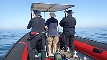
In South Africa, the standard dive boat is a large (6 to nearly 9 m) Rigid Inflatable Boat These are known as rubber ducks. Power is generally twin outboard motors, which may be two-stroke and smoky, but are increasingly often either four stroke, or the improved two-strokes which are cleaner and quieter.
These boats are generally powerful and fast, but speed is usually limited by sea state. They have a wet ride in a bumpy sea or if there is a crosswind. You travel in your dive suit, quite often with your hood on, and sometimes with your mask on to keep the spray out of your eyes. It has been known for the occasional diver to also use a snorkel to keep out heavy spray in rough conditions. If you wear a hat to protect your head from UV, make sure the hat is a tight fit, and preferably with a lanyard. The combination of cool sea air, wind, spray and high levels of UV can grill you in quite a short time, even in winter. Wear a good blockout or other method of keeping the sun from your skin. Unfortunately some blockouts wash off easily, and others sting your eyes if water gets into your mask and sloshes around a bit. A ski-mask is considered slightly eccentric, but it does the job.
Preparing for the dive.

If using all your own equipment, pack it as you find convenient, and check that everything is in good working order before leaving home. It will be wet on the way home, a waterproof bag or bin will keep the water off the upholstery. If using rental gear, get to the shop early to make sure it fits and works properly. If you are an unusual shape or size you may have difficulty finding a suit which fits well.At some places you will kit up at the side of the road or in a parking lot, and at others there will be changing rooms provided by the dive operator. If this is an issue, find out before the dive, You might want to take along a small mat or towel to stand on while putting on your suit, particularly if the ground is sandy or muddy.Some operators provide facilities at the dive shop for the customers to change into their dive suits and assemble equipment and load the boat before leaving for the launch site. In these cases the heavy equipment is usually loaded by staff, and the divers carry their light equipment to the boat. Where the boat collects divers from a jetty, the divers are expected to get their own kit to the boat. Actual loading will usually be done or supervised by the skipper.You will almost always be expected to wear your dive suit on the boat trip. There is no space to put it on during the ride, which may be wet.
What to take
- A small bag is useful to carry items like sunglasses, sunblock, hat, etc. Cell phones and car keys are usually kept in a waterproof bag or box by the skipper, and stored in the console. Large boxes for underwater cameras or video equipment should be negotiated before the dive, as there may or may not be space for them on board. In summer sunblock is advised for most skin types. UV factor is generally high and reflection from the water grills you from below. A peaked or brimmed hat may help if securely strapped on against the wind generated by boat speed.
- Kit bags for dive gear are not usually carried, but a medium sized soft bag to hold fins and mask, and other dive accessories like DSMB, reel, computer, dive light etc. is OK.
- On a long boat trip a small bottle of water or other suitable rehydration drink is nice to have, specially for after a deep or long dive. Similarly a small amount of high energy food may be welcome after a cold dive. In Cape Town, many dive boats supply a small chocolate bar or other sweet (candy) to each diver after the dive.
- A light waterproof windbreaker jacket is useful if the wind is strong, the weather or water is cold, or the trip is long. This can reduce wind-chill, particularly after the dive if you wear a wetsuit.
- A small emergency supplies (dive saver) kit of spare O-rings, fin strap, etc is acceptable.
What not to take
- Don’t take anything that you do not intend to use on the trip. (emergency equipment excepted).
- Don’t bring anything that must not get wet unless you have a watertight bag or box for it. A towel is usually a waste of time, as it will probably get wet. The same goes for dry clothing.
- Space is limited and must be shared by all. Do not annoy everyone by bringing a huge bin for your kit and fighting with the skipper at boarding time. No-one will have sympathy when you are evicted.
Loading kit and getting into the boat


The boat may loaded before launching, except where the water at the slipway is too shallow, when the boat is not taken out between dives, or when the slipway is not at the same place where the divers will be boarding.Loading of the boat is usually done by the skipper and divemaster. You are usually expected to transport your own equipment to the boat and hand it over to the person who will stow it for the trip. The standard arrangement is to stack scuba sets along a centreline rack, and tie them in place. You will usually sit at your scuba set, so if you want to do pre-dive buddy checks, ask for your gear and your buddy’s to be stowed together.Weight belts and pockets may be stacked on deck or in a box at the front or back of the rack. They are handed out when the boat gets to the site, so be sure you can identify your weights.
Fins and masks are usually stowed by the diver. There are often no special places reserved for this purpose, and fins are generally stowed either behind a handrope along the inner side of the pontoons, or between scuba sets along the rack. Be careful how you do this, as simply stacking them on top of the scuba sets can sometimes result in a fin or two being blown overboard by wind. This can ruin your dive, and is usually expensive. Masks are commonly stored in the foot pocket of a fin. The deck is not a good place for fragile items.Large cameras with strobe arms should be carried in the smallest plastic bin or crate that will hold them. There will often be several divers with camera boxes contending for the same limited storage space. Do not expect special treatment unless you have specifically organised it with the charterer.Some crews will carry your scuba set to the boat, but don’t count on it. If you need help, say so. If you are renting gear from the same organisation that runs the boat, they will usually load it for you. Make sure you can identify your rented gear and that it has all been loaded.
Slipway launches


Slipway launches are standard in the Western Cape
Where launching is from a slipway the procedure is fairly relaxed, and much depends on how far the slipway is from the parking area, and whether there is a convenient jetty.In some cases, usually at low tide, the water may be too shallow to launch the boat loaded with kit, but more often the boat is loaded with most of the dive gear, but not the divers, before launching. The boat is then launched with usually just the skipper on board, and the divers either get in from shallow water or from a jetty, as described above.Sometimes there may be commercial ski-boat fishermen launching at the same slipway. There are exceptions, but the lasting impression is of a mob of hooligans with no respect for anyone. They are generally a law unto themselves, and you will not gain brownie points by pointing out the error of their ways, and are likely to be given a brief introductory course in local invective at no charge.
Getting into the boat will depend on the launch site. In most cases the boat will be launched with only a skipper on board. Divers will board from the jetty or from the water.
Boarding from a jetty
Boarding from a jetty is usually easy, unless the step down to the boat is high. The crew will help where necessary and direct boarding. Follow their instructions. Do not leap down onto the deck, as it may not be designed to take this kind of shock load, and the sound of cracking glass fibre will not bring a smile to the skipper’s face. Also don’t leap down onto the pontoon, as this is likely to be followed by an inelegant face-plant onto the rack of scuba gear. The owners may be more concerned with damage to their equipment than your injuries.
The roll bar at the stern is a good place to hold if you can reach it. The radio antenna, plastic windscreen and engine control levers are not.Try to avoid getting parts of yourself between the boat and the jetty. The pontoons are fairly soft, but the jetty usually isn't, and may be decorated by barnacles and other abrasive material.
Boarding from shallow water
If boarding from standing in the water, try to get in where the water is not too deep, as most divers do not have the agility and upper body strength to boost themselves in without fins or a jump. Ask for help if you need it, but your fellow divers are more likely to be enthusiastic than skillful at pulling you in, Say goodbye to dignity, and hope for a reasonably comfortable landing.
The stern of the boat (blunt end) is usually lower and therefore easier to get into. This is often combined with it being in the shallowest water, so get in and out of the way of the people who have to hold the boat while the rest are getting in.
If you are a gymnast or acrobat you may safely ignore this advice.
बैठने की


Seating is almost exclusively on the pontoons, with your back to the water. This puts you in a position where losing your balance backwards will result in falling into the water, a manoeuvre most divers prefer to restrict to times when the boat is stationary at the dive site. To prevent unscheduled backward rolls, use the foot-straps and hand-ropes provided. As a general rule, sit opposite your scuba set, so you don’t have to move around when kitting up on site.
Occasionally there may be a seat across the stern in front of the motors. This will be the most comfortable place on the boat but may catch more spray in your face. The boat will bounce up and down as it hits waves. Bigger boats less so than small ones, and the part that bounces the least is the stern, so the most comfortable seating is as far back as you can get. This puts you close to the motors, and if they are two-stroke, closest to the exhaust smoke when the boat is not moving. You may not have much choice where you get to sit, but if you have a bad back or other disability which makes a rough ride a problem, mention this to your dive-master or the skipper as soon as possible. You will not be popular if the boat has to stop to re-arrange passengers. With practice it is possible to sit with one foot in a foot-strap (preferably the foot nearer the bow (pointy end)) and ride the bumps with very little effort. It is much like riding a horse, don’t fight the motion, absorb the bumps by relaxing a bit, and you will bounce less. A death-grip on the hand ropes will be exhausting if the ride is long.
Some boats have no footstraps. You will have to find something else to hold onto, or lean into the boat to keep more weight on your feet. Some divers may be seen comfortably sitting on the tubes, riding the waves with no obvious concern as the boat bounces along. They may not even need to hold on. They have done this before.
Moving around in the boat
If possible, don’t move around while the boat is moving, unless asked to trim the boat. You will be expected to sit where directed by the skipper, and unless there is a good reason not to, do as requested. Standing up when the boat is moving and there is nothing to hold onto can result in a fall and possible injury if the boat hits a wave or moves in an unexpected direction. If equipment comes loose under way, shout to the skipper, who will stop if it is safe, so that the equipment can be re-stowed.There may be cables and pipes in places on the deck. These are usually routed through areas where they are reasonably protected, but as a rule don’t stand on them or use them to hold on to. Batteries are often stored in plastic boxes near the transom, to keep the wires short. The lids are not usually load bearing structures, do not use them as steps.
Getting out of the boat

Getting into the water is usually done by a synchronised backward roll – falling into the water alongside your neighbour, neither on top nor underneath. Generally all the divers or a nominated group will roll off together, on a countdown from the skipper or divemaster. It is important to all roll together, as if you do not, the later divers may fall on top of the earlier ones, possibly casing injury or equipment damage. If you are not ready, or are not happy with this procedure, wait until the others are in and the boat is clear of them. The skipper will then let you roll in clear of the others, but you may have to fin a bit to get to them. This can be a problem if diving in a current. Some divers may not wish to backward roll with a large camera setup. जब वे पानी में हों तो वे कप्तान से कैमरा पास करने के लिए कह सकते हैं। इस मामले में उन्हें नाव के करीब रहना चाहिए और अधिमानतः उस पर तब तक पकड़ना चाहिए जब तक कि उनका कैमरा नीचे न चला जाए।
शॉटलाइन और मार्कर बॉय

केप टाउन में अधिकांश गोताखोरी एक चट्टान या मलबे में है। गोता लगाने से पहले स्थिति को एक शॉटलाइन के साथ चिह्नित करना सामान्य है ताकि गोताखोर सही जगह पर उतर सकें। यदि सतह पर थोड़ा सा करंट है, तो शॉटलाइन स्लैक को लेने के लिए नीचे की ओर बहाव करेगी। इस मामले में पानी में बॉय के ऊपर की ओर थोड़ी दूरी पर प्रवेश करना सामान्य है, और जैसे ही पानी के माध्यम से रेखा दिखाई देती है, वैसे ही उतरना शुरू कर देना चाहिए, ताकि धारा के विपरीत तैरने के काम को कम से कम किया जा सके। बुआ की ओर बहने का मतलब है कि आपको धारा के विपरीत वापस तैरना होगा। शॉटलाइन एंकर नहीं है। यदि आप अपने आप को बॉय लाइन से नीचे खींचते हैं, तो यह शॉट को खींच सकता है, और आप साइट के डाउन-करंट को समाप्त कर देंगे, जैसा कि आपके पीछे बाकी सभी लोग करेंगे। यदि शॉटलाइन बहुत छोटी है, तो शॉट को बॉय और ड्रिफ्ट ऑफ साइट द्वारा उठाया जा सकता है, इसलिए इसे कुछ सुस्ती की आवश्यकता है। करंट सीधे डाउनविंड नहीं चल सकता है। यहां तक कि जब यह एक हवा से प्रेरित धारा होती है, तो कोरिओलिस बल दक्षिणी गोलार्ध में हवा की दिशा से इसे वामावर्त ऑफसेट कर देगा, एक प्रभाव में एकमान परिवहन के रूप में जाना जाता है। प्रभाव सतह पर लगभग ४५° है, जितना अधिक आप गहराई में जाते हैं, लेकिन कम गति के साथ।
आप शॉटलाइन पर या उससे दूर दिखाई देना चुन सकते हैं। यदि आप साइट के बारे में नहीं जानते हैं तो आपके लिए अपना रास्ता खोजना मुश्किल हो सकता है। यह आमतौर पर कोई समस्या नहीं है, और अधिकांश केप टाउन गोताखोर गोता लगाने के अंत में कहीं भी चढ़ेंगे, लेकिन इस मामले में डीएसएमबी और सतह को अपने स्वयं के बोया, या अपने दोस्त की बोया पर तैनात करने की दृढ़ता से अनुशंसा की जाती है। डीएसएमबी एक गोताखोर की उपस्थिति का संकेत देगा ताकि क्षेत्र में नावें साफ रह सकें, और ताकि आपका गोताखोर नाव कप्तान ट्रैक कर सके कि उसके ग्राहक कहां सतह पर आ सकते हैं।

यदि बहुत अधिक नाव यातायात वाले क्षेत्र में शॉटलाइन से दूर आने की एक महत्वपूर्ण संभावना है, तो गोताखोरों को प्रोत्साहित किया जाता है, या इसकी आवश्यकता हो सकती है, डीएसएमबी ले जाने और सतह पर आने से पहले इसे तैनात करने के लिए। अन्य साइटें जहां गोताखोरों को डीएसएमबी ले जाने की आवश्यकता हो सकती है, वे दूर अपतटीय हैं, या किसी भी समय कप्तान को लगता है कि समुद्र की स्थिति के कारण गोताखोर ढूंढना मुश्किल हो सकता है। मनोरंजक डाइविंग के लिए, व्यक्तिगत DSMB के लिए रंग और आकार का चुनाव गोताखोर पर निर्भर है। पीला, नारंगी और लाल सबसे आम हैं, लेकिन कभी-कभी चमकीला गुलाबी भी देखा जाता है, और जब तक आप किसी रंग के लिए विशेष अर्थ के स्किपर को स्पष्ट रूप से सूचित नहीं करते हैं, तो यह माना जाएगा कि आपकी स्थिति को चिह्नित करने के अलावा कोई विशेष अर्थ नहीं है। कोई भी परवाह नहीं करेगा कि यह कितना बड़ा है जब तक इसे उचित दूरी से देखा जा सकता है। चिंतनशील स्ट्रिप्स, चमकती रोशनी और आपका नाम भी वैकल्पिक हैं।
डाइवमास्टर्स
नाव पर कोई हो सकता है, या नहीं भी हो सकता है। जो नावें स्थानीय लोगों की सेवा करती हैं, उनमें स्कूलों से जुड़ी नावों की तुलना में गोताखोर उपलब्ध कराने की संभावना कम होती है या जो आम तौर पर गुजरने वाले व्यापार और आगंतुकों को पूरा करती हैं। यदि आप किसी के बिना आपको डाइविंग के बारे में आश्वस्त नहीं हैं, तो बुक करते समय इसका उल्लेख करें, और विकल्पों के बारे में पूछें।
केल्प डाइविंग
उन क्षेत्रों में जहां भारी समुद्री घास की राख है, गोताखोर आमतौर पर गोता लगाने के दौरान एसएमबी को टो नहीं करते हैं। सौभाग्य से ये आमतौर पर ऐसे स्थान भी होते हैं जहां कोई महत्वपूर्ण धाराएं नहीं होती हैं, हालांकि उछाल मजबूत हो सकता है। केप टाउन के कई तटरेखा और तटवर्ती स्थलों में भारी समुद्री घास की राख है, विशेष रूप से अटलांटिक समुद्र तट पर। इन क्षेत्रों में गोताखोरों को डीएसएमबी ले जाने के लिए प्रोत्साहित किया जाता है, और शॉटलाइन से दूर आने पर उनका उपयोग किया जाता है, ताकि स्किपर ट्रैक कर सके कि हर कोई कहां सरफेस कर रहा है, और ताकि गुजरने वाली नौकाओं को आपको नीचे चलाने से बचने का मौका मिल सके यदि कोई परेशान कर रहा हो नजर रखने के लिए। जब आप सतह पर होते हैं तो नाव को संकेत देने के लिए डीएसएमबी भी बहुत प्रभावी होते हैं - एक काले रंग के वेटसूट में एक हाथ से कहीं ज्यादा। यह विशेष रूप से मूल्यवान हो सकता है यदि गोता लगाने के दौरान हवा तेज हो जाती है और सतह सफेद पानी से तड़पती है।
गोता लगाने के बाद नाव में वापस आना


नियम १: जब तक सीढ़ी न हो तब तक अपने पंख पानी में न उतारें। आपको बढ़ावा देने के लिए आपको उनकी आवश्यकता है। अधिकांश रबर बतख एक बोर्डिंग सीढ़ी प्रदान नहीं करते हैं। यह और भी महत्वपूर्ण है यदि आप नाव के ऊपर की ओर चढ़ रहे हैं, क्योंकि नाव लगभग हमेशा एक गोताखोर की तुलना में तेजी से नीचे की ओर बहती है। नाव के पास पहुंचें और बाहरी हाथ-रस्सी पर पकड़ बनाएं। हर समय नाव पर पकड़ बनाए रखने की कोशिश करें, और किट को हटाने के लिए केवल उतनी ही देर तक चलने दें, जब तक कि आप पकड़ में न हों, तब तक नाव बह सकती है।
कुछ नावें एक लूप के साथ एक छोटी ग्रैब-लाइन प्रदान कर सकती हैं जिससे आप एक हाथ को खिसका सकते हैं, लेकिन किसी कारण से यह अत्यंत दुर्लभ है। इससे भी कम आम एक क्लिप के साथ एक पंक्ति है जिसे आप इसे उतारने से पहले उपकरण से जोड़ सकते हैं। संभवत: इन वस्तुओं के लिए कोई ग्राहक मांग नहीं है ... आपके उपकरण चालक दल या अन्य गोताखोरों द्वारा बोर्ड पर उठाए जाएंगे।
अनुशंसित प्रक्रिया पहले किसी भी कैमरे या अन्य ढीले उपकरण को पास करना है। फिर अपना वजन उतारें और ऊपर उठाएं। यह सुनिश्चित करता है कि आप अपना बीसी हटाने के बाद तैरेंगे। जब तक आप सुनिश्चित न हो जाएं कि दूसरे व्यक्ति की पकड़ अच्छी है, वजन बेल्ट बहुत तेजी से डूबते हैं। स्कूबा सेट को हटा दें और इसे चालक दल को सौंप दें। आप सेट के नीचे धक्का देकर मदद कर सकते हैं जब वे उठाते हैं, और जांचते हैं कि डीवी और गेज हाथ-रस्सियों पर हुक नहीं करते हैं। यदि सुविधाजनक हो तो मास्क और स्नोर्कल किसी भी समय सौंपे जा सकते हैं। प्रदान किए गए हैंडल पर अच्छी पकड़ प्राप्त करें, या पोंटून के किनारे जितना संभव हो सके हाथ की रस्सी प्राप्त करें। कुछ उत्प्लावक लिफ्ट प्राप्त करने के लिए अपने आप को जितना संभव हो उतना नीचे डुबोएं, फिर मजबूती से ऊपर की ओर फिन करें और अपने आप को जितना हो सके ऊपर खींचने के लिए अपनी बाहों का उपयोग करें, फिर अपने ऊपरी शरीर को पोंटून पर घुमाते हुए रस्सी या हैंडल पर नीचे की ओर धकेलें। ग्रिप को अंदर के हैंडल या हैंड-लाइन में बदलें, और एक पैर को नाव में घुमाएँ। यहां रुकना सुविधाजनक हो सकता है जब कोई आपके पंख हटा दे, फिर बैठ जाएं और दूसरे पैर को नाव में घुमाएं। अच्छे पंख, अच्छी तकनीक और उचित ताकत के साथ आराम और गरिमा के साथ इस तरह से चढ़ना संभव है। तेज हवा में नीचे की ओर होने पर यह विधि बहुत अधिक कठिन होती है।

यदि आपके पास ताकत नहीं है, तो प्रक्रिया समान है, लेकिन पहले से ही नाव में मौजूद चालक दल या गोताखोरों की सहायता से, जो आपको मुख्य बल और जो कुछ भी वे पकड़ सकते हैं, द्वारा खींच लेंगे। किसी पर अभद्र हमले का आरोप लगाने से पहले, विचार करें कि क्या उनके लिए हड़पने के लिए कोई उचित वैकल्पिक स्थान था जो काम कर सकता था। लालित्य आपके आकार और द्रव्यमान के व्युत्क्रमानुपाती होता है। यदि आपके सूट के सामने जांघ की जेब है, तो जेब में किसी भी नाजुक या भारी उपकरण के साथ बोर्ड न करें। साइड पॉकेट आमतौर पर कोई समस्या नहीं होती है।

बोर्डिंग के लिए सीढ़ी प्रदान करने के लिए कुछ नावों के साथ एक नया चलन है। "क्रिसमस ट्री" शैली अपेक्षाकृत लोकप्रिय है क्योंकि अपने पैरों पर पंखों के साथ चढ़ना आसान है। रबर के बत्तखों पर इसे आमतौर पर किनारे पर लटका दिया जाता है, और कठोर पतवार कटमरैन पर ट्रांसॉम को प्राथमिकता दी जाती है।
गोताखोरी के बाद नाव से उतरना

जेटी पर बाहर निकलना आमतौर पर सीधा होता है, लेकिन उच्च जेटी और कम ज्वार से जटिल हो सकता है। यदि कोई समस्या है, तो चालक दल मदद करेगा और निर्देश देगा। यदि आप अपना काम स्वयं करते हैं, तो वैसी ही चेतावनियाँ लागू होती हैं जैसे किसी घाट से अंदर आने पर। विशेष रूप से अपने आप को नाव और घाट के बीच में न आने के बारे में।
केप टाउन में समुद्र तट पर निकलना असामान्य है, लेकिन अपेक्षाकृत सीधा है। यदि समुद्र तट पर दौड़ते समय नाव झुक जाती है तो आमतौर पर नीचे की तरफ उतरना सुरक्षित और अधिक सुविधाजनक होता है। यदि आप उच्च तरफ हैं, तब तक प्रतीक्षा करें जब तक कि जगह न हो और नीचे की तरफ चले जाएं, या कुछ मामलों में उच्च पक्ष निम्न पक्ष बन जाएगा क्योंकि लोड हटा दिए जाने पर नाव वापस फ्लॉप हो जाती है। यदि आप गलत जगह पर हैं और नाव आपके ऊपर लुढ़क जाती है, तो किट को ऊँची तरफ से उतारने की कोशिश न करें। यह विशेष रूप से संभावना है अगर नाव लहरों से पूरी तरह से स्पष्ट नहीं है।
ले देख

केप प्रायद्वीप और फाल्स बे के पानी शांत समशीतोष्ण समुद्री जीवों की एक संपन्न पारिस्थितिकी का समर्थन करते हैं, उनमें से कई दक्षिण अफ्रीका, या यहां तक कि छोटे क्षेत्रों के लिए स्थानिकमारी वाले हैं, और हालांकि मछली उष्णकटिबंधीय पानी में दिखाई देने वाले शानदार रंग नहीं हैं, कई हैं चट्टानों को ढंकने वाले अत्यंत ज्वलंत अकशेरुकी जीवों के बीच खुद को छलावरण करने के लिए काफी रंगीन।
समुद्री जानवरों
इस क्षेत्र में गोता लगाते समय समुद्री जानवरों की एक विस्तृत श्रृंखला देखी जा सकती है, और उनमें एक गोताखोर के लिए संभव कुछ सबसे भयानक और शानदार मुठभेड़ शामिल हैं।
व्हेल और डॉल्फ़िन
फाल्स बे व्हेल देखने के लिए प्रसिद्ध एक गंतव्य है। हर साल बड़ी संख्या में दक्षिणी दाहिनी व्हेल खाड़ी का दौरा करती हैं, लेकिन गोता लगाने के दौरान एक को देखना असामान्य है। कभी-कभी फाल्स बे में देखी जाने वाली अन्य व्हेल प्रजातियां हंपबैक व्हेल, ब्रायड व्हेल और ओर्का हैं, और डाइविंग के दौरान इन्हें देखे जाने की संभावना भी कम है। यदि आपके पास गोता लगाने के दौरान व्हेल का सामना करने का सौभाग्य है, तो सावधान रहें, क्योंकि उनका विशाल आकार एक गोताखोर के लिए अनजाने में घायल होना आसान बनाता है।
डॉल्फ़िन को फाल्स बे और अटलांटिक सीबोर्ड पर भी देखा जाता है। आम डॉल्फ़िन कभी-कभी सैकड़ों से हजारों की संख्या में स्कूलों में जाती हैं, लेकिन अक्सर गोताखोरों द्वारा नहीं देखी जाती हैं। सांवली डॉल्फ़िन छोटे समूहों में यात्रा करती हैं, लेकिन सुरक्षा स्टॉप पर एक गोताखोर की जांच करने की भी अधिक संभावना है। अन्य प्रजातियां कभी-कभी आती हैं, लेकिन गोताखोरों द्वारा पानी के नीचे देखी जा रही घटनाओं में फंसे होने के लिए अधिक प्रसिद्ध हैं।
शार्क

ग्रेट व्हाइट शार्क को देखने के लिए फाल्स बे सबसे विश्वसनीय स्थानों में से एक है, हालांकि शायद ही कभी गोताखोर के रूप में, और कई अन्य शार्क प्रजातियां भी अक्सर देखी जाती हैं। सेवनगिल या काउशार्क को अक्सर कुछ स्थलों पर देखा जा सकता है, जबकि गली शार्क और कैटशार्क अधिक व्यापक हैं। स्थानीय रूप से चार आम कैटशार्क प्रजातियां हैं, रंगीन पफडर श्याशार्क से लेकर बहुत बड़े पायजामा शार्क तक। अन्य पेलाजिक शार्क आमतौर पर केवल दक्षिण प्रायद्वीप के अपतटीय "ब्लू-वाटर" डाइव्स पर देखी जाती हैं, और इसी तरह की यात्राओं पर कई बड़ी पेलजिक मछली प्रजातियों को देखा जा सकता है।
श्रोणि

येलोटेल के बड़े शोल कभी-कभी कुछ गोताखोर स्थलों पर देखे जाते हैं, और अप्रत्याशित अवसरों पर गोताखोर भाग्यशाली हो सकते हैं जो ओशनिक सनफिश, दक्षिणी दाहिनी व्हेल, हंपबैक व्हेल, कॉमन, बॉटलनोज़ या डस्की डॉल्फ़िन को देख सकते हैं।
आम स्नोइक, जो एक स्थानीय लाइनफिशिंग उद्योग की आधारशिला है, बहुत शर्मीला है और शायद ही कभी गोताखोरों द्वारा देखा जाता है, बड़ी संख्या में शॉलिंग की अपनी आदत के बावजूद।
पेंगुइन और सील

फाल्स बे में अफ्रीकी पेंगुइन के उपनिवेश हैं, लेकिन गोता लगाने के दौरान उन्हें देखना बेहद असामान्य है। दूसरी ओर, केप फर सील गोताखोरों के लिए उत्सुक और बेखौफ दोनों हैं, और फाल्स बे और अटलांटिक सीबोर्ड दोनों में बहुत सामान्य रूप से देखे जाते हैं। ऐसे कई स्थान हैं जहां उन्हें लगभग देखे जाने की गारंटी दी जा सकती है।
प्रवाल - भित्ति वाली मछली

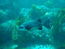


इस क्षेत्र की रीफ मछली फाल्स बे में सबसे अधिक विविध हैं, और समुद्री संरक्षित क्षेत्रों के प्रतिबंधित क्षेत्रों में सबसे आम हैं, जहां उन्हें कई दशकों तक कानून द्वारा संरक्षित किया गया है, हालांकि अवैध शिकार अभी भी होता है, और प्रवर्तन काफी अविश्वसनीय है। अधिकांश रीफ मछली कुछ हद तक छलावरण करती हैं। कई सिल्वर ग्रे और काउंटरशेड हैं, जैसे सर्वव्यापी हॉटनटॉट सीब्रीम, सिल्वर फ्रैंसमडम और स्टेंटजी। अन्य में ऊर्ध्वाधर बार या गहरे रंग के पैच होते हैं जो कि केल्प में उनकी प्रोफ़ाइल को तोड़ने में मदद कर सकते हैं, जैसे कि व्हाइट स्टंपनोज़, ज़ेबरा और व्हाइट स्टीनब्रा, जबकि कई छोटी प्रजातियां गुप्त रूप से रंगीन होती हैं और अपने वातावरण में बहुत अच्छी तरह से मिश्रित होती हैं। ये आम तौर पर मछलियाँ होती हैं जो अपना अधिकांश समय चट्टान पर या उसके बहुत करीब बिताती हैं, और उनका रंग आमतौर पर उनके निवास स्थान के विशिष्ट रंगों का संकेत होता है। इनमें विभिन्न स्थानिक क्लीफ़िश, और कुछ ब्लैनीज़ और गोबी, फ़िंगरफ़िन, केप ट्रिपलफ़िन, स्मूथस्किन स्कॉर्पियनफ़िश, हॉर्सफ़िश की दो प्रजातियाँ, एक पाइपफ़िश और रॉकसुकर शामिल हैं। कुछ लाल मछलियाँ भी हैं, जो काफी दिखाई देती हैं, जैसे कि बहुत ही सामान्य रोमन, और कम सामान्य लाल स्टंपनोज़ और लाल स्टीनब्रा। उल्लेख की गई अधिकांश मछलियाँ एकान्त हैं या छोटे शोलों में पाई जाती हैं, लेकिन स्ट्रेपीज़ और मासबैंकर भी हैं जो काफी बड़ी संख्या में शोल करते हैं, और हॉटनटॉट के मध्यम बड़े शोल काफी बार देखे जाते हैं। गैल्जोएन काफी दुर्लभ हैं और आमतौर पर चट्टान के शीर्ष पर छोटे समूहों में देखे जाते हैं जहां बहुत अधिक तरंग आंदोलन होता है, और इसी तरह दिखने वाले केप चाकूजॉ चट्टानों के बीच गहरे और उच्च प्रोफ़ाइल चट्टान को पसंद करते हैं। सीकैटफ़िश शर्मीली होती हैं और दिन के समय दरारों और छेदों में बिताती हैं।
रेतीले क्षेत्र

रेतीले क्षेत्रों में उनकी विशिष्ट मछलियाँ भी होती हैं, जिनमें रे, तलवों, गर्नार्ड्स, एक पफ़रफ़िश और चोंच वाली सैंडफ़िश की कुछ प्रजातियाँ शामिल हैं, जो दिन में दुर्लभ और शर्मीली होती हैं, लेकिन कुछ जगहों पर रात में बड़ी संख्या में देखी जा सकती हैं, जब वह उस रेत से बाहर आती है जिसमें वह छिप जाता है और स्वतंत्र रूप से तैरता है। क्लिपफिश की कुछ प्रजातियां रेत में भी रहती हैं, विभिन्न प्रजातियां रेत के विभिन्न घनत्वों को पसंद करती हैं, जो कि महीन रेत को पसंद करती हैं, जिसमें सांप जैसा शरीर होता है, जबकि मोटे रेत वाले लोग अधिक मजबूत होते हैं। उनके शरीर का पैटर्न रेत के प्रकार से भी मेल खाता है।
रीफ अकशेरूकीय
बेंटिक अकशेरुकी इस क्षेत्र की भित्तियों पर अधिकांश चमकीले रंग प्रदान करते हैं, और प्रजातियों का वितरण विभिन्न उप-क्षेत्रों की गहराई और पानी के तापमान की विशेषता है। विविधता बड़ी है, और गहराई और भौगोलिक स्थिति दोनों के साथ प्रमुख रीफ कवर में एक बड़ा बदलाव है। केप प्रायद्वीप के पूर्व और पश्चिम किनारों के बीच विशिष्ट रीफ जीवन काफी भिन्न होता है, और इसे दक्षिण पश्चिमी केप और अगुलहास इनशोर बायोरेगियंस के बीच की सीमा के रूप में मान्यता प्राप्त है। ऊर्ध्वाधर ज़ोनेशन भी विभिन्न जैव-क्षेत्रों की विशेषता है, इसलिए विभिन्न साइटों पर जो देखा जा सकता है उसमें बहुत ध्यान देने योग्य अंतर हो सकते हैं।
जीव की एक विशेष प्रजाति के लिए रीफ के दिए गए क्षेत्र का प्रभुत्व होने की एक सामान्य प्रवृत्ति है, उदाहरण के लिए, सामान्य पंख वाले सितारे, लाल-छाती वाले समुद्री खीरे, मौवे समुद्री खीरे, लाल चारा या समुद्री अर्चिन, इस हद तक कि एक प्रमुख सतह क्षेत्र का हिस्सा प्रमुख जीव द्वारा कवर किया गया है। इसका मतलब यह नहीं है कि कोई विविधता नहीं है, क्योंकि अधिकांश भित्तियों पर उन्मुखीकरण और रूढ़िवादिता के आधार पर आवासों की एक बड़ी श्रृंखला है, और काफी हद तक, जहां वे कर सकते हैं, वहां सेसाइल जीव रहते हैं, और यह काफी हद तक इस बात पर निर्भर करता है कि प्लवक के लार्वा कहां हैं। एक पायदान खोजें।
मिडवाटर
पेलजिक अकशेरुकी अपने ज्यादातर प्लवक के स्वभाव से अप्रत्याशित होते हैं कि उन्हें कब और कहाँ देखा जा सकता है। इनमें जेलीफ़िश की कई प्रजातियाँ, कंघी जेली की कुछ प्रजातियाँ, कुछ छिटपुट साइफ़ोनोफ़ोर्स, सैल्प्स और पटरोपोड्स, और बहुत सी ऐसी चीज़ें शामिल हैं जिन्हें आसानी से नोटिस नहीं किया जा सकता है। विद्रूप भी हैं, लेकिन वे बहुत शर्मीले हैं और शायद ही कभी दिन में देखे जाते हैं।
इस क्षेत्र से दर्ज किए गए स्पंज, निडारियन, कंघी जेली, फ्लैटवर्म, खंडित कीड़े, आर्थ्रोपोड, मोलस्क, ब्रायोजोअन, इचिनोडर्म, जलोदर, मछली, समुद्री पक्षी और समुद्री स्तनधारी सूचीबद्ध हैं। विकिपीडिया:केप प्रायद्वीप और फाल्स बे के समुद्री जानवरों की सूची. इनमें से कई मनोरंजक गोताखोरों द्वारा देखे जा सकते हैं।
समुद्री शैवाल
केल्प वन
केल्प वन केप टाउन के सबसे स्पष्ट समुद्री शैवाल हैं। स्थानीय रूप से तीन प्रजातियां पाई जाती हैं, कभी-कभी निकटता में। सबसे स्पष्ट समुद्री बांस है, जो पूरी तरह से विकसित होने पर सतह पर पहुंचता है, और शीर्ष पर गैस से भरी गुहा के साथ एक मोटी स्टिप होती है, और जो प्रकाश के अधिकतम जोखिम के लिए सतह के पास फ्रोंड रखता है। यह केल्प अटलांटिक समुद्र तट पर बहुत आम है, और यह फाल्स बे के दोनों किनारों पर भी पाया जाता है, लेकिन आमतौर पर खाड़ी के दक्षिणी भाग की ओर।
छोटा स्प्लिट-फैन केल्प गहरी चट्टानों पर बढ़ता है, और सतह तक नहीं पहुंचता है। स्टेप्स छोटे होते हैं और गैस से भरी गुहा नहीं होती है, इसलिए फ्रैंड्स गहरे पानी में डूबे रहते हैं। यह केल्प समान भौगोलिक सीमा के साथ, समुद्री बांस की तुलना में गहरे पानी में पाया जाता है।
तीसरा है ब्लैडर केल्प, जिसमें लंबे पतले स्ट्राइप्स के समूह होते हैं, जिसमें लंबे फ्रैंड्स और बड़ी संख्या में छोटे गैस से भरे ब्लैडर होते हैं जो केल्प को सीधा रखते हैं और फ्रैंड्स को सतह पर रखते हैं। यह केल्प फाल्स बे में नहीं पाया जाता है, और ज्यादातर रोबेन द्वीप के पास देखा जाता है।
अल्गल टर्फ और केल्प वन अंडरस्टोरी।
केल्प फ्रैंड्स के नीचे, उथले क्षेत्रों में चट्टान जहां पर्याप्त प्रकाश होता है, मिश्रित समुद्री शैवाल की एक छोटी सी परत द्वारा कवर किया जा सकता है, और विशेष प्रजाति विभिन्न कारकों पर निर्भर करेगी, जिसमें उपलब्ध प्रकाश की मात्रा और पानी की मात्रा शामिल है। आंदोलन। एक नियम के रूप में, हरे और भूरे रंग के समुद्री शैवाल उथले क्षेत्रों में पाए जाएंगे, और लाल गहरे होंगे, क्योंकि वे कम रोशनी में जीवित रह सकते हैं। सबसे गहरे अक्सर लाल कोरलाइन शैवाल होते हैं, जो चट्टानों की ऊपरी सतहों पर घने मैदान का निर्माण कर सकते हैं।
एनक्रस्टिंग कोरलाइन्स।
जहां सर्फ बहुत शक्तिशाली होता है या अन्य समुद्री शैवाल के लिए प्रकाश बहुत मंद होता है, वहां मौजूद कोरलाइन शैवाल अभी भी एक पैर जमाने और पनपने लग सकते हैं। ये लाल शैवाल चट्टान पर काफी सख्त और कसकर चिपकी हुई पपड़ी बनाते हैं, और इन्हें "गुलाबी पेंट" के रूप में भी जाना जाता है, जो उनके स्वरूप का एक उचित विवरण है - वे समुद्री शैवाल की तरह बिल्कुल नहीं दिखते। उनकी सीमा उस क्षेत्र में लगभग कहीं भी है जहां पर्याप्त प्रकाश प्रवेश करता है और चट्टान पर पहले से कोई अन्य रहने वाला नहीं है।
इस क्षेत्र से लगभग 57 हरे समुद्री शैवाल, 49 भूरे समुद्री शैवाल और 240 लाल समुद्री शैवाल दर्ज हैं। विकिपीडिया:केप प्रायद्वीप और फाल्स बे के समुद्री शैवाल की सूची.
जहाजों का मलबा

केप ऑफ स्टॉर्म और यह केप ऑफ़ गुड होप इस क्षेत्र के लिए और अच्छे कारण के लिए दोनों पारंपरिक अपीलीय हैं। कभी-कभी मौसम बहुत खराब हो सकता है, और तट बहुत खुला है, कुछ आश्रय वाले बंदरगाहों के साथ, लेकिन यह दुनिया के महान समुद्री व्यापार मार्गों में से एक पर एक महत्वपूर्ण रास्ता भी है। नतीजतन, स्थानीय समुद्र तट के साथ दर्ज किए गए जहाजों की एक कठिन संख्या है।
इनमें से कई मलबे कभी नहीं पाए गए हैं, और कई अन्य को मान्यता से परे तोड़ दिया गया है, या रेत में ढंका हुआ है, या टेबल बे के मामले में, भूमि सुधार परियोजनाओं के तहत दफन किया गया है, लेकिन कई गोता लगाने योग्य स्थानों में हैं और इनका दौरा किया जा सकता है गोताखोर यदि परिस्थितियाँ उपयुक्त हों।
गोता लगाने योग्य मलबे की गहराई 3 या 4 मीटर से 65 मीटर से अधिक तक भिन्न होती है, और स्थिति लकड़ी या स्टील के आधे दफन टुकड़ों से भिन्न होती है, जहाजों के लिए जो अपनी मूल संरचना और उपस्थिति को बनाए रखते हैं, और गहराई से बाहर निकलते हैं जैसे कि रेत तल के माध्यम से नौकायन।
अधिकांश चट्टानी जीवों से भारी रूप से घिरे हुए हैं, उथले पानी में समुद्री शैवाल से लेकर गहरे पानी में रंगीन अकशेरूकीय की एक बड़ी श्रृंखला तक। वे विभिन्न प्रकार की रीफ मछलियों को भी आश्रय देते हैं, और अप्रत्याशित अवसरों पर पेलजिक मछली द्वारा उनका दौरा किया जा सकता है। वास्तव में, वे कृत्रिम भित्तियों के रूप में काम करते हैं, और परिणामस्वरूप आम तौर पर उन गोताखोरों के लिए भी रुचि रखते हैं जो विशेष रूप से कलाकृतियों के रूप में उनमें रुचि नहीं रखते हैं।
स्थलाकृतिक विशेषताएं
कई साइटों में दिलचस्प स्थलाकृतिक विशेषताएं हैं, जिनमें शिखर, गली, गुफाएं, तैरना-थ्रू और ओवरहैंग शामिल हैं। ये विशेषताएं न केवल समुद्र के दृश्य में उनके योगदान के लिए उल्लेखनीय हैं, बल्कि साइट पर उपलब्ध आवासों में प्रमुख विविधताएं भी प्रदान करती हैं, और परिणाम उच्च जैव विविधता और दिलचस्प स्थलाकृति के बीच एक मजबूत संबंध है। किसी साइट का सामान्य स्थलाकृतिक चरित्र भूविज्ञान पर निर्भर है, और ग्रेनाइट साइट तलछटी बलुआ पत्थर और शेल साइटों से तुरंत अलग-अलग हैं। ग्रेनाइट चट्टानों को आम तौर पर गोल किया जाता है और एक ही चट्टान के बाहरी हिस्सों पर कोरस्टोन बोल्डर के रूप में ढेर किया जाता है, अक्सर उनके बीच सफेद क्वार्ट्ज रेत के साथ, या धीरे-धीरे ढलान वाले आधार के रूप में। विभिन्न आकार की चट्टानों के ये ढेर अक्सर काफी यादृच्छिक दिशाओं में शिखर और गली बनाते हैं, और उनके बीच के ओवरहैंग और छेद कुछ मामलों में गोताखोरों के तैरने के लिए काफी बड़े होते हैं, जो एक शानदार रीफ संरचना प्रदान करते हैं।
बलुआ पत्थर के स्तर स्थानीय डुबकी और हड़ताल के प्रभुत्व वाली संरचनाओं का उत्पादन करते हैं, और यह अधिक अनुमानित है। हालांकि, छोटे पैमाने पर विस्तार ग्रेनाइट क्षेत्रों की तुलना में अधिक छोटे छेद, दरारें, कगार और लकीरें उत्पन्न करता है, और ये सामान्य नियम के रूप में कम शानदार हैं। ऐसे अपवाद हैं, जहां बलुआ पत्थर की चट्टानें बहुत टेढ़ी-मेढ़ी हैं, आमतौर पर जहां डुबकी काफी खड़ी है, लेकिन ऊर्ध्वाधर नहीं है, और तटरेखा काफी खड़ी है, लेकिन डुबकी के लिए एक अलग विमान में है।
सौभाग्य से पुरानी कहावत "ऊपर के रूप में, इसलिए नीचे" काफी अच्छी तरह से लागू होती है, और निकटवर्ती तटरेखा परिदृश्य को देखकर रीफ्स के चरित्र का काफी मज़बूती से अनुमान लगाया जा सकता है। इस नियम का प्रमुख अपवाद स्मट्सविंकेल खाड़ी के दक्षिण में है, जहां पानी के ऊपर बलुआ पत्थर और नीचे ग्रेनाइट हैं।
इस क्षेत्र की भूवैज्ञानिक संरचना और इतिहास का संक्षेप में वर्णन किया गया है विकिपीडिया:केप प्रायद्वीप और फाल्स बे का समुद्री भूविज्ञान
पढ़ें
केप टाउन के जल की पारिस्थितिकी पर संदर्भ पुस्तकें:
से सर्जन, विशेष रूप से इस क्षेत्र के गोताखोरों के लिए: केप टाउन में चयनित गोताखोरी की दुकानों और किताबों की दुकानों से उपलब्ध है, और सीधे SURG से उपलब्ध है।
- जोन्स, जॉर्जीना। 2008. केप प्रायद्वीप के समुद्री जानवरों के लिए एक फील्ड गाइड, सर्ज, केप टाउन। आईएसबीएन ९७८०६२०४१६३९९
- ज़सिलवेज़, गुइडो। 2005. केप प्रायद्वीप की तटीय मछलियाँ और फाल्स बे, सर्ज, केप टाउन। आईएसबीएन ०६२०३४२३०७
- ज़सिलवेज़, गुइडो। 2007. केप प्रायद्वीप की नुडिब्रांच और फाल्स बे, सर्ज, केप टाउन। आईएसबीएन ०६२०३८०५४३
अन्य प्रकाशकों से, और अधिक सामान्य अनुप्रयोग से:
- शाखा, जी। और शाखा, एम। 1981, दक्षिणी अफ्रीका के रहने वाले तट, स्ट्रुइक, केप टाउन। आईएसबीएन ०८६९७७११५९
- शाखा, जी.एम. ग्रिफिथ्स, सी.एल. शाखा, एमएल और बेकले, एल.ई. २०१०, दो महासागर - दक्षिणी अफ्रीका के समुद्री जीवन के लिए एक गाइड, डेविड फिलिप, केप टाउन। आईएसबीएन ९७८१७७००७७७२०
- गोस्लिनर, टी. 1987. दक्षिणी एरिका की नुडिब्रांच, सी चैलेंजर्स और जेफ हैमन, मोंटेरे। आईएसबीएन 0930118138
- हेमस्ट्रा, पी। और हेमस्ट्रा ई। 2004, दक्षिणी अफ्रीका की तटीय मछलियाँ, एनआईएससी/एसएआईएबी, ग्राहमस्टाउन।
- ईडी। स्मिथ, एम.एम. और हेमस्ट्रा, पी. 2003 स्मिथ की समुद्री मछलियाँ. स्ट्रूक, केप टाउन
- स्टेगेंगा, एच. बोल्टन, जे.जे. और एंडरसन, आर.जे. 1997, दक्षिण अफ़्रीकी पश्चिमी तट के समुद्री शैवाल. बोलस हर्बेरियम, केप टाउन। आईएसबीएन ०७९९२१७९३एक्स (बल्कि तकनीकी)
केप प्रायद्वीप के भूविज्ञान पर संदर्भ पुस्तकें:
- कॉम्पटन, जॉन एस. 2004, केप टाउन की चट्टानें और पहाड़. डबल मंजिला, केप टाउन। आईएसबीएन १९९९३०७०१

![]()